Method and apparatus for geographically aiding navigation satellite system solution

a satellite system and navigation satellite technology, applied in the field of positioning systems, can solve the problems of satellite signals being weak or otherwise difficult for gps receivers to lock, rarely taking advantage of selective cartography information by navigation devices, etc., and achieve the effect of improving the positional accuracy of gps receivers

Active Publication Date: 2011-10-20
CSR TECH HLDG
View PDF15 Cites 45 Cited by
  • Summary
  • Abstract
  • Description
  • Claims
  • Application Information

AI Technical Summary

Benefits of technology

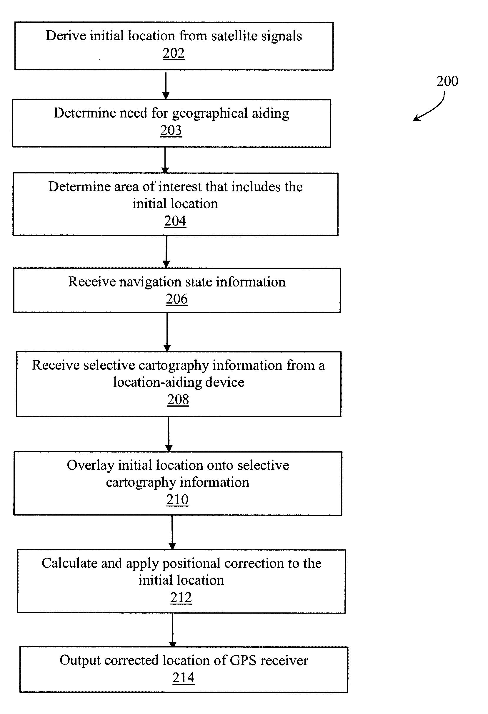
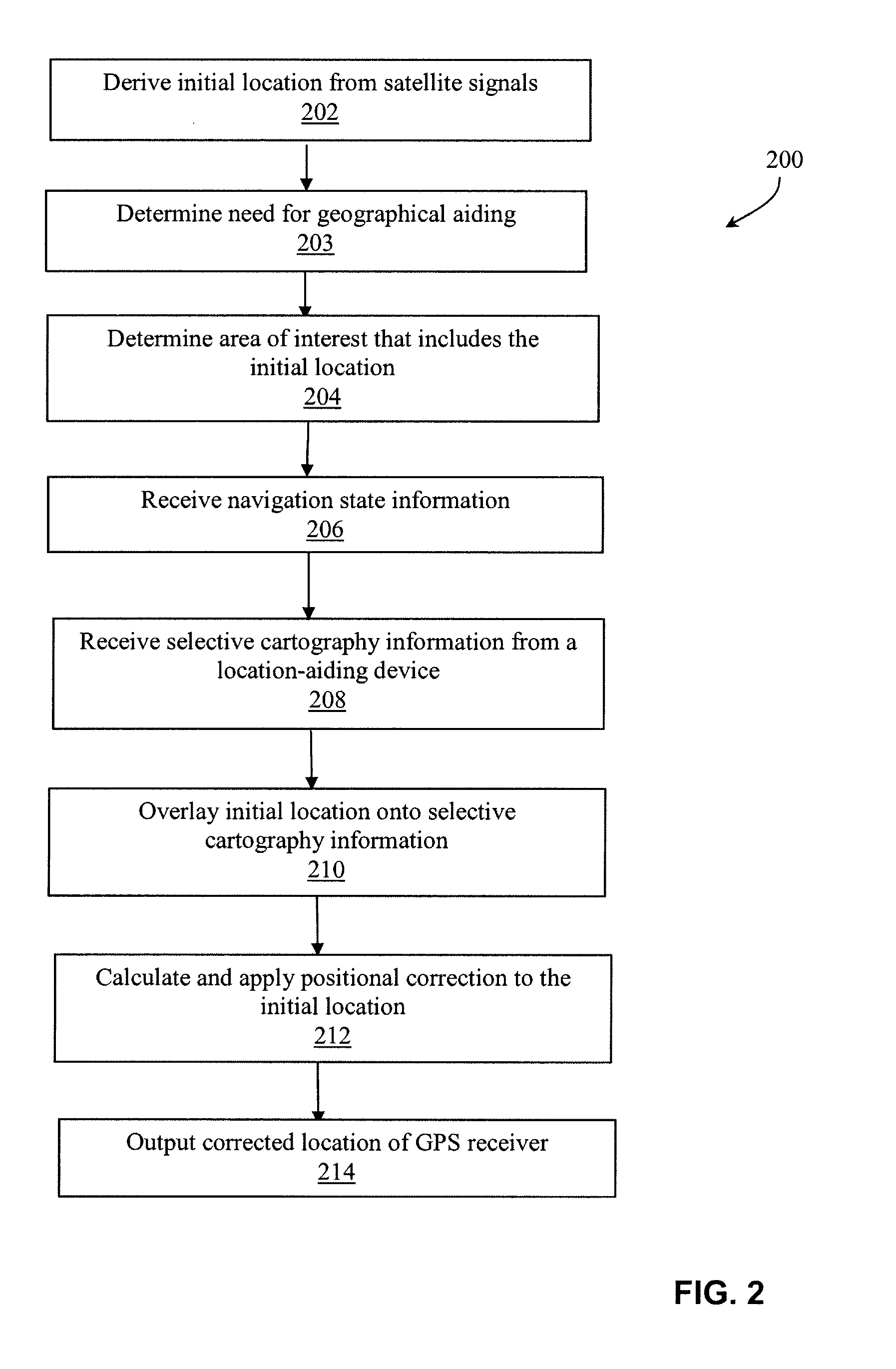
[0008]According to a first aspect, a method for improving positional accuracy of a GPS receiver is disclosed. The method comprises: deriving an initial location from a navigation satellite system (NSS) data received at a GPS receiver, wherein the initial location is determined to be within an area of interest; receiving navigation state information of the GPS receiver; receiving selective cartography information from a location-aiding device coupled to the GPS receiver, wherein the selective cartography information includes attributes of one or more geographic objects within the area of interest; overlaying the initial location onto the selective cartography information; deriving positional correction from the NSS data, the navigation state information, the selective cartography information; applying the derived positional correction to the initial location to determine a corrected location of the GPS receiver; and outputting the corrected location of the GPS receiver.

Problems solved by technology

However, the navigation device seldom takes advantage of selective cartography information obtained by using the map-matching algorithm to further improve the positional accuracy of the navigation device by incorporating appropriate positional correction to the originally determined location derived from the NSS data.
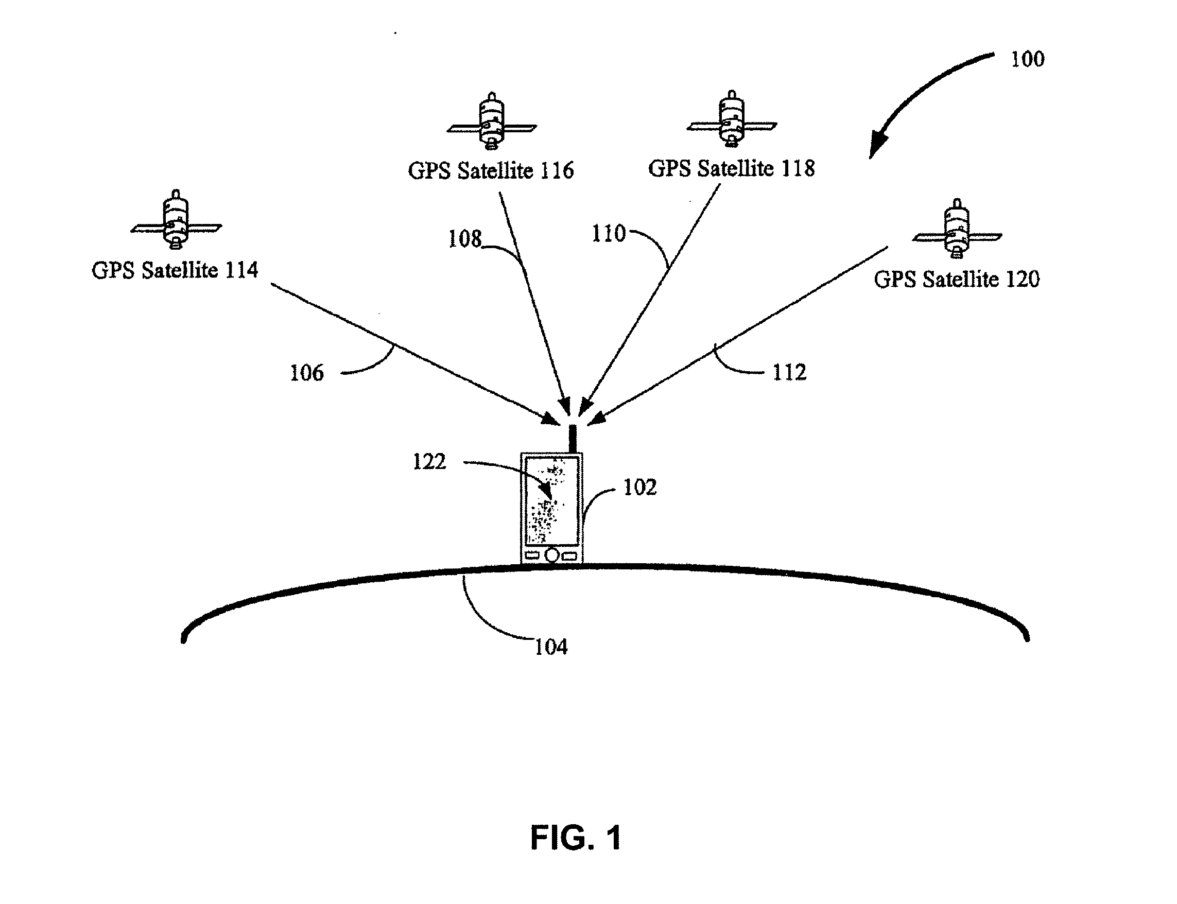
Improving the positional accuracy becomes more of a necessity in environments where satellite signals are degraded, and, as a result, the GPS receiver frequently encounters problems in locking onto the signals that are needed for the calculation of position, velocity, altitude, and time.
In a degraded signal environment (e.g., a signal environment where signal strength is below 28 dBHz), satellite signals can be weak or otherwise difficult for GPS receivers to lock on to.
In urban canyons, satellite signals are frequently not visible or are degraded due to the signals being partially or fully blocked by buildings, for example.
Consequently, the problem of inaccurate position calculations by GPS receivers in degraded signal environments is especially acute in urban areas.
However, embedding a map database in the GPS receiver itself may lead to bulkier navigation device size.
In order to optimize the size of the navigation device, size of the map database itself and / or complexity of the map-matching or navigational algorithms may have to be compromised.

Method used


Image

  • Method and apparatus for geographically aiding navigation satellite system solution
  • Method and apparatus for geographically aiding navigation satellite system solution
  • Method and apparatus for geographically aiding navigation satellite system solution

Examples


Embodiment Construction

[0021]The present invention will now be described in detail with reference to the drawings, which are provided as illustrative examples of the invention so as to enable those skilled in the art to practice the invention. Notably, the figures and examples below are not meant to limit the scope of the present invention to a single embodiment, but other embodiments are possible by way of interchange of some or all of the described or illustrated elements. Moreover, where certain elements of the present invention can be partially or fully implemented using known components, only those portions of such known components that are necessary for an understanding of the present invention will be described, and detailed descriptions of other portions of such known components will be omitted so as not to obscure the invention. Embodiments described as being implemented in software should not be limited thereto, but can include embodiments implemented in hardware, or combinations of software and...


PUM


Abstract

The present invention is related to position calculation and navigation systems, and more particularly, to a method and apparatus for making accuracy improvements to a GPS receiver's navigation solutions. According to a first aspect, selective cartography information from a map database accessed by a GPS receiver from a location-aiding device is integrated into the position calculations performed by the GPS receiver. According to another aspect, selective cartography information includes indices representing associated attributes of geographical objects, such as, a width-indicator index for a road segment.

Description

FIELD OF THE INVENTION[0001]The present invention is related to positioning systems, and more particularly, to a method and apparatus of integrating a map-matching algorithm with a navigational routine in a geographically-aided position determination algorithm in satellite positioning systems, such as GPS systems.BACKGROUND OF THE INVENTION[0002]With the development of radio and space technologies, several satellites based navigation systems (i.e. satellite positioning system or “SPS”) have already been built and more will be in use in the near future. SPS receivers, such as, for example, receivers using the Global Positioning System (“GPS”), also known as NAVSTAR, have become commonplace. Other examples of SPS systems include but are not limited to the United States (“U.S.”) Navy Navigation Satellite System (“NNSS”) (also known as TRANSIT), LORAN, Shoran, Decca, TACAN, NAVSTAR, the Russian counterpart to NAVSTAR known as the Global Navigation Satellite System (“GLONASS”) and any fu...

Claims


Application Information

Patent Timeline
Patent Type & Authority Applications(United States)
IPC IPC(8): G01C21/00
CPCG01C21/30G01S19/48
Inventor TUCK, DAVID ALLANCHANSARKAR, MANGESHHESHMATI, ARDALAN
Owner CSR TECH HLDG
Why Eureka
Try Eureka