Method of displaying points of interest and related portable electronic device

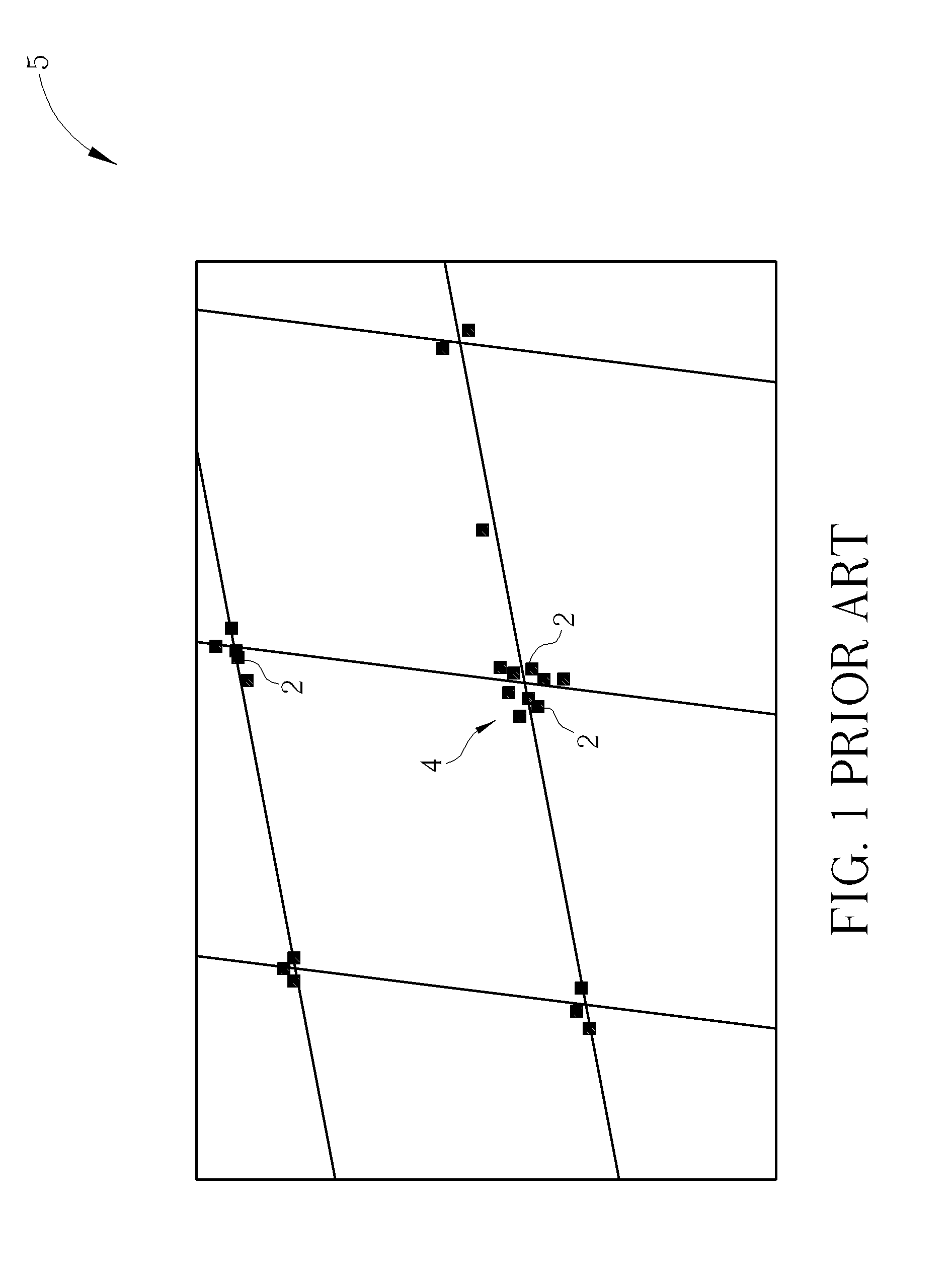
a portable electronic device and display method technology, applied in surveying, navigation, instruments, etc., can solve the problems of difficult selection of points of interest in a cluster, impaired legibility, difficult to do, etc., and achieve the effect of reducing clutter and facilitating identification and selection

Inactive Publication Date: 2014-03-13
MITAC INT CORP
View PDF9 Cites 44 Cited by
  • Summary
  • Abstract
  • Description
  • Claims
  • Application Information

AI Technical Summary

Benefits of technology

[0022]It is an advantage that the present invention displays only the points of interest having higher weighted scores so as to avoid cluttering a display of the portable electronic device with too many points of interest that block what is being shown on an underlying map. By using information about the suggested navigation route that the user is traveling on, the points of interest selected to be shown on the...

Problems solved by technology

When looking at a map with points of interest present, legibility is impaired when there are a large number of points of interest on a small area of the screen.
When points of interest are clustered together, this makes it difficult to select one of the points of interest in a cluster.
If a user wishes to select a point of interest for either finding out more information about it or for receiving navigation instructions to the point of interest, this can be difficult to do if there are many icons clustered together.
As an example, area 4 on the map 5 has many points of interest 2 grouped nearby one another, making it difficult for a user to distinguish among the points of interest located in area 4.
From the above, it can be seen that it is difficult to clearly show multiple points of interest that are in very close proximity to each other on the display of a personal navigation device.
While this approach solves the issue of the map or icon being hidden, it does not provide a useful indication to the user as to what points of interest are present without looking at the contents of each group.
Additionally, it does not show useful points of interest close to the current location when the map is significantly zoomed out.
Another problem with traditional approaches to displaying points of inte...

Method used


Image

  • Method of displaying points of interest and related portable electronic device
  • Method of displaying points of interest and related portable electronic device
  • Method of displaying points of interest and related portable electronic device

Examples


Embodiment Construction

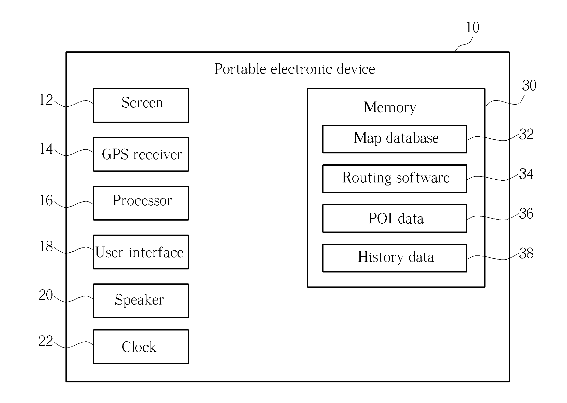
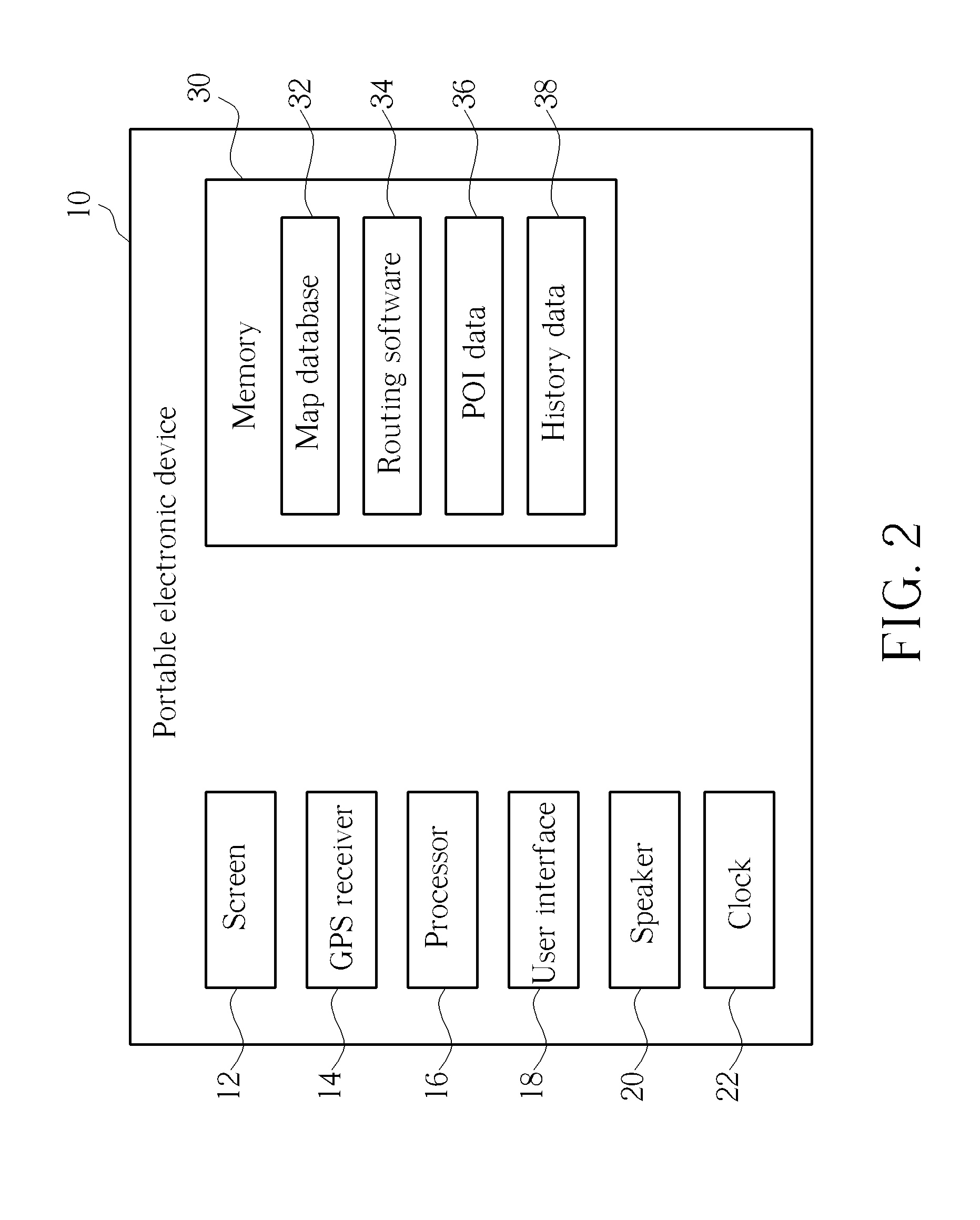
[0028]Please refer to FIG. 2. FIG. 2 is a block diagram of a portable electronic device 10 according to the present invention. The portable electronic device 10 contains a screen 12 which can be a touch-sensitive screen, a Global Positioning System (GPS) receiver 14 for receiving the current coordinates of the portable electronic device 10, a processor 16 for controlling operation of the portable electronic device 10, a user interface 18, a speaker 20, a clock 22, and memory 30. The memory 30 is used to store a map database 32 containing map data and points of interest. The memory 30 also stores routing software 34, point of interest data 36, and history data 38.

[0029]The point of interest data 36 stores a plurality of points of interest, and each point of interest may have at least one corresponding point of interest category label and brand label. Common category labels include “gas station”, “restaurant”, “hotel”, “bank”, “coffee shop”, and so on. To make it easier to identify th...


PUM


Abstract

A method of displaying points of interest to a user of a portable electronic device includes receiving an input from a user for entering a destination location into the portable electronic device for generating navigation instructions to the destination location, determining a current location of the portable electronic device according to received position signals, and providing navigation instructions to the destination location along a suggested navigation route according to the current location of the portable electronic device. The method further includes displaying points of interest located within a display area of a map shown on a display of the portable electronic device according to weighted scores assigned to the points of interest, where the weighted scores are modified according to the relevance of the points of interest to the suggested navigation route, and the points of interest having higher weighted scores are displayed.

Description

BACKGROUND OF THE INVENTION[0001]1. Field of the Invention[0002]The invention relates to a method of displaying points of interest on a portable electronic device, and more particularly, to a method for assigning weighted scores to points of interest for displaying the most relevant points of interest to the user.[0003]2. Description of the Prior Art[0004]Global Positioning System (GPS) based navigation devices are well known and are widely employed as in-car navigation devices. Common functions of a navigation device include providing a map database for generating navigation instructions that are then shown on a display of the navigation device. These navigation devices are often mounted on or in the dashboard of a vehicle using a suction mount or other mounting means.[0005]The term “navigation device” refers to a device that enables a user to navigate to a pre-defined destination. The device may have an internal system for receiving location data, such as a GPS receiver, or may me...

Claims


Application Information

Patent Timeline
IPC IPC(8): G01C21/00G01C21/34
CPCG01C21/3682
Inventor BROWN, MICHAEL
Owner MITAC INT CORP
Why Eureka
Try Eureka