
Wireless Location Assisted Zone Guidance System

a technology of location assisted and guidance system, applied in the field of electric communication, can solve the problems of limited ways to exert the control of a dog, no value between a pet and a owner, and high installation cost and installation time, and achieve the effects of modifying the behavior of a pet, simple and efficient set-up and operation, and efficient and expeditious pet training

Inactive Publication Date: 2015-08-06
GPSIP
View PDF7 Cites 26 Cited by
  • Summary
  • Abstract
  • Description
  • Claims
  • Application Information

AI Technical Summary

Benefits of technology

The present invention is a self-contained apparatus for modifying the behavior of a pet. It uses universally available location systems, such as satellite GPS or cellular triangulation systems, to determine the location of the pet and provide a stimulus based on that location. The apparatus can be easily set up and operated by a person. It can efficiently and expeditiously train a pet and significantly reduce training time and increase effectiveness of the training while preserving the animal's positive attitude. The apparatus can also automatically generate a number of zones that facilitate positive training and behavior modification, and guide the pet accordingly. The technical effects of this invention include improved accuracy of determining the pet's present location, improved safety, and efficient and effective training.

Problems solved by technology

Irrespective of the reason, there have been limited ways to exert this control over a dog.
As may be apparent, such structures are typically expensive and time consuming to install, and necessarily static in location.
In other words, they are only useful at the location where they are constructed, and so are of no value when a pet and owner travel.
Furthermore, these static structures often interfere in other ways with other activities of the dog owner, such as with lawn care or interfering with the owner's movement about a property.
Unfortunately, most dogs are notoriously bad at untangling or unwrapping a leash from a fixed object.
Consequently, dogs tend to tangle the leash about trees, posts and other objects, and can become completely unable to move.
If the owner is not aware that the dog has become tangled, this can lead to dangerous situations in cases such as extreme weather or when the dog has been left unattended for an extended period.
Once again, if the owner is unaware, the dog may travel from the desired area into other unsuitable areas such as roadways and the like.
This may put both dog and humans in jeopardy, such as when a vehicle swerves to avoid the dog or when a dog has a temperament not suited to the general human population.
As can be understood, for all but circularly limited areas, this leads to a great deal of space that the dog cannot access, but which would otherwise be suitable for the dog.
Unfortunately, burying a line can be difficult or impossible if there are other objects, such as irrigation systems, buried utility lines, landscaping, hard surfaces, trees, or other fixed objects.
Additionally, current soil conditions such as frozen soil or snow covered ground in the winter may also limit the ability to bury the line.
Consequently, a dog may be shocked or otherwise punished without basis or appropriate reason.
As is known in the field of psychology, this random punishment can literally destroy the training of a dog, and may lead to erratic or wanton misbehavior.
This problem is also very location dependent, meaning that there are places where there is so much EMI-RFI that a radio system is completely unusable.
As a result of the inability to completely eliminate or substantially eradicate the effects of EMI-RFI, the use of these radio systems is far from universal.
Several systems have been proposed in the literature for decades, but these systems have not as yet become commercially viable.
One significant limitation of prior art GPS systems is the accuracy of the system.
However, for pet containment this level of accuracy is completely unacceptable.
Another limitation is the amount of calculation required to determine whether the pet is within a selected area of containment.
Unfortunately, this requires a substantial amount of computation, which increases greatly as the number of nodes are increased.
Undesirably, this also adds complexity, drains precious battery power limiting the usable collar time, and again makes the containment system dependent upon conventional radio communications systems.
In addition, the need for both the collar and a secondary base station makes the system far less portable.
This means, for example, that taking the dog from home to a park is impractical.
A further limitation of the prior art is battery life.
A collar that must be removed and recharged every few hours is unacceptable for most purposes.
Unfortunately, the intensive computations required by prior art systems either requires a fast and consequently higher power processor unit, or a communications link such as a radio link to a base station.
It will be apparent that walkie-talkies, cell phones and other hand-held radio devices all have very large batteries to provide adequate transmission and reception life, and yet these devices often only support several hours of communications.
As can be appreciated, size and weight are severely restricted for a device fully self-contained on a dog's collar, and the inclusion of a large battery is undesirable.

Method used


Image

  • Wireless Location Assisted Zone Guidance System
  • Wireless Location Assisted Zone Guidance System
  • Wireless Location Assisted Zone Guidance System

Examples


Embodiment Construction

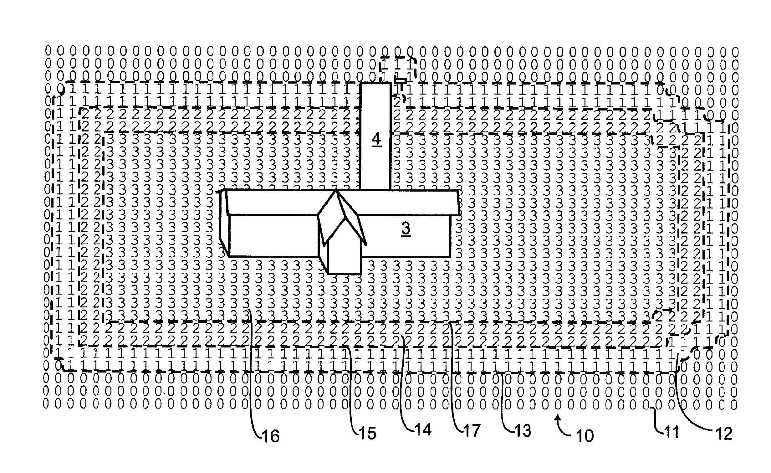
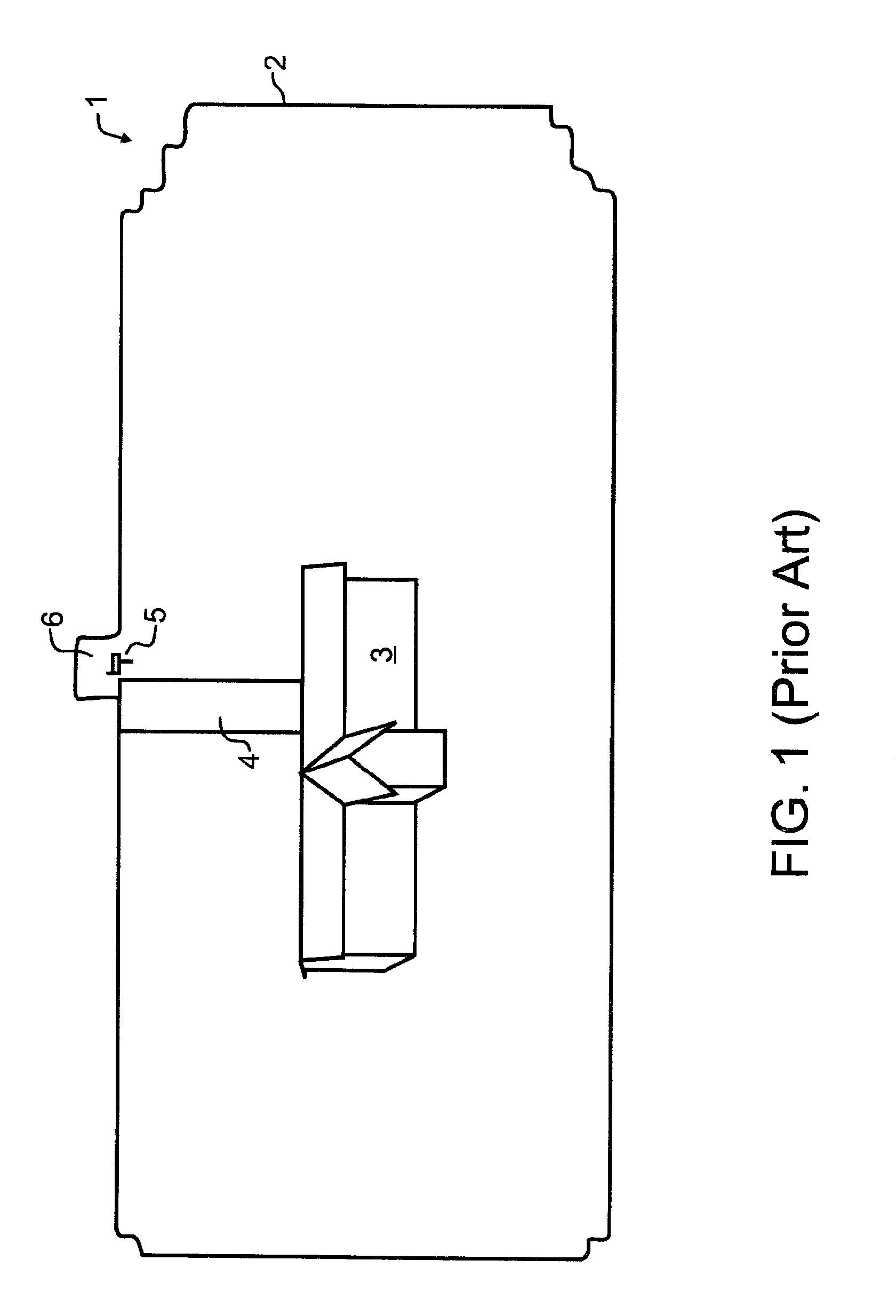
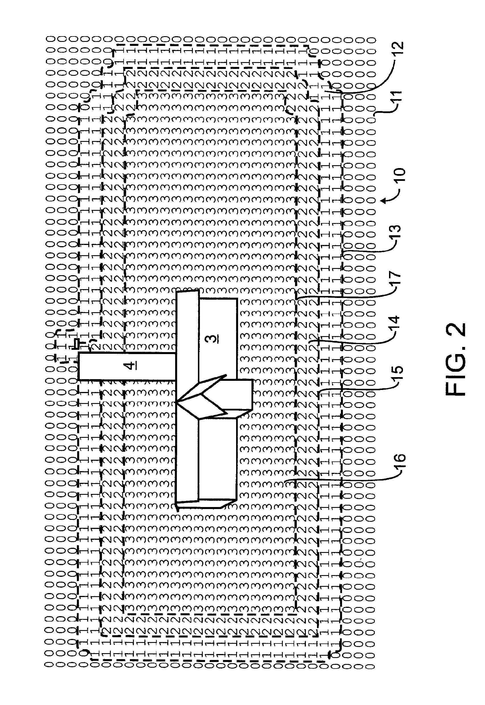
[0032]In a preferred embodiment designed in accord with the teachings of the present invention, a pet owner might want to train a pet to stay within an example property such as that illustrated in prior art FIG. 1. An outer limit of the property 2 may encompass one or more buildings 3, a driveway 4, and a mailbox 5. If, for exemplary purposes, the pet is or will be trained to walk with the owner to the mailbox, or to retrieve the newspaper from adjacent to the mailbox, then the owner may wish to provide a small peninsula 6 which could extend beyond the bounds of the particular property location.

[0033]A self-contained collar apparatus, which might for exemplary purposes and not solely limiting thereto resemble that illustrated by Swanson et al in 2007 / 0204804 and incorporated by reference herein above, will contain the necessary electronic components such as illustrated in the Swanson et al FIG. 5, including components to receive and decipher location determining signals and also exp...


PUM


Abstract

A look-up table is defined by at least one reference point, and rows and columns that are offset from the reference. The table rows and columns correspond to ordinate and abscissa data points representing geographic locations. Each data point offset in the table corresponds to a predefined geographic offset. The look-up table contains machine-stored values at each table location, with each value representing a particular one of several guidance zones. The real-time determination of the guidance zone is made by first determining present location using GPS or other wireless location signals. The corresponding table location is identified by calculating latitudinal and longitudinal offsets from a reference point, and using these offsets as the two indices to access a double-indexed array. The value retrieved from the indexed array identifies the guidance zone. Each guidance zone has an associated set of characteristics used to provide behavioral guidance to an animal.

Description

CROSS REFERENCE TO RELATED APPLICATIONS[0001]This application claims the benefit under 35 USC 119(e) of U.S. provisional 61 / 801,509, filed Mar. 15, 2013 and co-pending herewith, the contents incorporated herein by reference in entirety.BACKGROUND OF THE INVENTION[0002]1. Field of the Invention[0003]This invention pertains generally to electrical communications, and more particularly to condition responsive indicating systems with radio link and including personal portable device for tracking location. The condition responsive indicating systems of the present invention monitor the specific condition of humans or animals. In one preferred manifestation, a fully self-contained collar designed in accord with the teachings of the present invention monitors the location of a pet such as a dog, and provides well-defined and primarily positive stimulus to train the pet to stay within a predetermined area.[0004]2. Description of the Related Art[0005]Dogs are well-known as “man's best friend...

Claims


Application Information

Patent Timeline
Patent Type & Authority Applications(United States)
IPC IPC(8): A01K15/02G06F3/06H04W4/021
CPCA01K15/023G06F3/0671G06F3/0655G06F3/0604G06F16/2237G06F16/2264G06F16/2282H04W4/021
Inventor LANDERS, RODNEY P.NIEUWSMA, KEVIN L.JAMES, CHAD R.ERICKSON, MICHAEL D.
Owner GPSIP
Learn More