
Wireless Location Assisted Zone Guidance System Incorporating Secure Transmission of Location

a wireless location and zone guidance technology, applied in the field of electrical communication, can solve the problems of personnel tracking, machinery monitoring, and inability to meet the needs of pet containment, etc., and achieve the effect of reducing training time, facilitating training, and facilitating the application of technology

Active Publication Date: 2021-06-24
GPSIP
View PDF13 Cites 1 Cited by
  • Summary
  • Abstract
  • Description
  • Claims
  • Application Information

AI Technical Summary

Benefits of technology

The present invention is an apparatus for monitoring the location of a portable tracking device. It is designed to be safe and secure and can be used with different location systems, such as GPS and cellular triangulation. The apparatus is easy to set up and operate and can track a wide range of subjects. It can also create complex geometries with minimal training and knowledge. Additionally, it can communicate with a monitoring apparatus on an as-needed basis, providing secure and low-power communication.

Problems solved by technology

Several systems have been proposed in the literature for several decades, but these systems have not as yet become commercially viable.
One significant limitation of prior art GPS systems is the accuracy of the system.
However, this level of accuracy is completely unacceptable for pet containment, personnel tracking, and machinery monitoring.
As will be readily appreciated, this unpredictable locating will lead to incorrect actions and alerts, when, in fact, the portable location tracking device is within the proper location.
In turn, this will seriously erode confidence in the system, and can lead to very undesirable disregard for alerts issued by the apparatus.
Another limitation is the amount of calculation required to determine whether the portable location tracking device is within a selected area.
Unfortunately, this requires a substantial amount of computation, which increases greatly as the number of nodes are increased.
Undesirably, this also drains precious battery power, limiting usable time between battery recharge cycles, and again makes the portable location tracking device dependent upon communication with a monitoring apparatus.
In addition, the need for a secondary base station makes the system far less portable.
For exemplary and non-limiting purpose, this means that taking the portable location tracking device away from a home base to a park may be impractical or impossible.
A further limitation of the prior art is battery life.
A portable location tracking device that must be removed and recharged every few hours is unacceptable for most purposes.
Unfortunately, the intensive computations required by prior art systems require either a fast and consequently higher power processor unit, or a high power and continuous communications link such as a radio link to a base station.
It will be apparent that walkie-talkies, cell phones and other hand-held radio devices all have very large batteries to provide adequate transmission and reception life, and yet these devices often only support several hours of communications.
As can be appreciated, size and weight are severely restricted for a small and portable location tracking device, and the inclusion of a large battery is undesirable.
Yet another limitation of the prior art is the unintentional blocking or loss of GPS signals.
There are a number of conditions that can lead to loss of GPS signals.
One is unfavorable weather, which can lead to a severely attenuated satellite signal, and much higher Signal to Noise Ratios (SNR).
However, GPS systems require multiple satellites to obtain a position fix, and even if only one of the satellites is blocked, then the ability to accurately fix position may be lost.
Another situation that can lead to signal loss is when the portable location tracking device itself is covered.
In such case, then satellite signals may either be blocked or be too severely attenuated.
In any of these situations where the GPS signal is partially or completely blocked or attenuated, the latitudinal and longitudinal positional accuracy will either be inadequate, or may be completely lost.
In such instances, a prior art portable location tracking device may become completely non-functional.
Worse, this loss of function can occur without notice in an erratic manner, possibly causing severe harm or complete disruption or loss of the intended function.
However, with the introduction of the various location tracking apparatus has come a sometimes highly undesirable side effect.
Unfortunately, not only has encryption improved, but so has the entire field of cryptography, including decryption.
While an apparatus may today be provided with an encryption code or apparatus that may be difficult or time-consuming to break, in only a matter of a few short months or years, the hardware and software used for cryptography may advance sufficiently to render these encryptions useless against even a poorly skilled hacker.
Further, this encryption and decryption once more requires processor intense operation, which is as already noted herein above quite detrimental to both battery life and hardware costs.

Method used


Image

  • Wireless Location Assisted Zone Guidance System Incorporating Secure Transmission of Location
  • Wireless Location Assisted Zone Guidance System Incorporating Secure Transmission of Location
  • Wireless Location Assisted Zone Guidance System Incorporating Secure Transmission of Location

Examples


Embodiment Construction

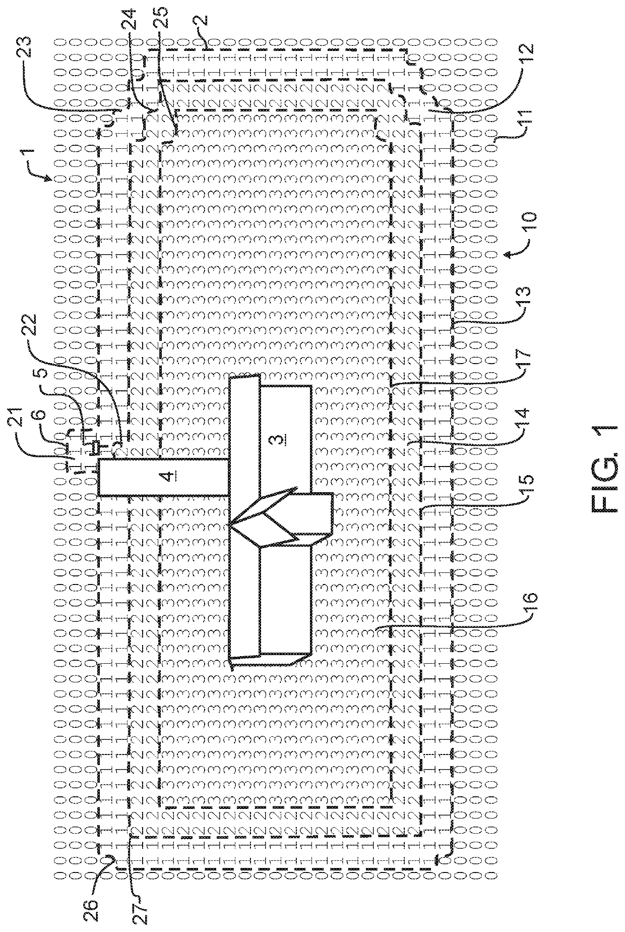
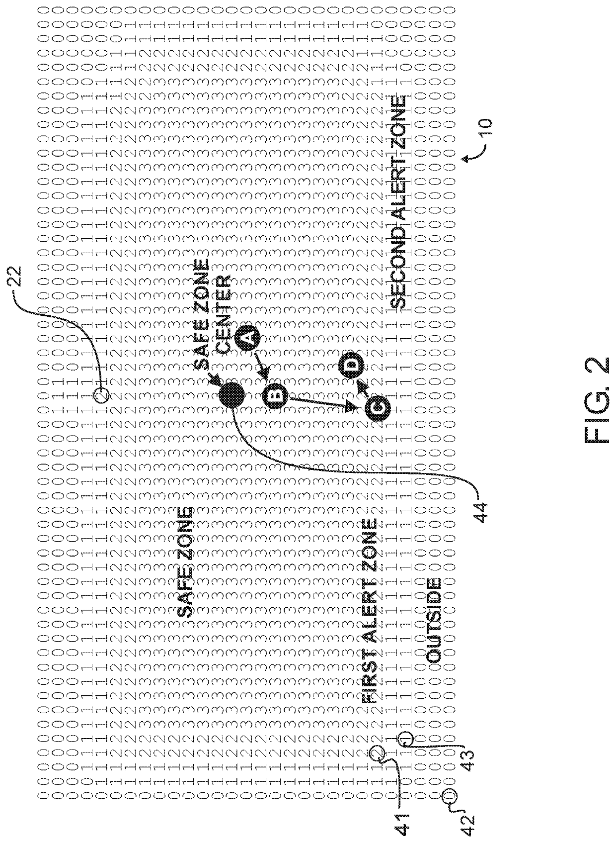
[0025]In a preferred embodiment wireless location assisted zone guidance system 100 designed in accord with the teachings of the present invention, a person might want to monitor a child, pet, machine, or other animate or inanimate object located within an example property 1 such as that illustrated in FIG. 1. An outer limit of the property 2 may encompass one or more buildings 3, a driveway 4, and a mailbox 5. For exemplary purposes, a mailbox may be located on a small peninsula 6 which could extend beyond the bounds of the particular property location.

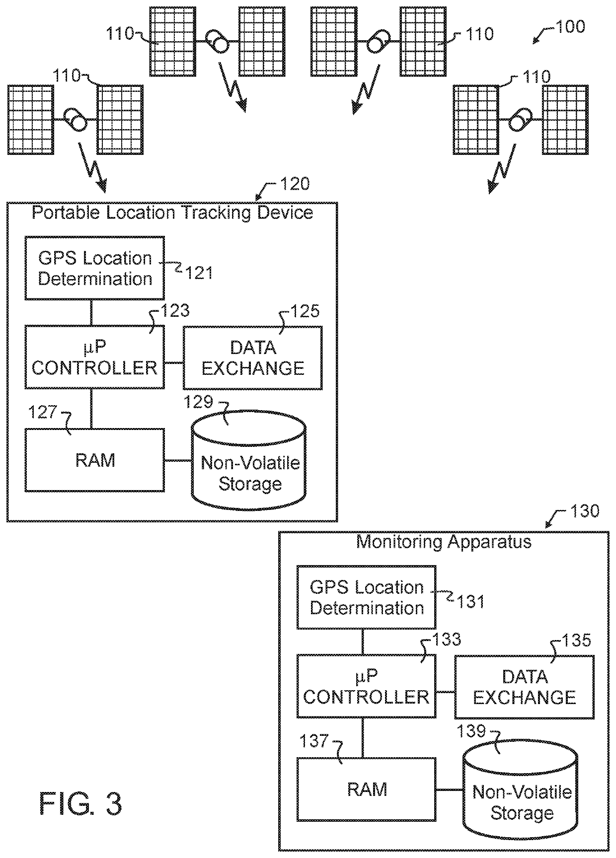
[0026]A self-contained portable location tracking device 120, which might for exemplary purposes and not solely limiting thereto resemble that illustrated in FIG. 3, will preferably contain the necessary electronic components to perform a number of tasks as described herein. Some exemplary components include: components to receive and decipher location determining signals through GPS location determination apparatus 121; a microproce...


PUM


Abstract

A fully self-contained portable location tracking device autonomously compares a current location with a latitude-longitude map stored in memory. The latitude-longitude map stores guidance zone values indicative of a predetermined safe zone, progressive alert zones, and a predetermined reference point. The guidance zone values represent actions to be taken based upon current GC location. When initiated by some combination of current location or zone value, location history, and time, or when otherwise queried, the tracking device transmits the offset from reference location, rather than actual current location data, to at least one wireless communications monitoring apparatus. The monitoring apparatus also stores a copy of the latitude-longitude map and reference point. Using the received offset, the monitoring apparatus knows both the location of the location tracking device and the actions to be taken based upon current location.

Description

TECHNICAL FIELD[0001]This invention pertains generally to electrical communications, and more particularly to condition responsive indicating systems with a wireless communications link, at least one wireless communications monitoring apparatus, and at least one portable location tracking device. In one preferred manifestation, a fully self-contained portable location tracking device designed in accord with the teachings of the present invention monitors location relative to both of a predetermined area and a predetermined reference point, and securely communicates status to the at least one wireless communications monitoring apparatus.BACKGROUND ART[0002]With the advent and substantial advancement of Global Positioning Systems (GPS), presently primarily used for navigation, artisans have recognized the opportunity to incorporate GPS technology into personnel tracking and pet containment. Several systems have been proposed in the literature for several decades, but these systems hav...

Claims


Application Information

Patent Timeline
Patent Type & Authority Applications(United States)
IPC IPC(8): G01C21/20H04W4/024G01S19/42
CPCG01C21/20G01S19/42H04W4/024G01S5/0027H04W4/02H04W4/90A01K15/023
Inventor LANDERS, RODNEY P.
Owner GPSIP
Learn More