Ground Surface Estimation
a technology for ground surface and estimation, applied in image analysis, image enhancement, instruments, etc., can solve the problems of not being able to localise itself, maps are not available for the majority of the roads around the world, and maps can become outdated
- Summary
- Abstract
- Description
- Claims
- Application Information
AI Technical Summary
Benefits of technology
Problems solved by technology
Method used
Image
Examples
Embodiment Construction
[0091]The following detailed description refers to the accompanying drawings. Several illustrative embodiments are described herein, however other implementations are possible and various modifications and adaptations are possible. For example in various implementations, modifications, substitutions and additions may be made to the listed components illustrated in the drawings. Also, the methods described herein may be modified by; reordering, substituting, removing, or adding steps to the disclosed methods. The following detailed description is accordingly, not limited to the disclosed embodiments and the proper scope is defined by the appended claims.
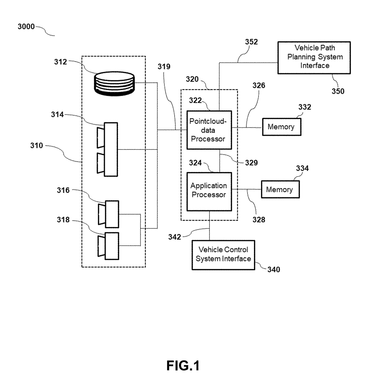
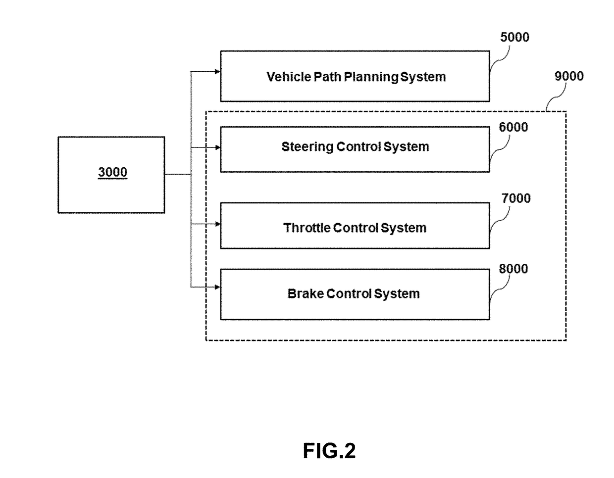
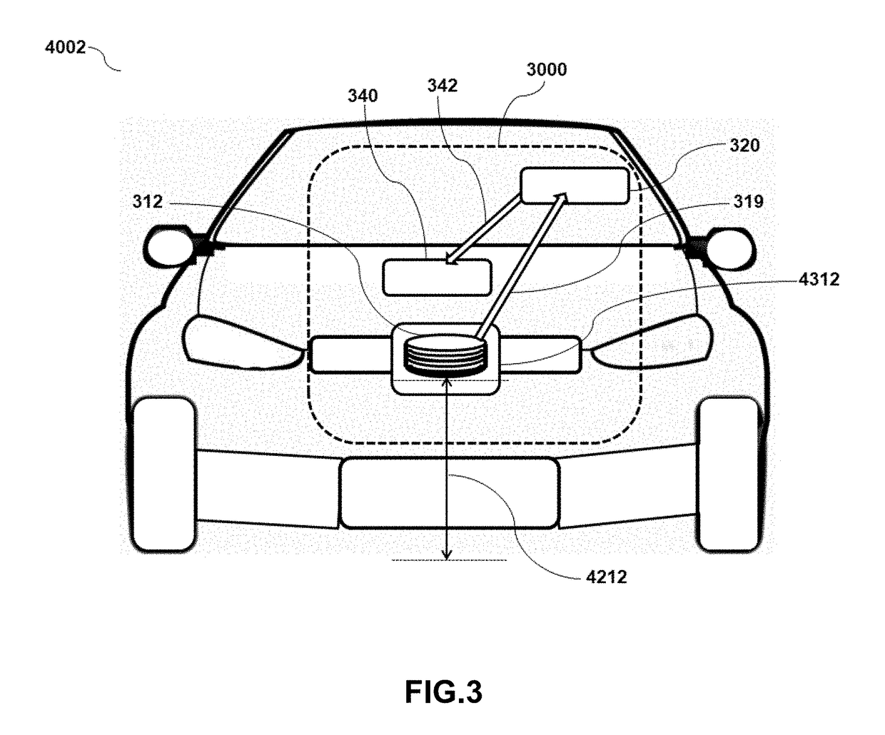
[0092]FIG. 1 is a block diagram representation of a system 3000 consistent with the exemplary disclosed embodiments. As per the requirements of various implementations, system 3000 may include various components. In some embodiments system 3000 may include a sensing unit 310, a processing unit 320, one or more memory units 332, 334, v...
PUM
 Abstract
Description
Claims
Application Information
 - R&D
- Intellectual Property
- Life Sciences
- Materials
- Tech Scout
- Unparalleled Data Quality
- Higher Quality Content
- 60% Fewer Hallucinations
Browse by: Latest US Patents, China's latest patents, Technical Efficacy Thesaurus, Application Domain, Technology Topic, Popular Technical Reports.
© 2025 PatSnap. All rights reserved.Legal|Privacy policy|Modern Slavery Act Transparency Statement|Sitemap|About US| Contact US: help@patsnap.com


