

Image geo-registration for absolute navigation aiding using uncertainy information from the on-board navigation system
a geo-registration and navigation system technology, applied in direction controllers, navigation instruments, instruments, etc., can solve the problems of time-consuming and laborious preparation of reference maps, introducing errors into navigation solutions, and reducing the accuracy of reference maps, so as to improve accuracy, improve accuracy, and improve accuracy.
- Summary
- Abstract
- Description
- Claims
- Application Information
AI Technical Summary
Benefits of technology
Problems solved by technology
Method used
Image

Examples
Embodiment Construction
[0034]The present invention describes a technique for feeding back and incorporating the uncertainty distribution of the state estimate output by the INS in the image geo-registration process to handle larger navigation errors, provide a full six degree of freedom position and attitude absolute navigation update for the navigation system and provide a more accurate update. Generating the update simultaneously for multiple images may provide a more robust solution to address any observability issues that may be present, the ability to fuse different sensor modalities and in general more accurate updates. Key frames may be used to improve the computational efficiency of the method.
[0035]The image geo-registration process may be used in aerial, land and underwater vehicles and is of particular use for autonomous navigation of such vehicles. Autonomous navigation may be used for unmanned vehicles or to provide an “auto pilot” mode for manned vehicles.
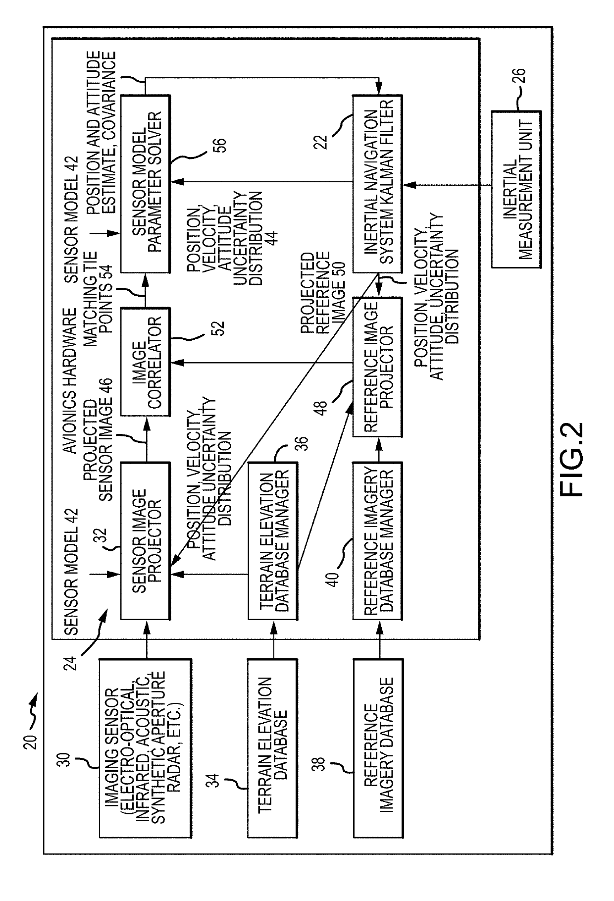
[0036]As depicted in FIG. 2, an embo...
PUM
 Abstract
Description
Claims
Application Information