

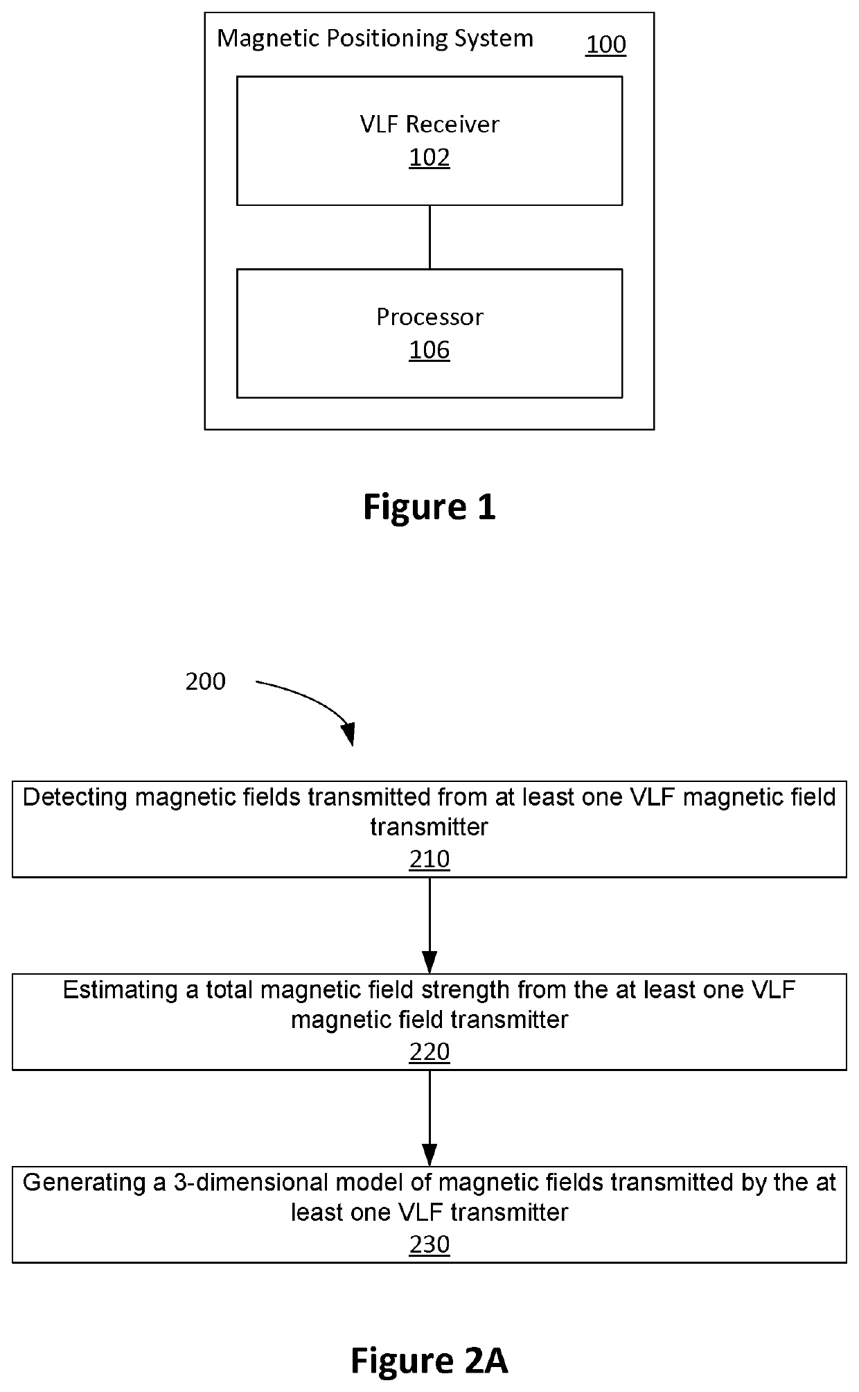
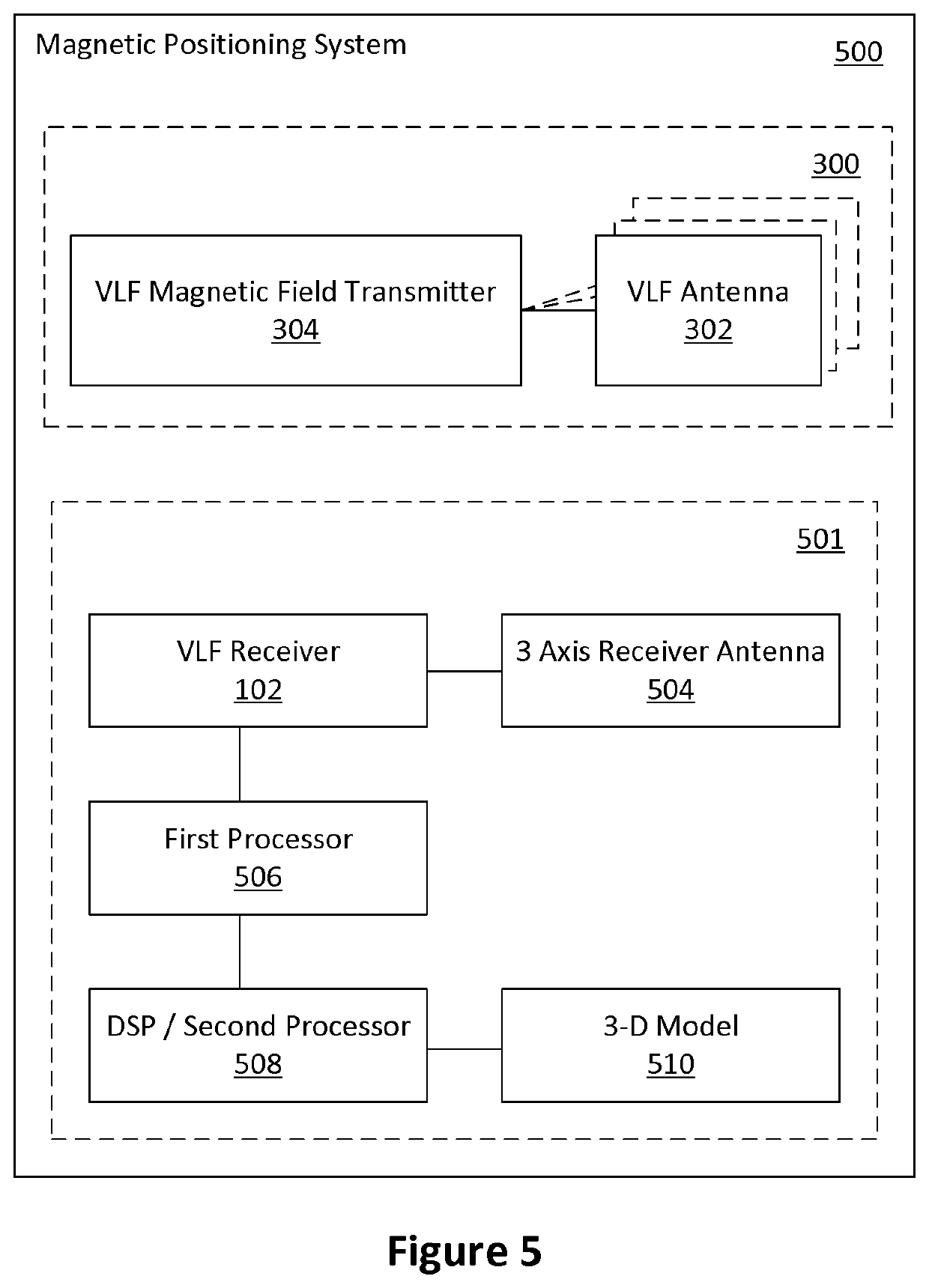
Magnetic positioning system
a positioning system and magnetic field technology, applied in the direction of electrical/magnetically converting the output of the sensor, instruments, navigation instruments, etc., can solve the problems of high cost of accurate ins sensor for passenger vehicles, inability to transmit simulated gnss signals, etc., and achieve accurate field models.
- Summary
- Abstract
- Description
- Claims
- Application Information
AI Technical Summary
Benefits of technology
Problems solved by technology
Method used
Image

Examples
Embodiment Construction
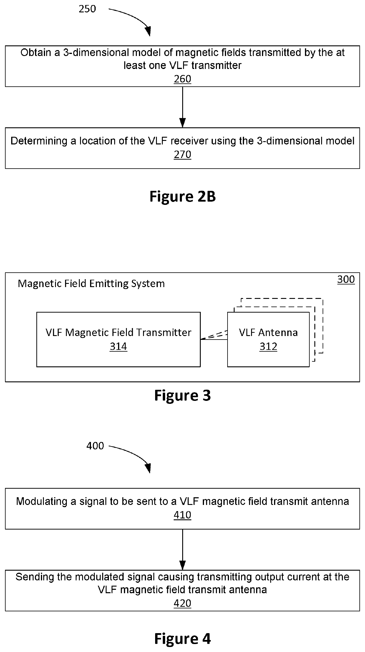
[0042]Embodiments described herein may provide a magnetic positioning system for environments that constructed using, or otherwise include, conducting material (e.g., magnesium phosphosilicate cement MPSCM, or steel reinforced concrete). Such environments include underground mines, tunnels and parking structures.
[0043]Systems based on using radio frequency (RF) waveforms, such as Wi-Fi, or Bluetooth, have been proposed. In such systems, a receiver determines its location based on the signal level or direction of arrival of the signals from a number of transmitters set up at known fixed locations. However, RF based methods are degraded by the presence of multipath signals created by the signal from the local transmitter undergoing multiple reflections from the ground and other conducting structures in the environment. Reinforced concrete, which is widely used in the construction of parking garages and underpasses, has a relatively high conductivity property, and thus acts as a good r...
PUM
 Abstract
Description
Claims
Application Information