
Pseudolite navigation system

Active Publication Date: 2006-11-28
ROCKWELL COLLINS INC
View PDF4 Cites 17 Cited by
  • Summary
  • Abstract
  • Description
  • Claims
  • Application Information

AI Technical Summary

Benefits of technology

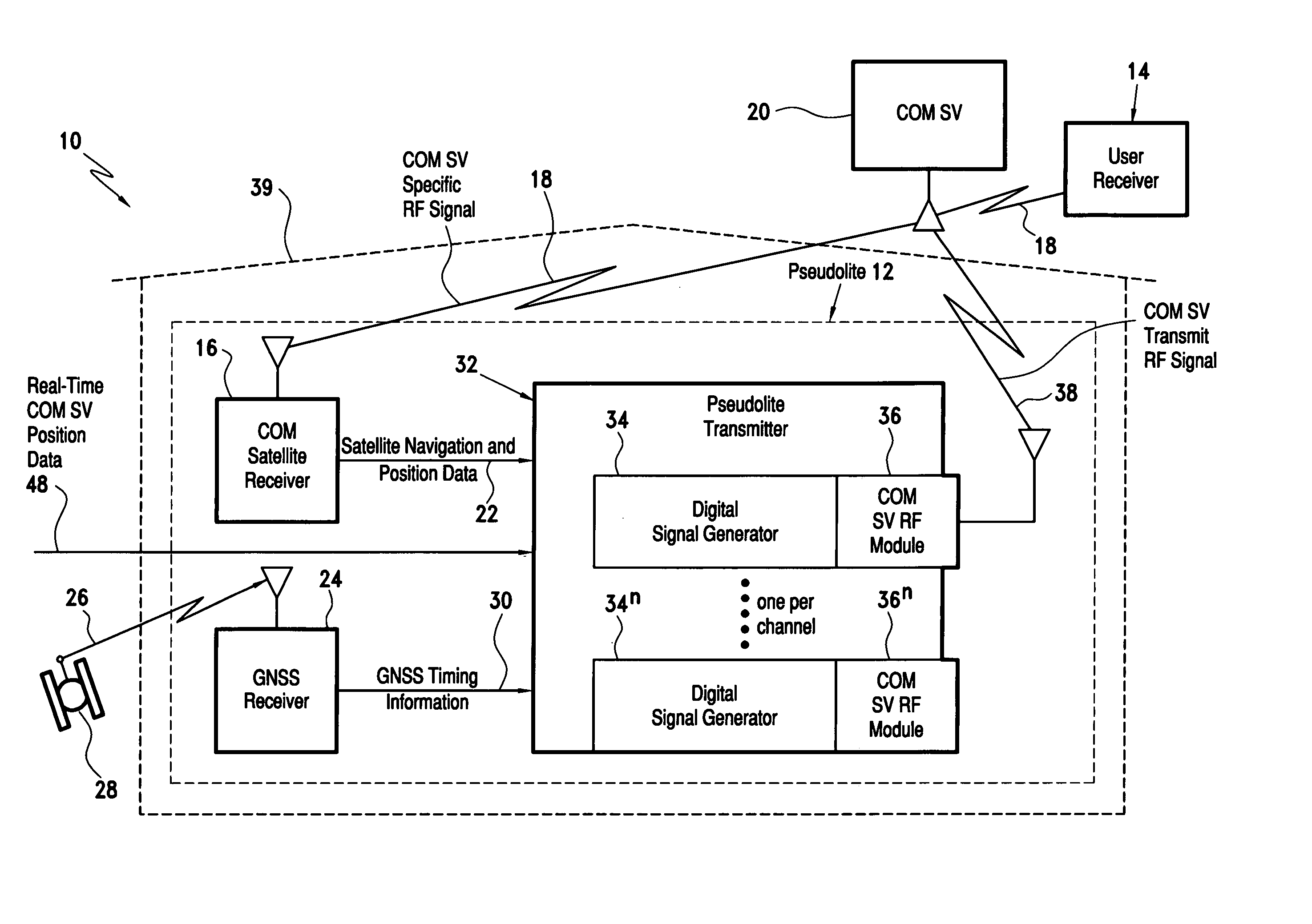
[0012]During operation of the pseudolite the communication satellite transmit RF signal is broadcast to a communication satellite. Then a communication satellite specific RF signal is broadcast from the communication satellite capable of being received by the communication satellite receiver. Thus, a closed loop control feedback is provided to adjust the timing of the broadcasted communication satellite specific RF signal so that it is synchronized with the GNSS signal. The broadcasted communication satellite specific RF signal can be utilized by a user, the pseudolite thereby being capable of operating at relatively high power to overcome GNSS jamming effects with beyond the line-of-sight capability.
[0014]Use of the communication channel RF frequencies provides flexibility. Communication satellites operate over a wide frequency range with thousands of possible broadcast channels. The covert pseudolite signals can be hidden within any combination of existing broadcast channels and arbitrarily changed as desired.
[0015]In a battlefield application, the present invention obviates the need for distributed transmitters scattered all over the battlefield. A central ground based control facility with line of sight to the desired communications satellites can house all of the required pseudolite transmitters. This approach represents a significant cost savings over the current systems which require expensive transmitter integration on multiple airborne platforms. A technical advantage of this approach is the ability to directly synchronize all the pseudolite hardware, thereby reducing independent platform synchronization errors.
[0016]The present invention provides an unpredictable navigation capability that does not require participation from the communication satellite providers other than “renting” use of the communications channel.

Problems solved by technology

There are times when it is difficult or impossible to receive the true GPS signals from the satellites.
A major limitation of the current art in pseudolite navigation systems is their limitation of usefulness to line of sight distances.
A second limitation is the ease of adversaries to jam or otherwise interfere with known GNSS frequencies.
GNSS signals in space are low power and susceptible to small amounts of interference levels.

Method used


Image

  • Pseudolite navigation system
  • Pseudolite navigation system
  • Pseudolite navigation system

Examples


Embodiment Construction

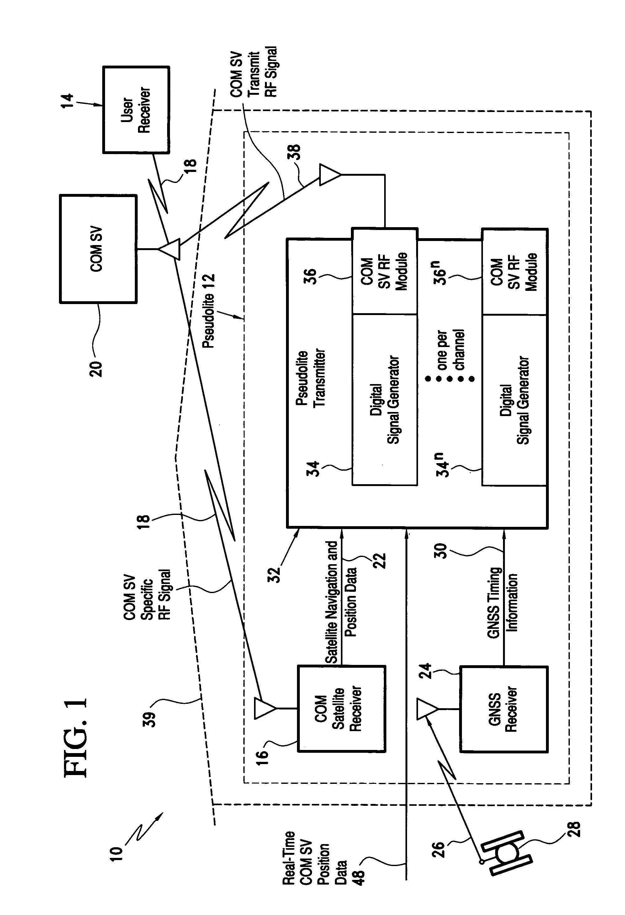
[0020]Referring now to the drawings and the characters of reference marked thereon, FIG. 1 illustrates a preferred embodiment of the pseudolite navigation system of the present invention, designated generally as 10. The pseudolite navigation system 10 includes a pseudolite, designated generally as 12; and, a user receiver, designated generally as 14.

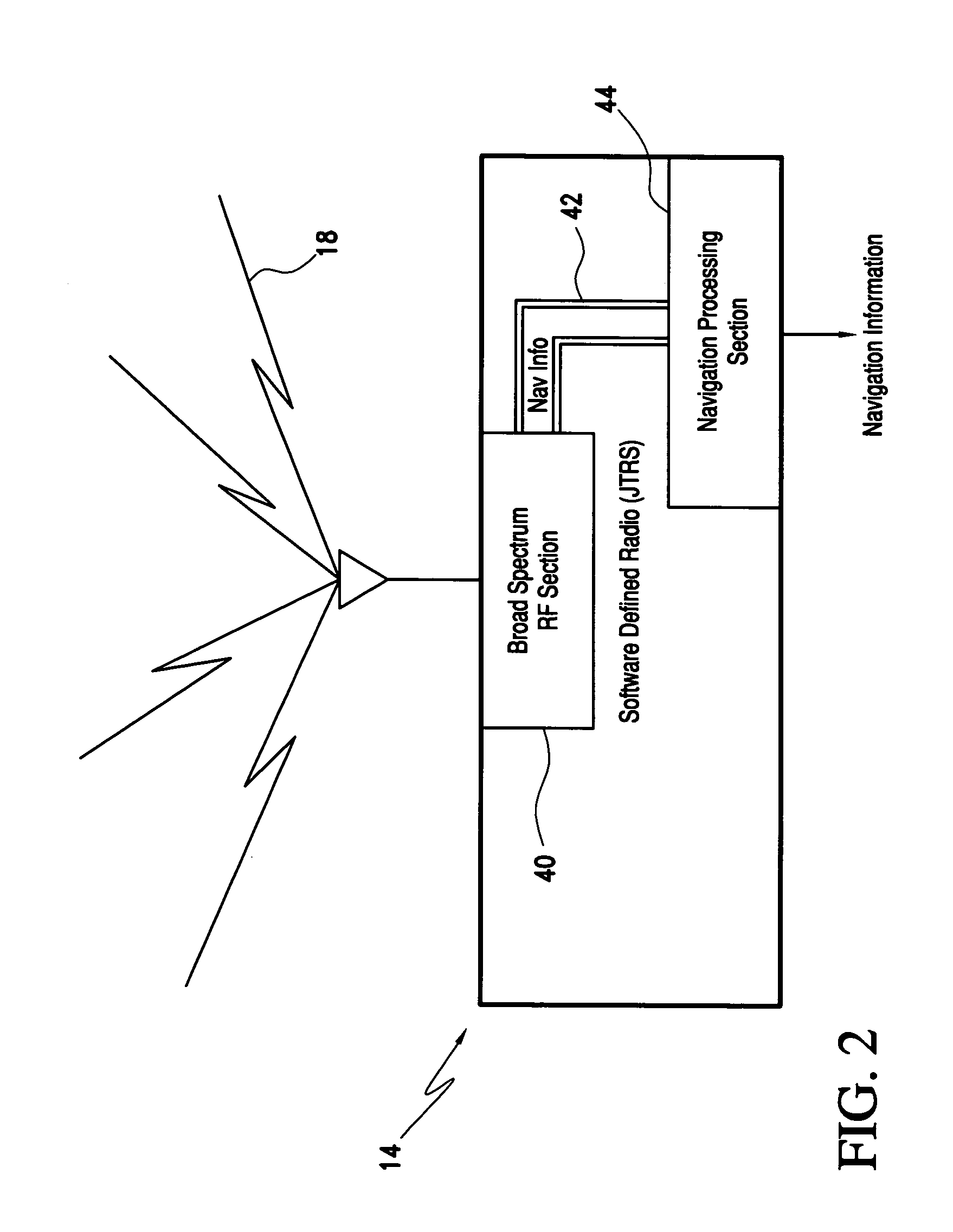
[0021]The pseudolite 12 includes a communication (COM) satellite receiver 16 for receiving a communication (COM) satellite specific RF signal 18 from a communication (COM) satellite 20 and providing communication (COM) satellite navigation and position data 22. The communication satellite receiver 16 is preferably a joint tactical radio system (JTRS) as discussed in more detail below. Other possible receiver types include any of the current inventory of military tactical radios. Commercial radio sets such as Iridium are possibilities as well. The communication satellite 20 may be any of a number of communication satellites, such as Iridi...


PUM


Abstract

The pseudolite includes a communication (COM) satellite receiver for receiving a communication satellite specific RF signal from a communication satellite and providing communication satellite navigation and position data. A GNSS receiver receives a GNSS signal from a GNSS satellite and provides GNSS timing information. A pseudolite transmitter receives the communication satellite navigation and position data and the GNSS timing information. The pseudolite transmitter includes at least one digital signal generator for utilizing the communication satellite navigation and position data and the GNSS timing information for providing a digital signal generator output having an intermediate frequency and navigation message data which are suitable for up-conversion to a desired communication channel RF frequency. At least one communication satellite RF module of the pseudolite transmitter receives the digital signal generator intermediate frequency output from an associated signal generator and converts the intermediate frequency output to a communication satellite transmit RF signal having the desired communication channel RF frequency. The communication channel RF frequency is preferably adjustable and may cover a range of potential communication frequencies.

Description

BACKGROUND OF THE INVENTION[0001]1. Field of the Invention[0002]The present invention relates to satellite navigation and positioning systems. More particularly, the present invention relates to a pseudo-satellite (pseudolite) navigation system which enhances operation of a global navigational satellite system (GNSS) when satellite ephemeris data is unavailable due to jamming or otherwise too weak.[0003]2. Description of the Related Art[0004]Global navigational satellite systems (GNSS) are known and include the global positioning system (GPS) and the Russian global orbiting navigational satellite system (GLONASS). GNSS-based navigational systems are used for navigation and positioning applications. In this regard, the present invention will be discussed with respect to the global positioning system (GPS). However, it will be apparent to those skilled in the art that the present invention can be applied to any global navigational satellite system (GNSS), including the Russian global ...

Claims


Application Information

Patent Timeline
IPC IPC(8): G01S1/08G01S5/14H04B7/185G01S19/11G01S19/18G01S19/21
CPCG01S19/11G01S19/18G01S19/21H04B7/18513
Inventor FARLEY, MICHAEL G.
Owner ROCKWELL COLLINS INC
Learn More