Selective rendering of cartographic entities for a navigation system

a navigation system and cartographic entity technology, applied in navigation instruments, traffic control systems, instruments, etc., can solve the problems of increasing the amount of time it takes users, difficult identification, and distracting users, and achieve the effect of rapid regenerating of video displays

Inactive Publication Date: 2007-01-30
DIDI HK SCI & TECH LTD
View PDF28 Cites 58 Cited by
  • Summary
  • Abstract
  • Description
  • Claims
  • Application Information

AI Technical Summary

Benefits of technology

[0005]Accordingly, the above invention provides the desired level of map details and have the video display regenerated rapidly.

Problems solved by technology

The map area shown on the video display may have numerous cartographic entities displayed making the vehicle route, which is typically the user's primary interest, more difficult to identify.
That is, the shear number of cartographic entities displayed on the video display distracts the user and increases the amount of time it takes the user to locate the vehicle route on the video display.
Additionally, displaying numerous cartographic entities increases the time it takes to regenerate or update the video display, which may cause an undesirable delay in displaying the updated information to the user as the vehicle moves across the map area.
Furthermore, the intensity of the vehicle route and other roads in the map area are the same, making it difficult to quickly identify the vehicle route.

Method used


Image

  • Selective rendering of cartographic entities for a navigation system
  • Selective rendering of cartographic entities for a navigation system
  • Selective rendering of cartographic entities for a navigation system

Examples


Embodiment Construction

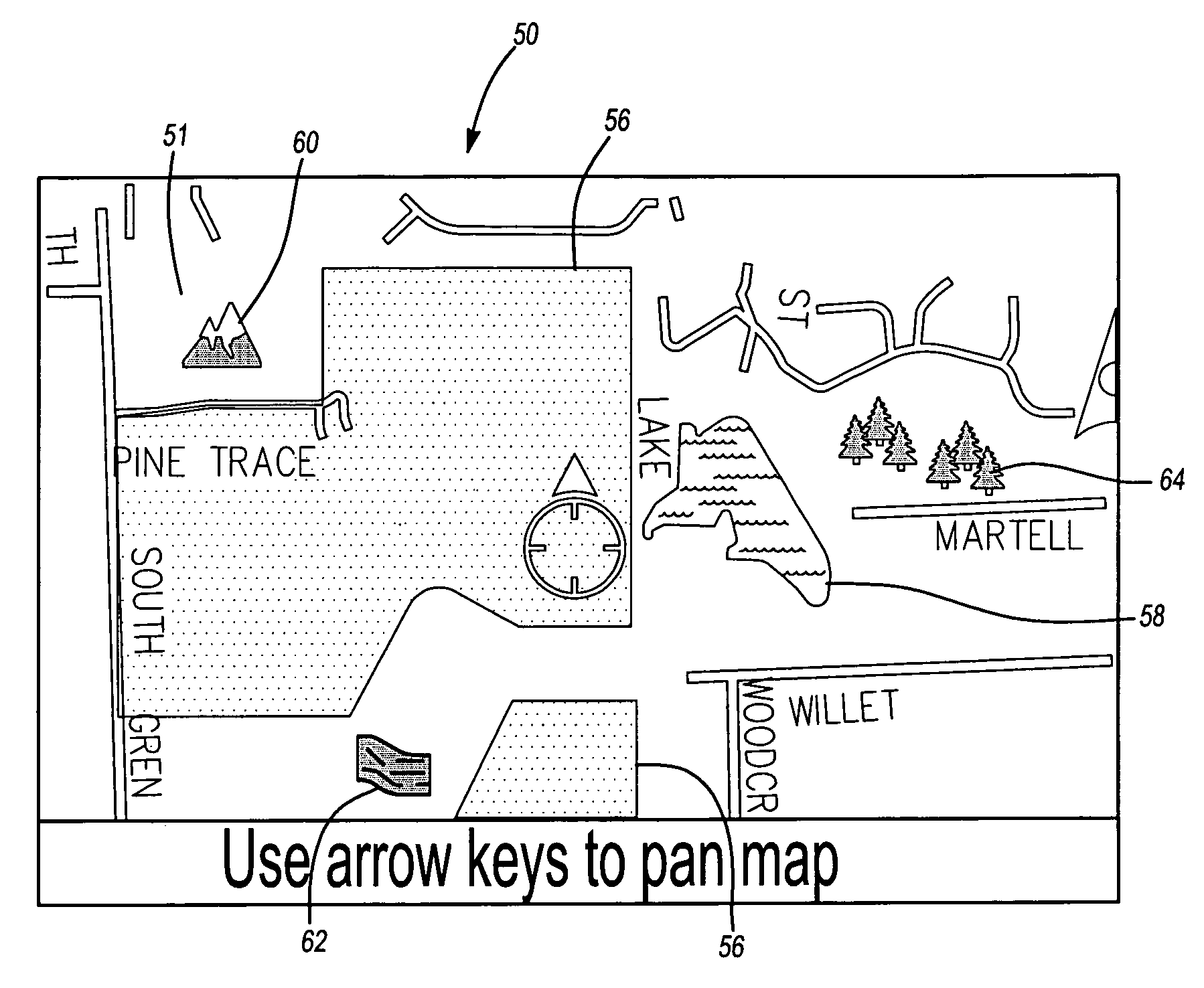
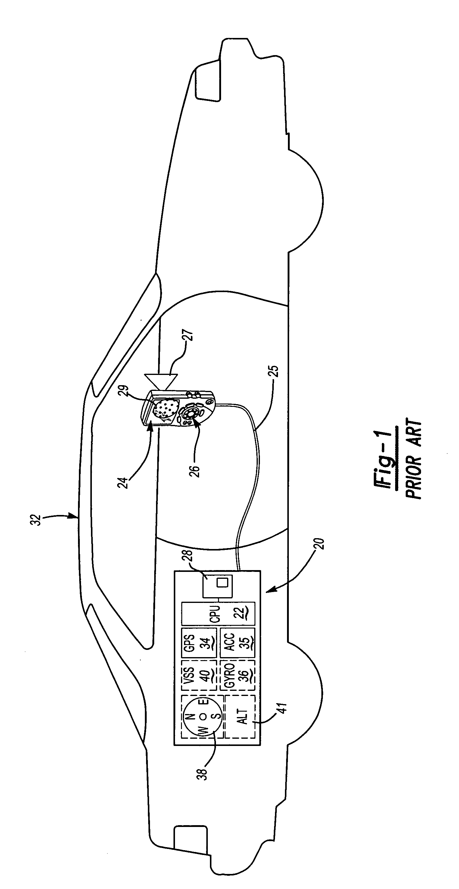
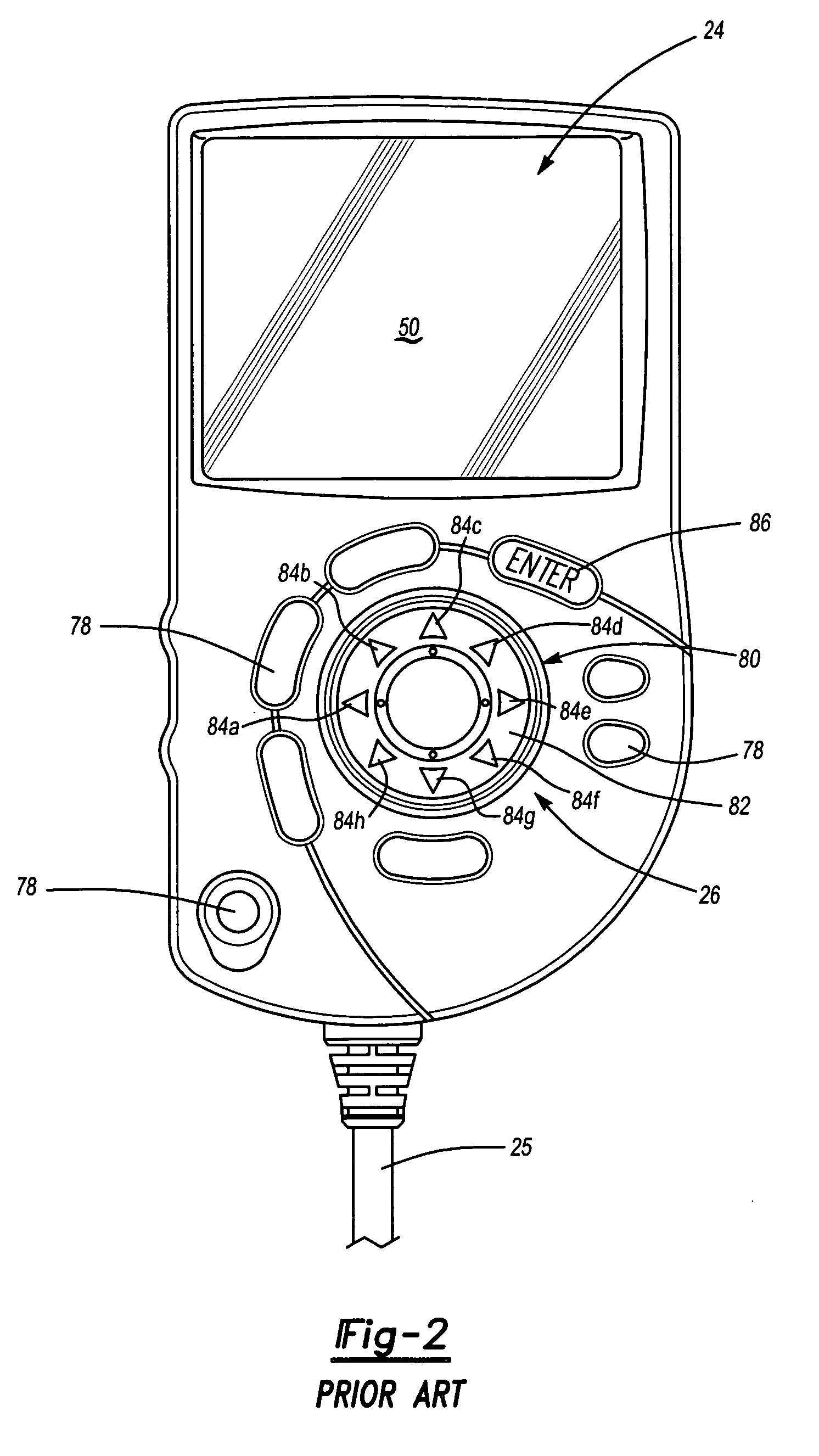
[0012]The navigation system 20 of the present invention is shown schematically in FIG. 1. The navigation system 20 includes a CPU 22 (Central Processing Unit) connected to a display device 24 and a directional input device 26 attached to the vehicle interior by a bracket 27, or the like. The navigation system 20 further includes a database 28 connected to the CPU 22. The database 28 is a mass media storage device, such as a CD-ROM, hard drive, DVD, RAM, ROM or the like which includes a map of the road system in the area to be traveled by the user. Each road in the database is divided into road segments, each having an associated set of cost values, which indicate the “cost” of traveling that road segment. For example, the cost values may include the length of the road segment, the estimated time to travel the road segment, and the type of road (i.e., highway, secondary road, toll road, one way, etc.). The road segment may be part of the vehicle route or may be a road segment outside...


PUM


Abstract

A method of selectively providing cartographic features on a video display of a navigation system for improved rendering is provided. The method includes the steps of determining an operational mode of the navigation system, selecting a desired cartographic entity for a cartographic feature based upon the operational mode, and displaying the desired cartographic entity on the video display. For example, less detailed cartographic entities are selected for display when the navigation system is in an operational mode that requires the video display to be updated frequently ore a mode in which it is desirable to focus the user's attention on a different cartographic entity. The less detailed cartographic entity may have a lower intensity than or contrast less with surrounding cartographic entities. In this manner, the user may be provided the desired level of map details with the video display regenerated rapidly.

Description

BACKGROUND OF THE INVENTION[0001]This invention relates to vehicle navigation systems and, more specifically, to map images appearing on a navigation system video screen of a display device.[0002]Vehicle navigation systems typically include a display device with a video display that provides a graphical interface for the user. A main function of the video display is to depict the desired map area and route on which the user's vehicle is travelling. The map area shows various cartographic features, such as lakes and golf courses, to increase the utility to the user. These cartographic features are represented by cartographic entities that convey the nature of the cartographic feature so that the user may easily interpret it. For example, a solid green body may be used to represent a golf course and a solid blue body may be used to represent a lake. The map area shown on the video display may have numerous cartographic entities displayed making the vehicle route, which is typically th...

Claims


Application Information

Patent Timeline
Patent Type & Authority Patents(United States)
IPC IPC(8): G06T17/00
CPCG01C21/367G09B29/106G01C21/3673
Inventor MILLINGTON, JEFFREY ALANPALANISAMY, CHANDIRAN
Owner DIDI HK SCI & TECH LTD
Why Eureka
Try Eureka