System and method for aircraft navigation using signals transmitted in the DME transponder frequency range

a technology of aircraft navigation and transponder frequency, applied in the field of system and method of aircraft navigation using signals transmitted in the dme transponder frequency range, can solve the problems of insufficient significant amount of signal garbling and data loss, existing gnss-based aircraft navigation systems, etc., and achieve poor dme-dme mlat position accuracy

Active Publication Date: 2014-05-27
SAAB INC
View PDF13 Cites 12 Cited by
  • Summary
  • Abstract
  • Description
  • Claims
  • Application Information

AI Technical Summary

Problems solved by technology

FIG. 4 illustrates the case where inadequate DME-DME MLAT position accuracy is obtained due to undesirable AC-DME transponders geometry.
However, the density of transmitted signals on the 1030 MHz and 1090 MHz SSR frequency bands is causing a significant amount of signal garbling and loss of data, especially in high traffic areas.
In addition, existing GNSS-based aircraft navigation systems can be disrupted by solar storms that cause severe ionosphere delay variations that degrade both GPS and WAAS and affect the L1 and L5 signals.
Current correction broadcasting cannot keep up with the rapid variations during times of solar storms.
Under these conditions, WAAS-only aircraft, which include many General Aviation (GA) aircraft, will lose their RNAV capability.
Still further, in regional areas interference and jamming will cause weak GPS / WASS signals to be undetectable, thereby causing a loss of RNAV capability.
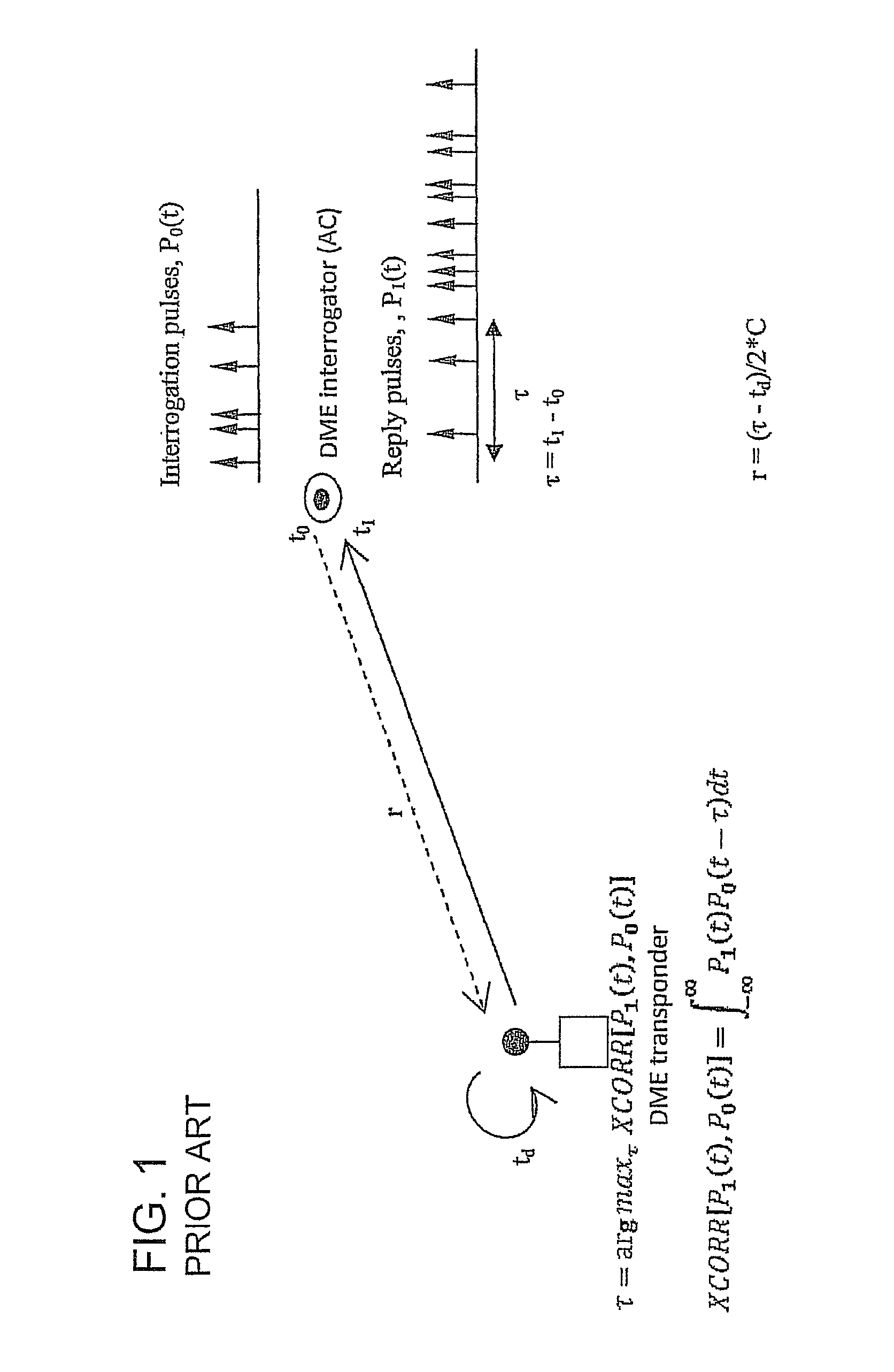
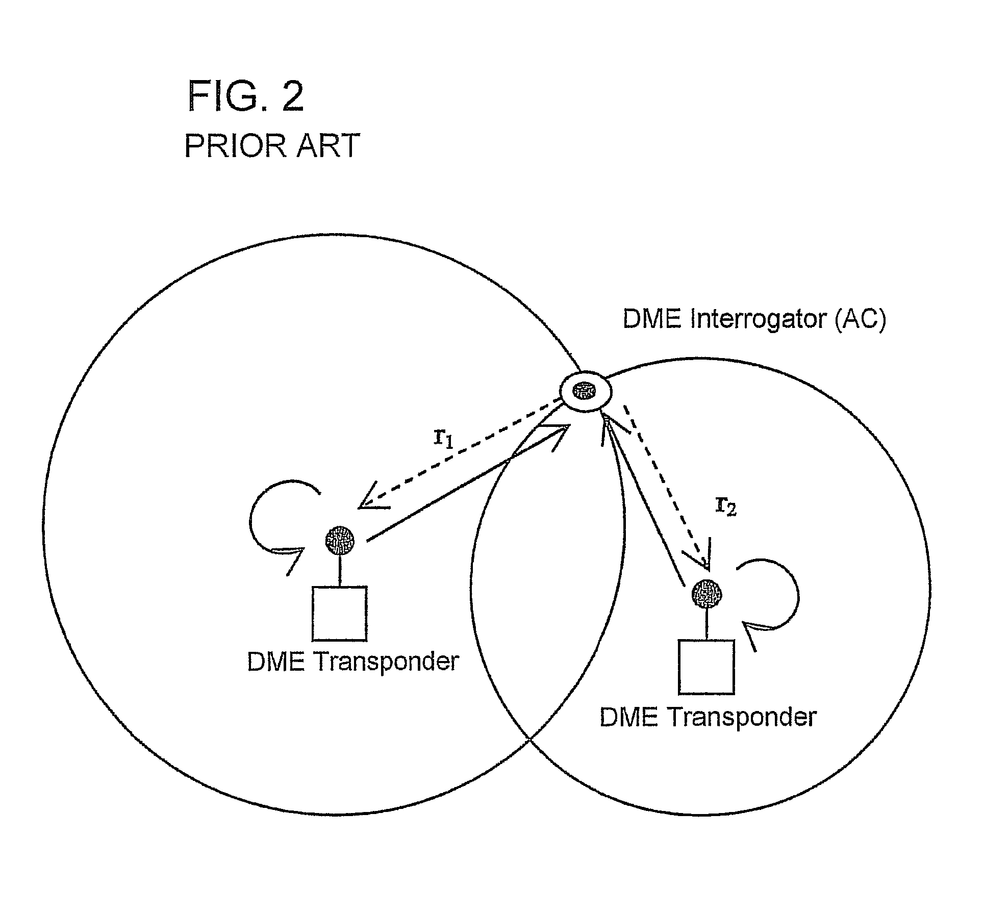
While the DME / DME or rho-rho MLAT technique, with or without inertial measurement unit (IMU), has been deemed an acceptable means for GPS backup for navigation, this approach suffers from the need of intense interrogations and the lack of DME / DME coverage in the current NAS.
In addition, the DME / DME or rho-rho MEAT approach will almost certainly receive resistance from general aviation (GA) users due to the relative high cost of installing an on-board DME / DME or DME / IMU capable unit.
Another potential option, eLoran, has not yet gained full political support for deployment and use worldwide.
In addition, there are practical concerns regarding intentional and unintentional interference, regional and temporal unavailability of GPS services, GPS avionic malfunctions and the need for a robust and economic backup solution to the GLASS-based surveillance and navigation systems.

Method used


Image

  • System and method for aircraft navigation using signals transmitted in the DME transponder frequency range
  • System and method for aircraft navigation using signals transmitted in the DME transponder frequency range
  • System and method for aircraft navigation using signals transmitted in the DME transponder frequency range

Examples


Embodiment Construction

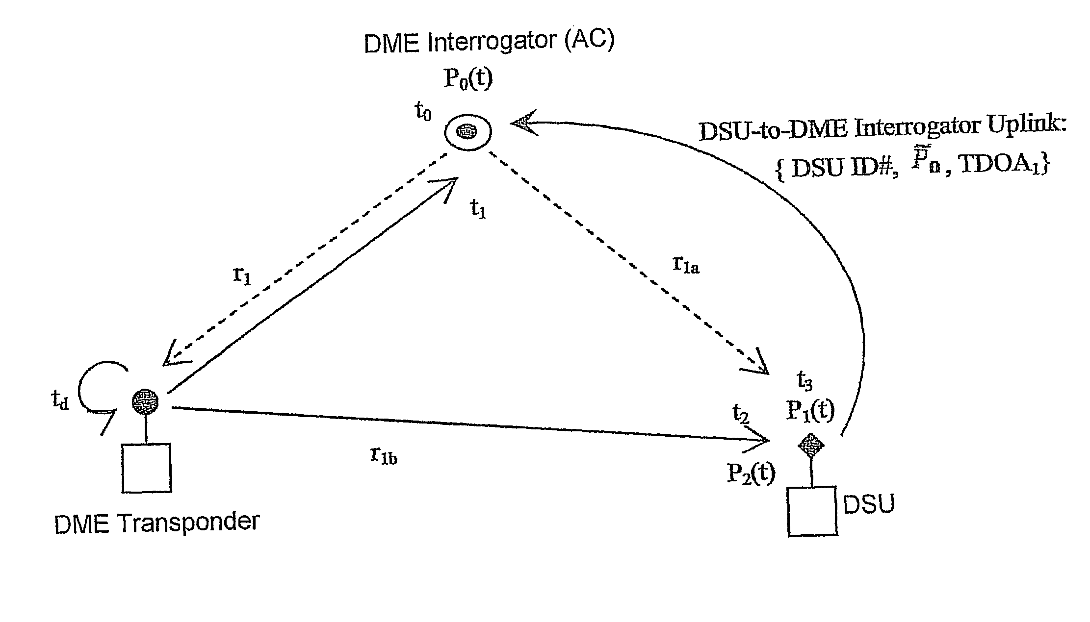
[0066]The present invention provides a navigation infrastructure in lieu of fully-functioning GPS and traditional NAV AID, such as VOR and NDB, by utilizing the existing DME ground station network and SBS GS network. The present invention enables a greater synergy between the DME network and SBS GS network to provide a more robust, economic, and better integrated navigation capability that can act as a backup to the existing GNSS-based aircraft navigation system.

[0067]According to a first embodiment of the present invention, there is provided a system and method for determining aircraft position by passively listening to DME transponder ground stations broadcasting periodic navigation heartbeat signals to enable aircraft to perform self-positioning and navigation by multilateration, independent of GPS capability. The periodic broadcast signal eliminates the need for aircraft to interrogate the DME ground stations, which greatly increases the system capacity (theoretical capacity app...


PUM


Abstract

The present invention provides a system and method for aircraft to determine own position and navigate using a navigation heartbeat signal broadcast on a DME uplink and / or a Mode-S uplink frequency. The present invention enables deep integration between the existing navigation systems (DME interrogation-reply ranges and GPS / WAAS raw TDOA or pseudo range measurements) and the DME heartbeat TDOAs or Mode-S heartbeat TDOAs to provide a highly accurate navigation positioning capability and provide necessary backup capability in lieu of GPS to maintain the necessary RNP / RNAV capability and avoid degrading aircraft operational safety.

Description

FIELD OF THE INVENTION[0001]The invention relates to a system and method for providing aircraft navigation using the existing Distance Measuring Equipment (DME) ground transponder infrastructure and the Surveillance Broadcast Service (SBS) ADS-B ground station (GS) network. In one embodiment, the present invention synchronously broadcasts ground heartbeat signals to provide a means for aircraft navigation either in place of or as a backup system for fully-functioning GPS using SBS GS and DME ground transponders. In another embodiment, the present invention retransmits a DME reply signal from a DME Sensor Unit to provide at least one TDOA to an aircraft to determine its own position using the at least one TDOA and determined range from the DME transponder. In yet another embodiment, the present invention retransmits a DME reply signal from a Slave DME device to provide at least one TDOA to an aircraft to determine its own position using the at least one TDOA and determined range from...

Claims


Application Information

Patent Timeline
Patent Type & Authority Patents(United States)
IPC IPC(8): G01S13/87G01S13/46G01S13/76G01S13/78
CPCG01S13/765G01S13/876G01S13/785G01S5/10G01S13/878
Inventor WU, RYAN HAOYUNVIGGIANO, MARC J.
Owner SAAB INC
Why Eureka
Try Eureka