Mobile base station positioning method based on wireless communication network

A mobile base station, wireless communication technology, applied in the field of communication, surveying and mapping, can solve the problems of low communication rate, application limitation, high cost of satellite communication communication, etc., to achieve the effect of ensuring real-time and integrity.

Inactive Publication Date: 2008-01-09
SOUTHEAST UNIV
View PDF0 Cites 37 Cited by
  • Summary
  • Abstract
  • Description
  • Claims
  • Application Information

AI Technical Summary

Problems solved by technology

The existing wireless communication methods mainly include: ultrashort wave (230MHz) wireless data transmission, spread spectrum, satellite communication, GSM digital cellular communication system, etc. Among them, satellite communication is only used in some special fields due to high communication costs, and has not been popularized. ; Although the spread spectrum communication technology has a high rate, it can only be transmitted within the line of sight, and its application is als

Method used


Image

  • Mobile base station positioning method based on wireless communication network
  • Mobile base station positioning method based on wireless communication network
  • Mobile base station positioning method based on wireless communication network

Examples


Embodiment Construction

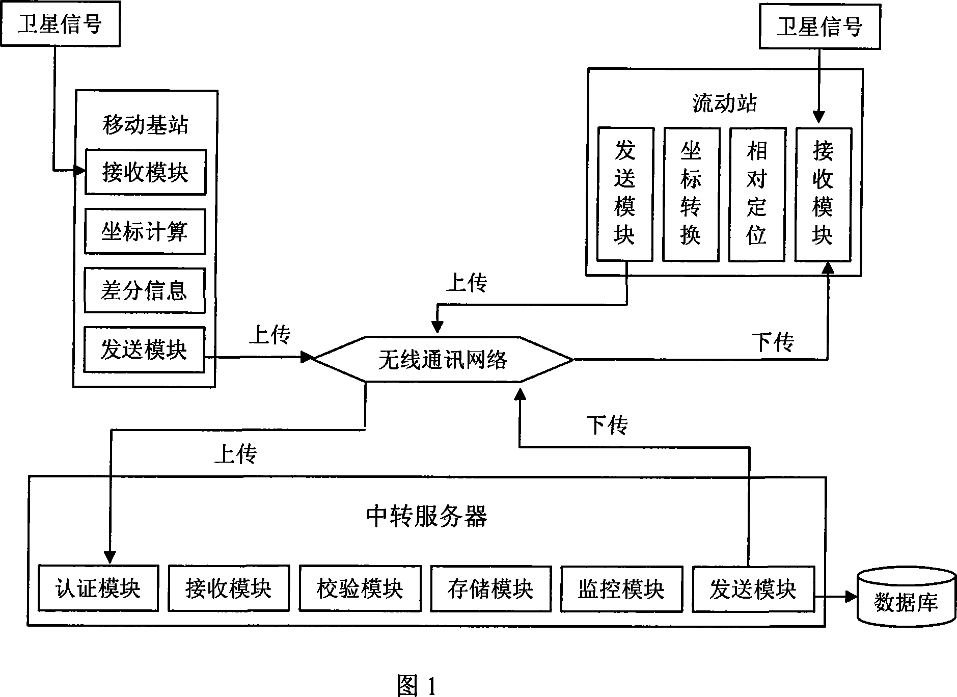
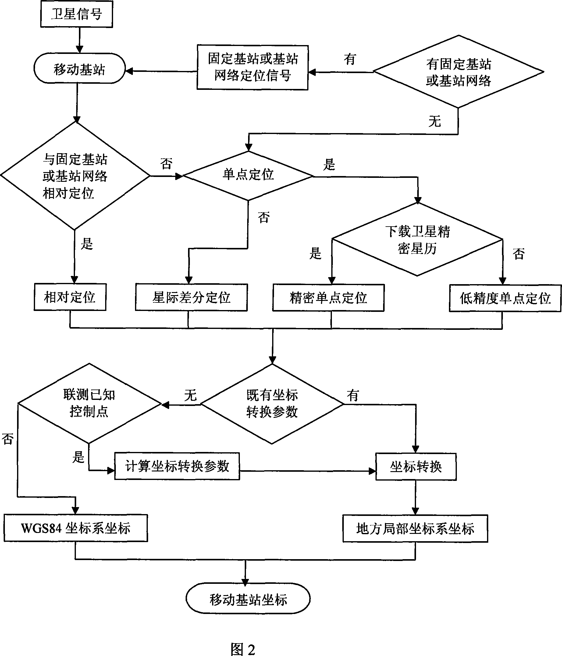
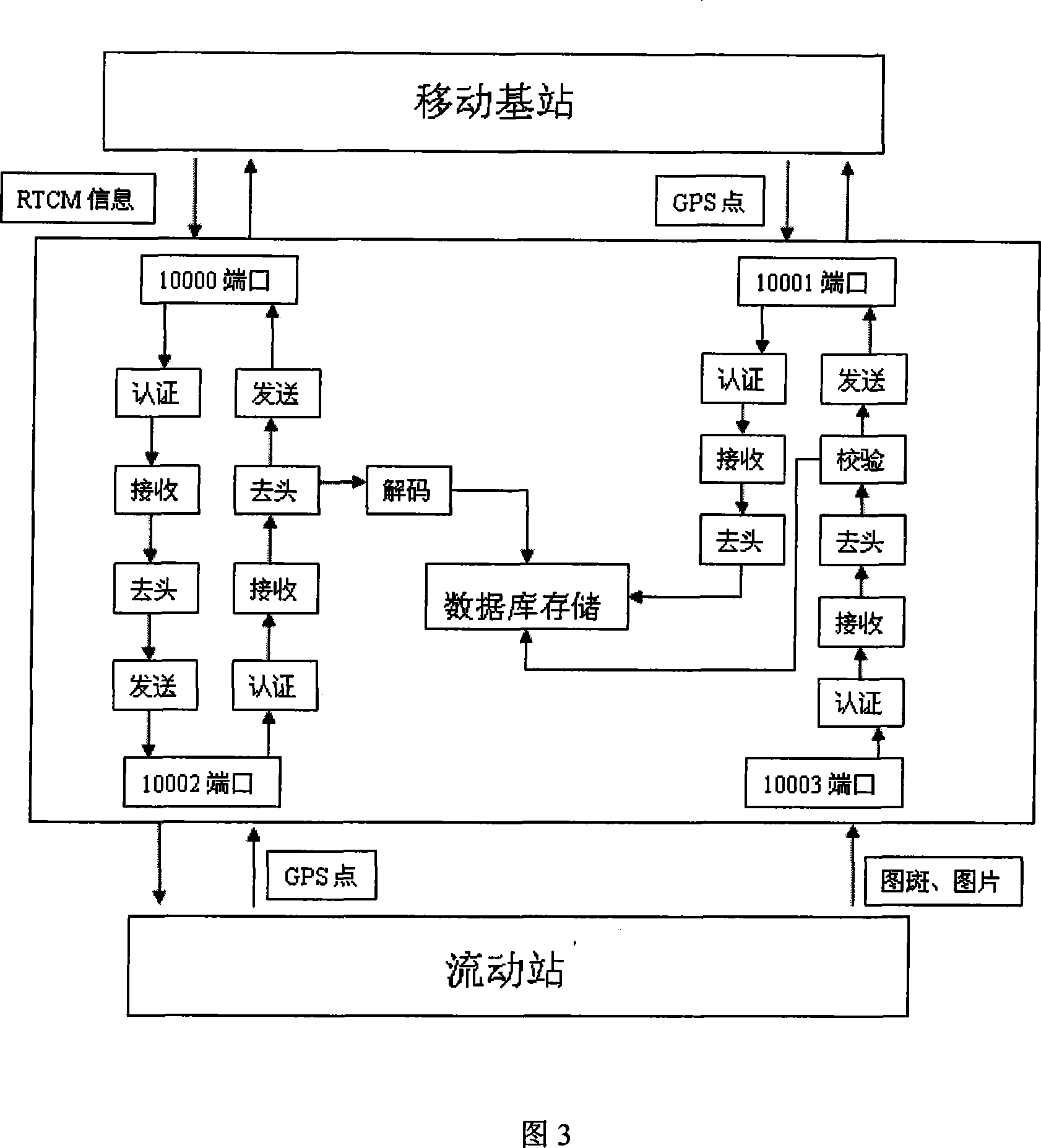
[0018] Below in conjunction with accompanying drawing, the working principle of the present invention and embodiment will be further described:

[0019] The method of the invention installs a GPS receiver at any position on the surveying and mapping site as a mobile base station, temporarily sets up a receiving module of the mobile base station to receive global positioning satellite signals, a coordinate calculation module calculates the coordinates of the mobile base station, and a difference information generation module calculates the difference information, and then the mobile base station sends The module uploads the differential information and mobile base station status information to the data transfer server through the wireless communication network. The server performs user authentication on the upload application through the authentication module. After confirming that it is legal, the uploaded data is received through the receiving module, and then the data integri...


PUM


Abstract

The method comprises: installing the GPS receiver at any location of the scene as a base station; the GPS receiver receives the GPS satellite signals and generates the differential correction information; the differential correction information is uploaded to the relay server via radio communication network; the relay server sends the differential correction information to the user's receiver of mobile station via radio communication network; the mobile station receives the GPS satellite carrier and pseudo range signal and navigation message, and receives the differential information from relay server via the radio communication network so as to realize the relative positioning between the base station and mobile station; making coordinate conversion and calculation for the positioning result to the user-desired coordinate.

Description

technical field [0001] The invention relates to a real-time positioning method, in particular to a mobile base station positioning method based on a wireless communication network, belonging to the technical fields of communication and surveying and mapping. Background technique [0002] In conventional GPS real-time kinematic (hereinafter referred to as RTK) positioning, a GPS receiver is usually placed near the survey area as a reference station, and a transmitting station is configured, and the reference station sends the differential correction information to the nearby rover station through the station user, so as to realize RTK relative positioning and obtain the coordinates of the rover user. During the entire positioning process, the reference station sends data to the rover one-way, whether the rover can receive the data, and the working status of the rover cannot be confirmed by the reference station. Obviously, the positioning of this model is not suitable for ce...

Claims


Application Information

Patent Timeline
IPC IPC(8): H04Q7/38G01S5/02H04W64/00G01S19/46H04L29/08
Inventor 王庆裴凌喻国荣王彪
Owner SOUTHEAST UNIV
Why Eureka
Try Eureka