
Road network model based on virtual nodes

A virtual node and road network technology, applied to road network navigators, instruments, electrical components, etc., can solve problems such as errors, inability to adapt to the needs of dynamic route planning, dynamic traffic network real-time analysis functions, different singular shapes, etc.

Inactive Publication Date: 2008-04-16
BEIHANG UNIV
View PDF0 Cites 52 Cited by
  • Summary
  • Abstract
  • Description
  • Claims
  • Application Information

AI Technical Summary

Problems solved by technology

Therefore, using the traditional node-based road network model to represent the road network in the real world not only has unavoidable defects in the model simplification, but also requires the electronic map makers to make more changes in order to select the appropriate node position after the simplification of the intersection points between road segments. high technical requirements
[0005] In addition, for the multi-lane representation of road segments in the real-world road network, different driving rules for different lanes at intersections, such as the representation of left-turn, straight-going, right-turn, etc., as well as dynamic path planning based on road network and real-time analysis of dynamic traffic network Function The demand for traffic information at intersections, such as signal light damping information, distance damping information of moving objects passing through intersections, etc., cannot be described by using the current traditional node-based road network model
[0006] Since the node simplification method based on the node road network model has the above-mentioned defects at the intersections (intersections) between road segments, there are inevitable errors in the existing electronic map road network data at intersections. For electronic map road networks from different manufacturers The data will also have different singular shapes at intersections
In addition, the existing electronic map road network data can no longer meet the needs of dynamic route planning and real-time analysis of dynamic traffic networks

Method used


Image

  • Road network model based on virtual nodes
  • Road network model based on virtual nodes
  • Road network model based on virtual nodes

Examples


Embodiment Construction

[0021] The present invention will be further described below in conjunction with accompanying drawing.

[0022] The road network model is the bridge connecting the road network of the navigation electronic map and the road network of the real world, and it is the theoretical basis for making the road network in the navigation electronic map. Its meaning is to simplify the road network in the real world so that it is easy to digitize the road network, and finally realize the production of the navigation electronic map road network, and ensure that the digital road network generated after the simplification can truly reflect the road network in the real world.

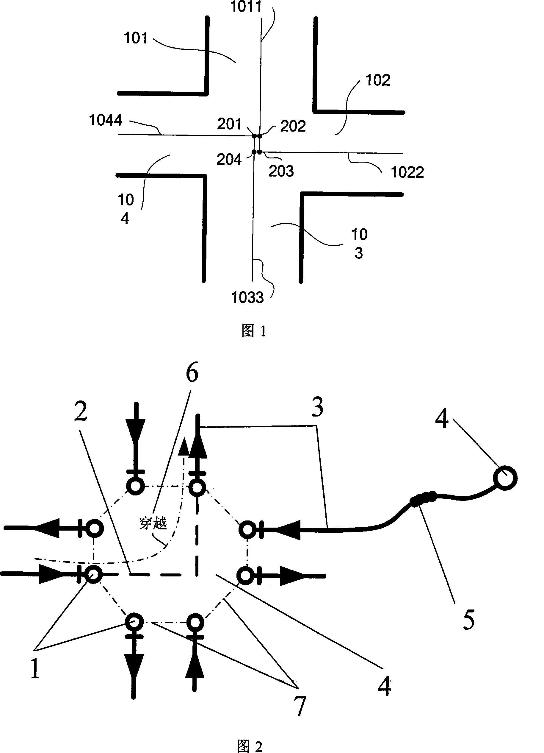
[0023] Figure 2 shows the basic geometric elements (geometric network) in the digitalized road network based on the virtual node road network model. It uses point elements and line elements to express the road network in the real world and can be displayed, mainly including virtual Node 4, road center line 3, shape point...


PUM


Abstract

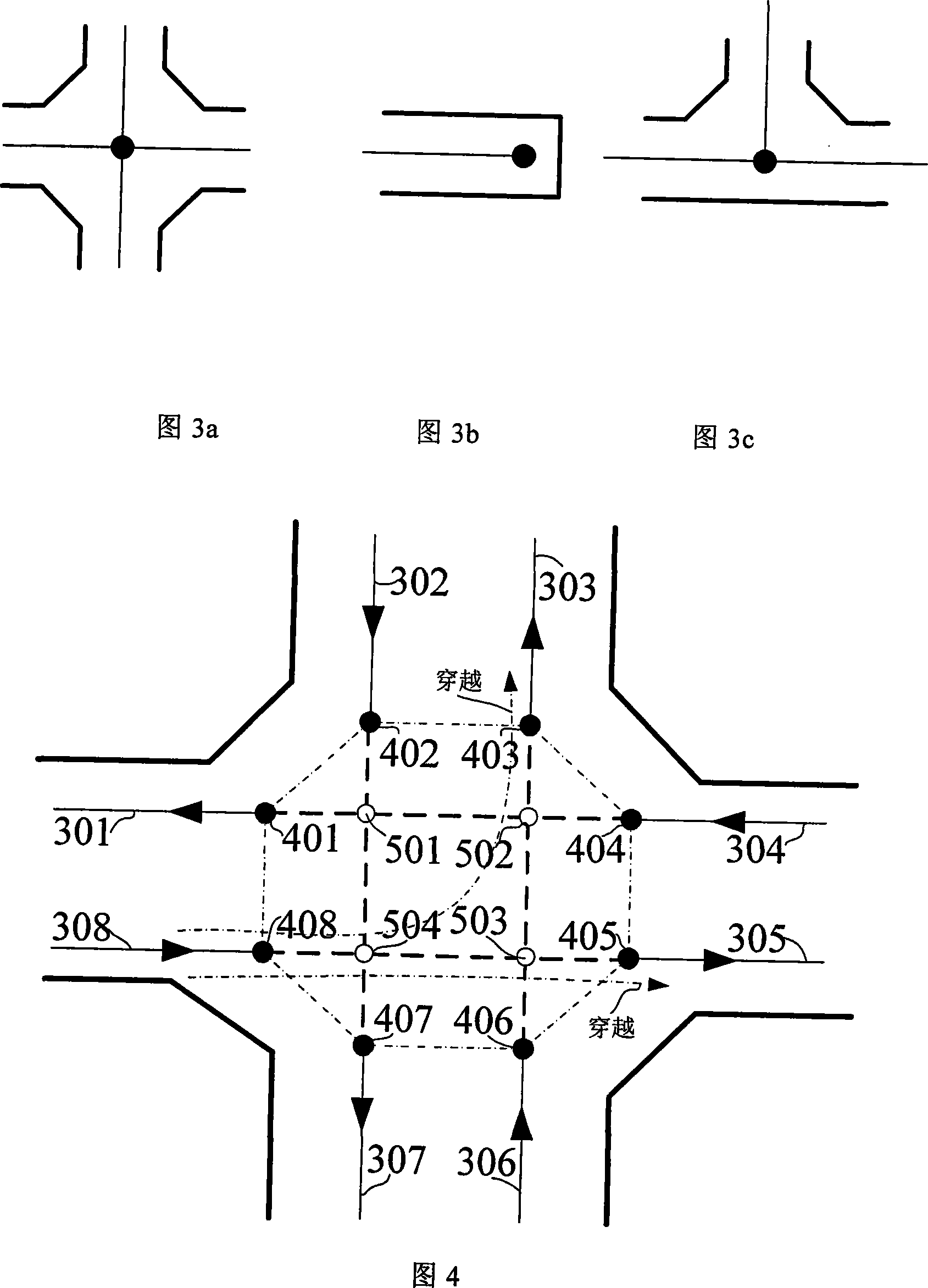
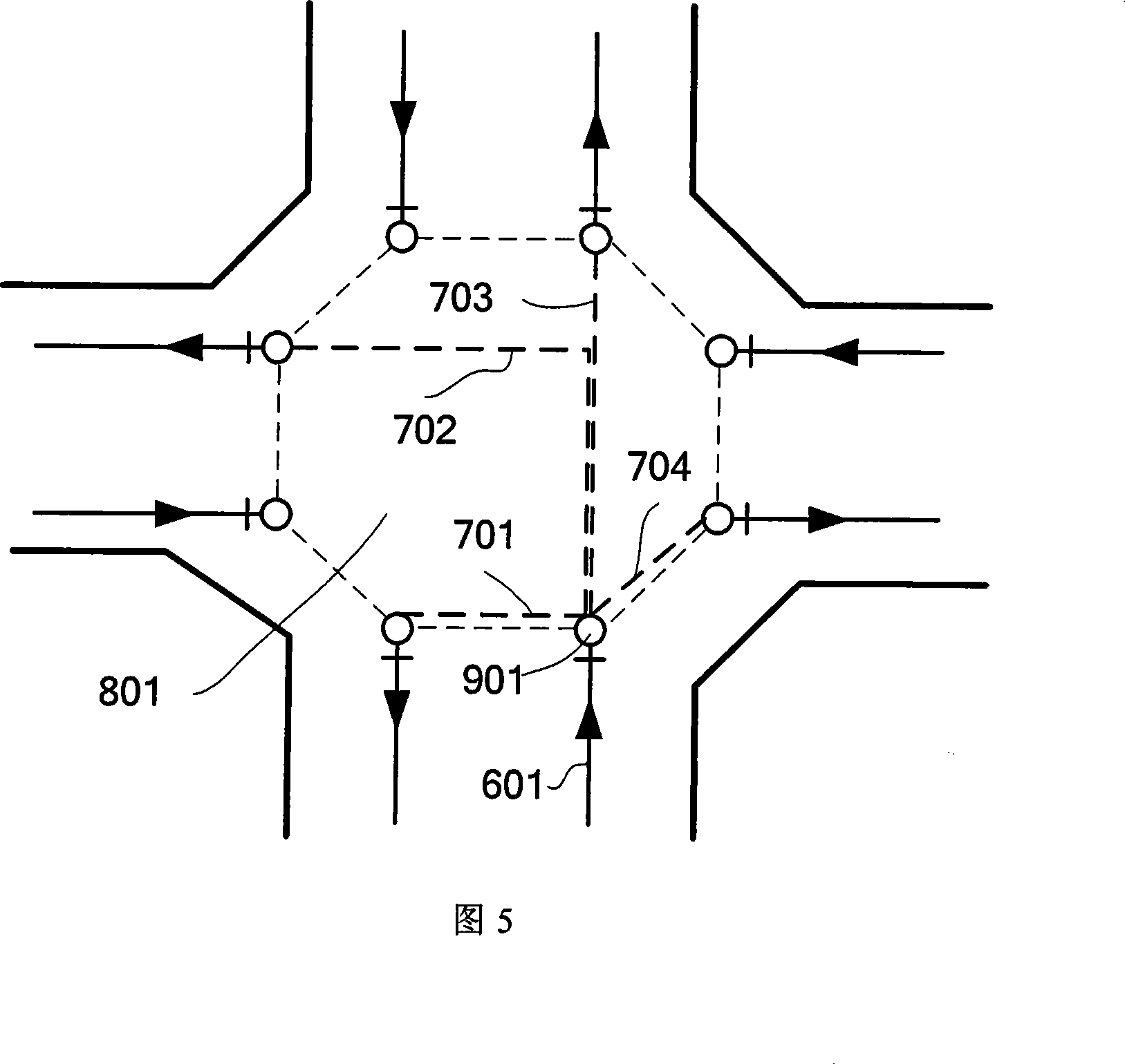
The invention discloses a road network model based on virtual nodes, and the road network model is the theory for network digitalization. The structure of the model mainly comprises a geometric net and a topology relationship between road sections. The basic elements of the geometric net comprise virtual nodes, road center-lines and shape points. The virtual nodes represent intersections between road sections, the beginnings of road sections or the ends of road sections, and comprises virtual road sections, inner points, envelopes of inner points; the road center-lines express road sections and are connected through inner points and virtual nodes; the shape points express turning points of road sections. The virtual road sections represent the topology relationship between road center-lines and traffic information, such as the distance damp and the time damp when road center-lines passing through junctions, and multi-lanes at junctions and different driving rules; the inner points determines the position information of virtual nodes. The model of the invention not only overcomes the shortages of traditional model, but also reflects the real road network more truly; and the model has better adaptability for functions, such as map match, route planning and real-time analysis for dynamic transportation network.

Description

technical field [0001] The invention relates to a road network structure model in a navigation electronic map, which is used for map matching, dynamic path planning and real-time analysis of the dynamic traffic network of a land moving object navigation system. Background technique [0002] For the land moving object navigation system, the navigation electronic map is an essential part, and the road network data in the navigation electronic map is its core unit. The accuracy of the road network database will directly affect the accuracy of map matching, thereby affecting the performance of the navigation system. In addition, with the continuous improvement of real-time traffic information service system, dynamic route planning and real-time analysis of dynamic traffic network have been widely used. Therefore, new requirements are put forward for the road network database in the navigation electronic map. [0003] In the current land moving target navigation electronic map, ...

Claims


Application Information

Patent Timeline
IPC IPC(8): G01C21/26G01C21/32G09B29/10
CPCH04L41/12H04L41/122
Inventor 朱庄生房建成
Owner BEIHANG UNIV
Learn More