
Moving terminal navigation method and system

A mobile terminal and navigation system technology, applied in traffic control systems, navigation calculation tools, road network navigators, etc., can solve problems such as loss of mobile navigation, poor data update capability, and transmission failure, and achieve fast map update and real-time performance, the effect of reducing the amount of transmission

Inactive Publication Date: 2008-07-02
CHINA MOBILE COMM GRP CO LTD
View PDF0 Cites 60 Cited by
  • Summary
  • Abstract
  • Description
  • Claims
  • Application Information

AI Technical Summary

Problems solved by technology

This is a limiting bottleneck of the navigation capability of this device, and there is another defect of this device, that is, the data update ability is very poor
Because the database information stored in the navigation client is static and pre-stored, the database cannot be updated in real time. Therefore, in order to obtain the latest data, the map must be redrawn according to the latest geographical conditions, and then stored in the navigation client database. , which makes it almost impossible for users to obtain real-time information during navigation
[0004] Completely online mode, this way includes navigation computer, navigation server and other equipment. During mobile navigation, the required map and route information are downloaded and transmitted through the navigation server. This system has a huge advantage, it can update the map and route information, and download it to the navigation computer terminal, and display it through the display terminal image, this system can overcome the defects of the completely offline mode, but because the map and route information must be downloaded in real time through the network, the amount of downloaded information is extremely large, and the network bandwidth make high demands
For a network environment with high bandwidth, this kind of system can run smoothly, but for a system with a narrow bandwidth, this kind of navigation system may be out of use, because the slow data transmission will greatly reduce the efficiency of the entire navigation system, even during the transmission of network data. In the process, the transmission often fails due to timeout, which loses the meaning of mobile navigation

Method used


Image

  • Moving terminal navigation method and system
  • Moving terminal navigation method and system
  • Moving terminal navigation method and system

Examples


Embodiment Construction

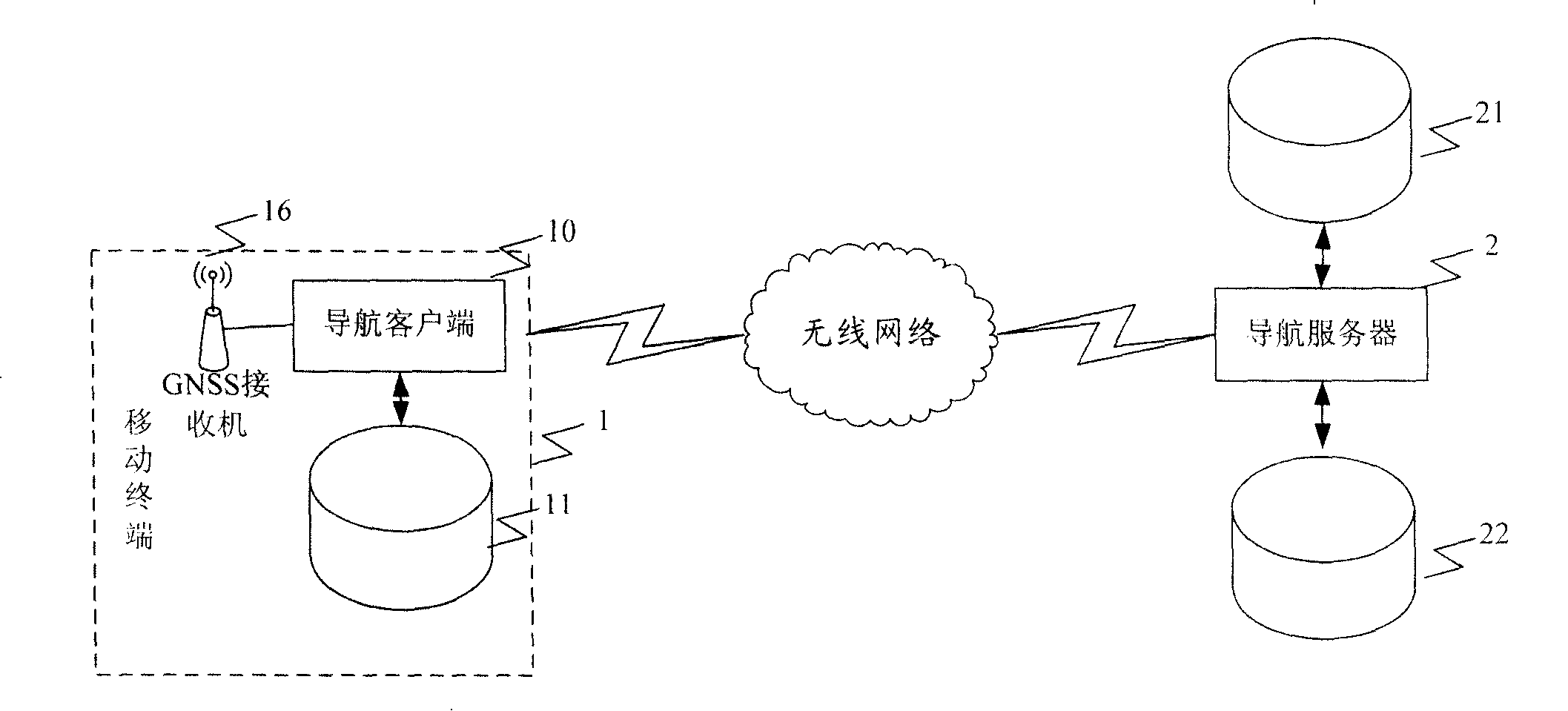
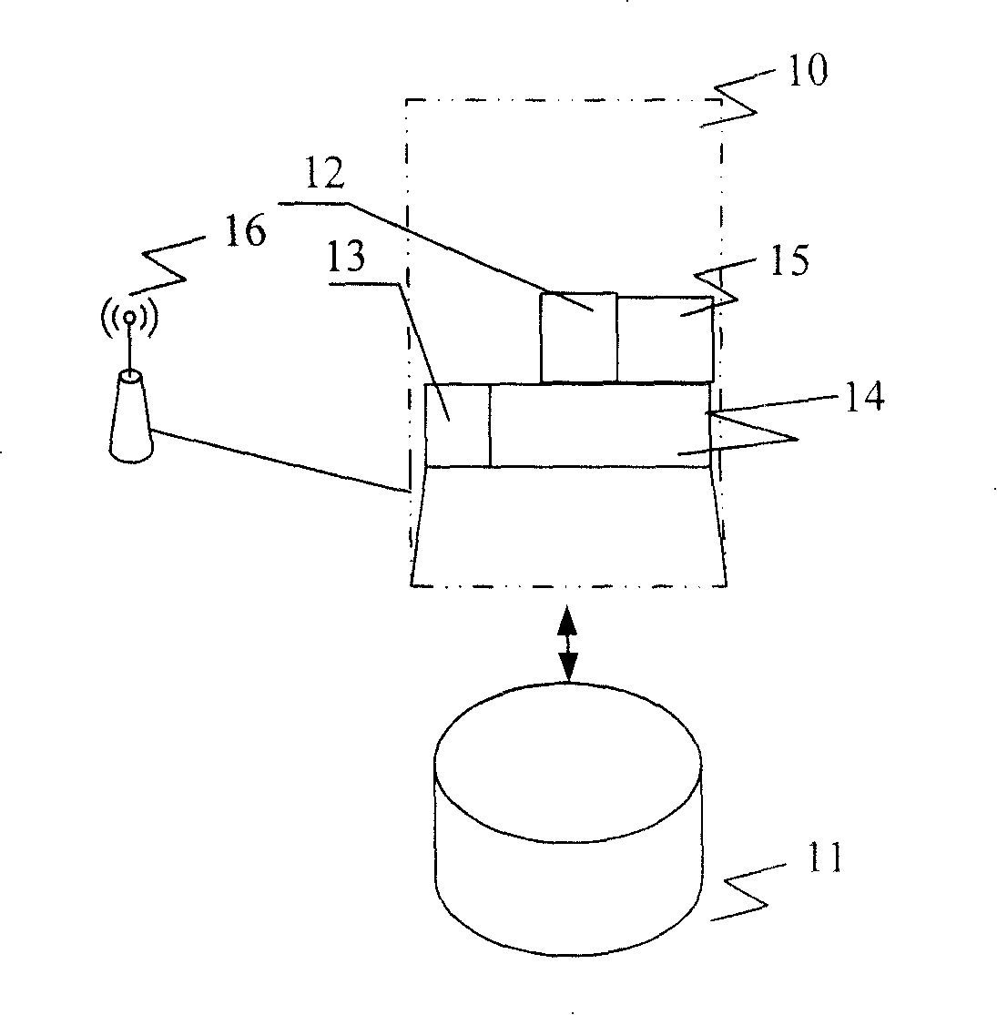
[0025] see figure 1 ,Such as figure 1 Shown is the structural diagram of Embodiment 1 of the mobile terminal navigation system of the present invention. The mobile navigation terminal of the present invention includes a mobile terminal 1, mainly includes a navigation client 10, and a GNSS (Global Navigation Satellite System, Global Navigation Satellite System) receiver 16 connected to the navigation client, and the navigation client 10 is connected to the navigation client for The local map database 11 of local query and call navigation information, mobile terminal 1 is used for the navigation server 2 of mobile terminal navigation through wireless network connection, and this navigation server includes the server map database 22 of storing map information, and is used for providing mobile terminal The real-time dynamic information database 21 of the data source. The GNSS system includes different positioning satellite systems, such as GPS (Global Positioning System) system,...


PUM


Abstract

The invention discloses a method and a system of mobile terminal navigation applied in small-bandwidth wireless network. The system comprises a mobile terminal and a GNSS receiver connected with the mobile terminal. The mobile terminal is also connected with a local map database for local searching and managing navigation information. The mobile terminal is connected with a navigation server through wireless network. The navigation server comprises the map database for storing the map information and a real-time dynamic information database. The method comprises that after receiving a navigation request sent from the mobile terminal, the navigation server will obtain the navigation information according to the server map database and the real-time dynamic information database and send the navigation information back to the mobile terminal; the mobile terminal manages the local map and marks the navigation information on the local map and outputs the display module. The invention greatly reduces the data transmission so that large capacity of map won't cause a navigation default in small-bandwidth environment.

Description

technical field [0001] The present invention relates to a mobile terminal navigation system, in particular to a mobile terminal navigation system for users to use in a low-bandwidth wireless network; the present invention also relates to a mobile terminal navigation method, in particular to the realization of A method for querying a route and a point of interest (POI for short). Background technique [0002] Existing mobile terminal navigation systems mainly have two modes, one is a completely offline mode, and the other is a completely online mode. Its principles and defects are summarized as follows: [0003] Completely offline mode, this method mainly includes an independently set navigation client, the navigation client is connected to the GNSS receiver, the navigation client is equipped with a storage database of maps and road information, and there are some shops, hotels, tourist attractions These are commonly referred to as point of interest (POI for short) informat...

Claims


Application Information

Patent Timeline
IPC IPC(8): G01S1/02G01S5/02G01C21/26G01C21/34G01C21/36G01C21/30G01C21/20G06F17/30G08G1/00G09B29/00G09B29/10H04Q7/22H04Q7/38
Inventor 林智于蓉蓉黄璐
Owner CHINA MOBILE COMM GRP CO LTD
Learn More