Midair aligning method for satellite/inertia combined navigation system
A technology of inertial combination and navigation system, applied in the field of initial attitude self-alignment and its simulation verification
- Summary
- Abstract
- Description
- Claims
- Application Information
AI Technical Summary
Problems solved by technology
Method used
Image

Examples
Embodiment Construction
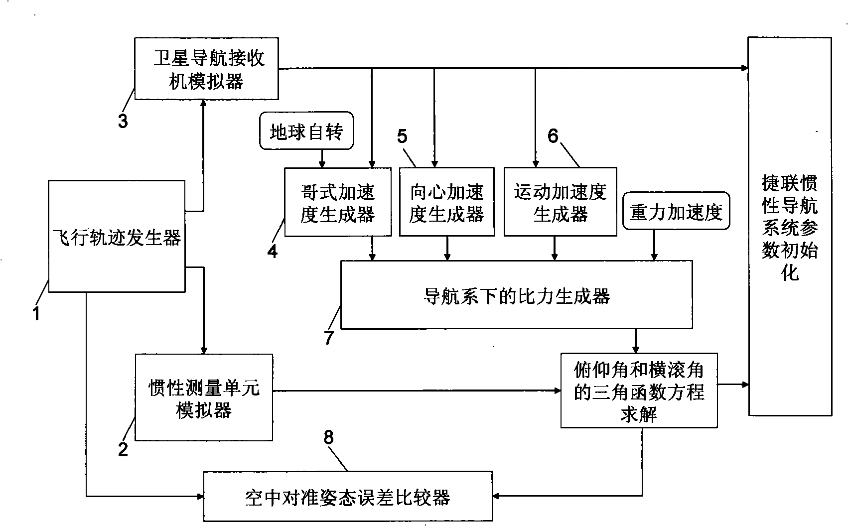
[0053] In order to realize the aerial alignment of the satellite / inertial integrated navigation system of the aircraft in various flight states, work needs to be done:
[0054] (1) Acquisition of positioning data by star navigation receiver: the integrated navigation computer G Continuously read the navigation information in a specific format output by the satellite navigation receiver from the interface connected to the satellite navigation receiver, and interpret it to obtain the real-time three-dimensional position, three-dimensional velocity and track azimuth of the aircraft, where the three-dimensional position includes the longitude λ , latitude L and altitude H, eastward velocity V in the local geographic coordinate system E , East speed V N and the eastward velocity V U , track azimuth ψ ;
[0055] (2) Satellite navigation positioning data cache: read the three-dimensional position, three-dimensional velocity, track azimuth and time information output by the satelli...
PUM
 Abstract
Description
Claims
Application Information
 - Generate Ideas
- Intellectual Property
- Life Sciences
- Materials
- Tech Scout
- Unparalleled Data Quality
- Higher Quality Content
- 60% Fewer Hallucinations
Browse by: Latest US Patents, China's latest patents, Technical Efficacy Thesaurus, Application Domain, Technology Topic, Popular Technical Reports.
© 2025 PatSnap. All rights reserved.Legal|Privacy policy|Modern Slavery Act Transparency Statement|Sitemap|About US| Contact US: help@patsnap.com