High-fidelity digital modeling method for landform altitude

A terrain elevation and modeling method technology, applied in electrical digital data processing, special data processing applications, measurement devices, etc., can solve problems such as regional distortion of grid DEM terrain simulation, and achieve broad industrial application prospects, high efficiency and high fidelity Digital simulation, the effect of improving accuracy and integrity

Inactive Publication Date: 2009-01-14
NANJING NORMAL UNIVERSITY
View PDF0 Cites 31 Cited by
  • Summary
  • Abstract
  • Description
  • Claims
  • Application Information

AI Technical Summary

Problems solved by technology

The technical process covers two key technical links: push-broom terrain data acquisition technology with local terrain adaptive matching function and grid DEM data structure correction technology based on vector feature data seamless embedding technology. Regional Distortion of Grid DEM Terrain Simulation

Method used


Image

  • High-fidelity digital modeling method for landform altitude
  • High-fidelity digital modeling method for landform altitude
  • High-fidelity digital modeling method for landform altitude

Examples


Embodiment Construction

[0076] The present invention will be described in further detail below in conjunction with the accompanying drawings and specific embodiments.

[0077] (Taking plain hilly terrain as an example)

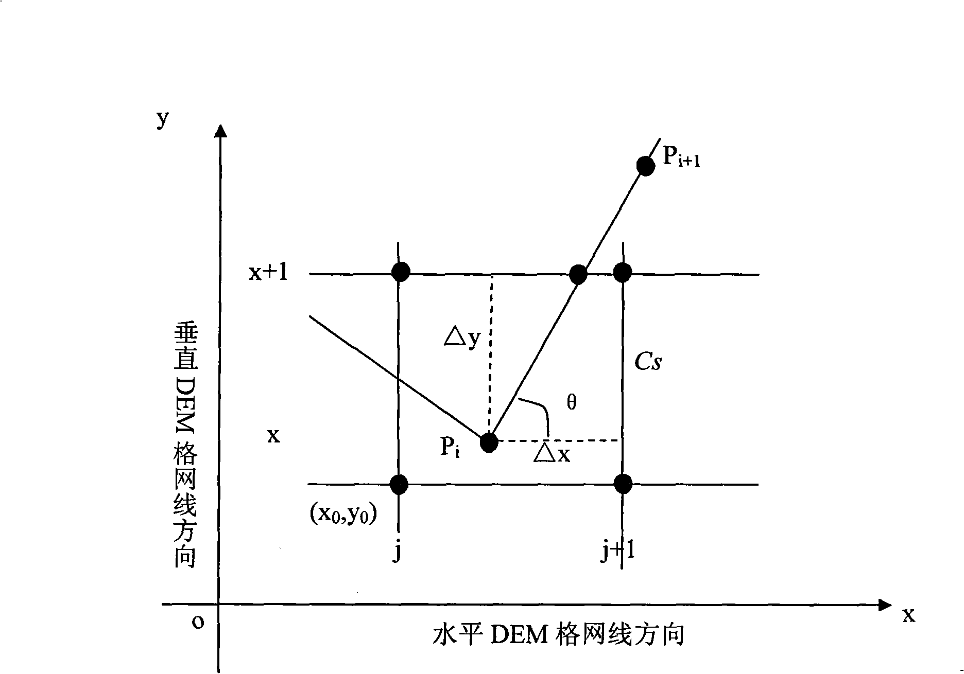
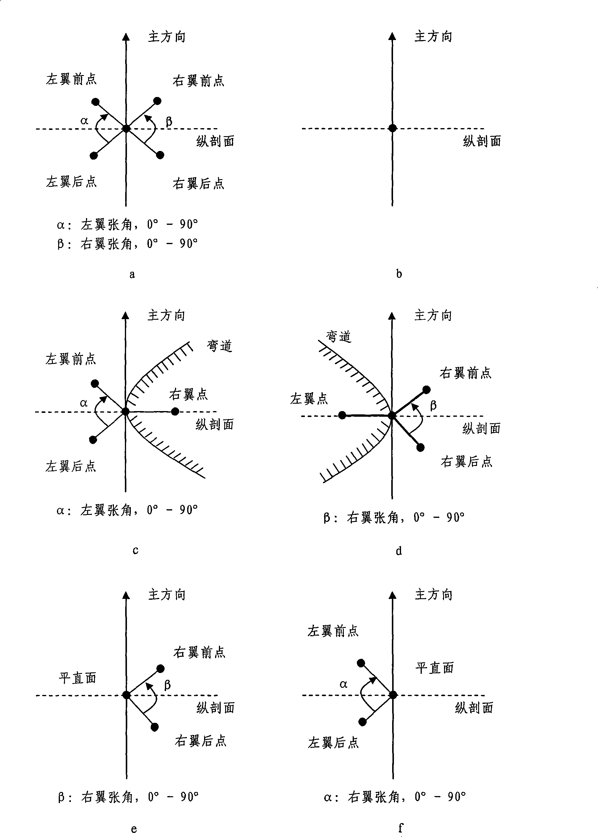
[0078] The overall feature of plain hilly terrain is that a large range of flat terrain is embedded with many finer regular terrains, such as cofferdams, aqueducts, dams, ponds, rice fields, artificial straight slopes, and so on. The sampling interval (grid size) stipulated by the country’s existing 1:10000 scale DEM is 5 meters, which on the one hand has a large amount of redundant data on the terrain of plain micro-hills, on the other hand it is difficult to accurately reconstruct and reproduce the The typical characteristics of plain micro-hill terrain such as canals, dams, ponds, rice fields, and artificial straight slopes make it difficult for the existing DEM to carry out effective geoscience analysis and engineering applications in this area.

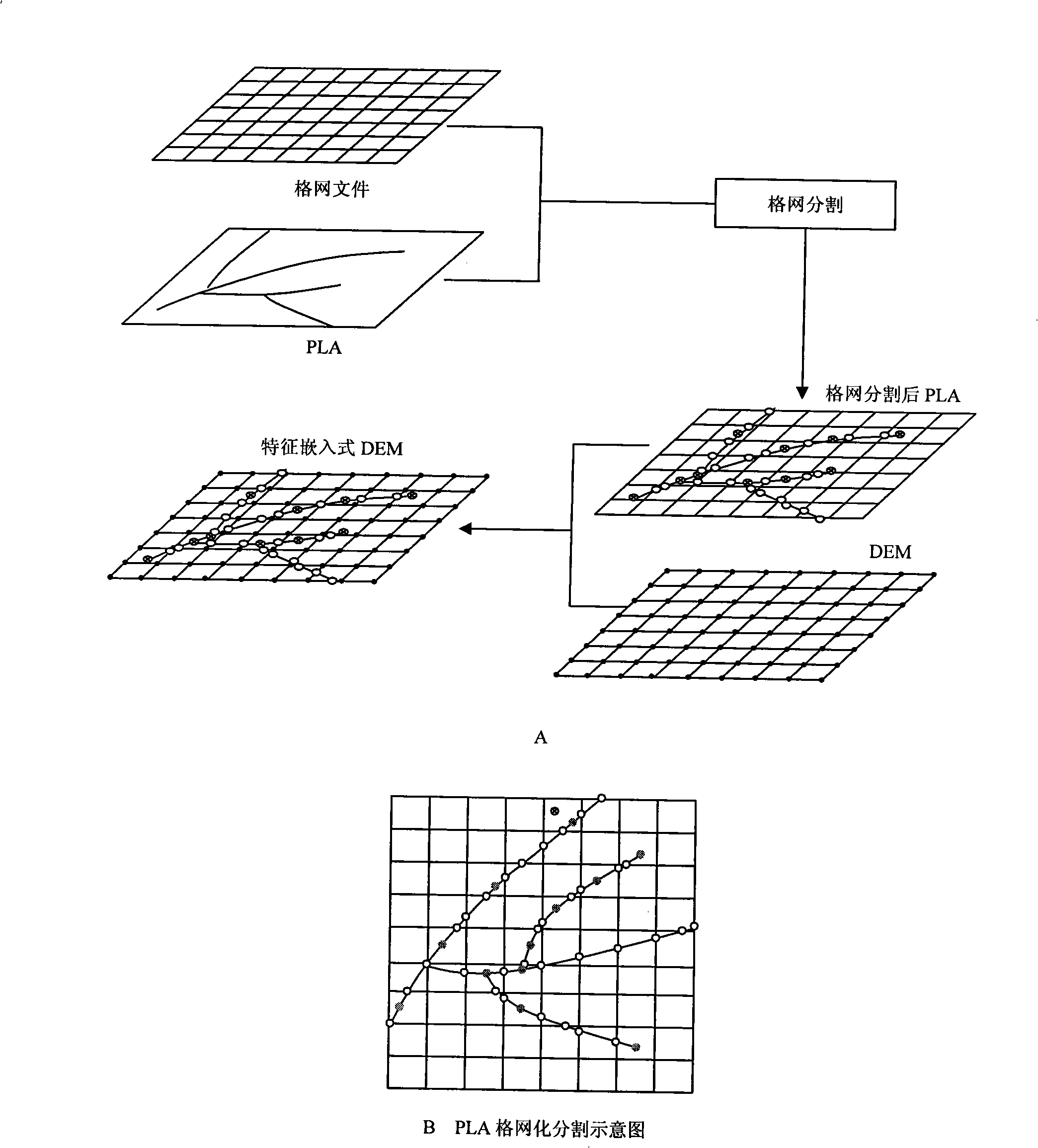
[0079] The construction process...


PUM


Abstract

The invention discloses a high-fidelity digital modeling method of terrain elevation, the steps are as follows: the first step is to carry out push-broom data acquisition; the second step is to carry out grid segmentation of the acquired vector terrain feature data; the third step is to carry out similar DEM grid data organization of PLA, organization management is carried out to the PLA data after the grid segmentation treatment according to grid data structure; the fourth step is to generate a new digital elevation model file to carry out the seamless embedding of the vector feature data; a feature embedded digital elevation model data structure is composed of three sub-files which comprise a grid file, a feature identification file and a feature file; the grid file is a regular grid data structure; the feature identification file is used for spatial data index of a vector grid integrated organization, the structure thereof is consistent with the current national DEM data structure and only records the grids with the features; the feature file records terrain feature information which is contained in one grid unit, and the information comprises feature points and feature lines.

Description

technical field [0001] The invention relates to a formation technology of a terrain digital elevation model, in particular to a high-fidelity digital modeling method of terrain elevation based on local surface matching terrain data acquisition mode and seamlessly embedded vectorization technology. technical background [0002] Digital elevation model products (Digital Elevation Models, DEM) are the core data products of national spatial basic geographic data, and the core system of GIS for terrain simulation analysis and geoscience analysis. Resource management, planning, tourism and many other fields, for example, in the surveying and mapping department, it is mainly used for 3D terrain modeling, visual domain analysis, engineering earthwork estimation, geometric correction of remote sensing images, etc.; Inundation analysis and other three-dimensional geoscience analysis; in the land and resources department, it is mainly used for detailed inspection of land use types, etc...

Claims


Application Information

Patent Timeline
Patent Type & Authority Applications(China)
IPC IPC(8): G01C7/02G06F17/30
Inventor 刘学军汤国安王春陶旸
Owner NANJING NORMAL UNIVERSITY
Why Eureka
Try Eureka