

Remote sensing survey method and system for estimating tree coverage percentage of city
A measurement method and coverage technology, which is applied in the fields of remote sensing image processing and application, urban garden statistics, forest and vegetation mapping, can solve the problems of low precision and difficulty in determining the coverage length and radius, and achieve high precision, accuracy and precision Improvement, high efficiency effect
- Summary
- Abstract
- Description
- Claims
- Application Information
AI Technical Summary
Problems solved by technology
Method used
Image

Examples
Embodiment Construction
[0031] The present invention will be described in detail below in conjunction with the accompanying drawings and specific embodiments.
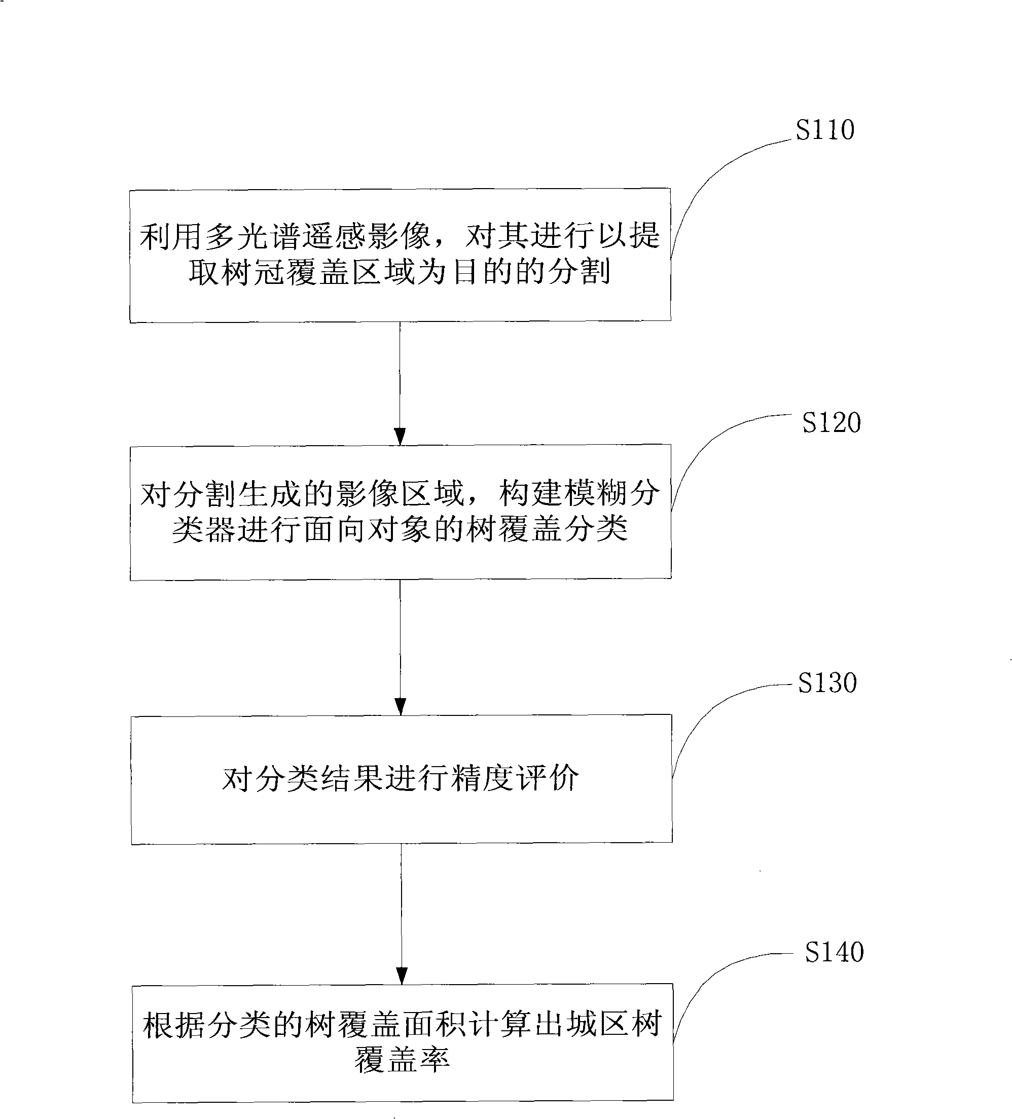
[0032] figure 1 It is a flow chart of the remote sensing measurement method for estimating urban tree coverage according to the first embodiment of the present invention.
[0033] like figure 1 As shown, it includes the following processing steps:
[0034] Segmentation for the purpose of extracting tree crown coverage areas is carried out using multi-spectral remote sensing images (S110);
[0035] Constructing a fuzzy classifier for object-oriented tree covering classification (S120) for the image region generated by segmentation;
[0036] Carry out precision evaluation to classification result (S130);
[0037] Calculate the urban tree coverage rate according to the classified tree coverage area (S140).
[0038] In the present invention, in step S110, the resolution of the multi-spectral (blue, green, red, near-infrared band) remote sens...
PUM
 Abstract
Description
Claims
Application Information