Unmanned aerial vehicle vision/inertia integrated navigation method in unknown environment

A technology of unknown environment and navigation method, which is applied in the field of UAV vision/inertial integrated navigation, achieving the effects of wide adaptability, good concealment, and high navigation accuracy

Inactive Publication Date: 2009-12-09
BEIHANG UNIV
View PDF0 Cites 109 Cited by
  • Summary
  • Abstract
  • Description
  • Claims
  • Application Information

AI Technical Summary

Problems solved by technology

[0008] The present invention proposes a visual / inertial combined navigation method for unmanned aerial vehicles in an unknown environment. Its purpose is to solve the problem of integrated navigation for unmanned aerial vehicles in an unknown environment. Anti-jamming and fully autonomous navigation during the process

Method used


Image

  • Unmanned aerial vehicle vision/inertia integrated navigation method in unknown environment
  • Unmanned aerial vehicle vision/inertia integrated navigation method in unknown environment
  • Unmanned aerial vehicle vision/inertia integrated navigation method in unknown environment

Examples


Embodiment Construction

[0034] Before carrying out this method, it is necessary to first define and align the coordinate system:

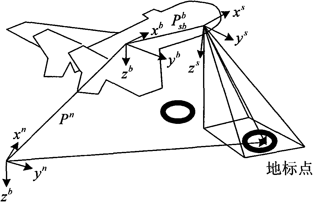
[0035] 1. Definition of coordinate system

[0036] like figure 1 As shown, the coordinate axis definition includes the body coordinate system (o b x b the y b z b ), navigation coordinate system (o n x n the y n z n ), camera coordinate system (o s x s the y s z s ) and the IMU coordinate system (o i x i the y i z i )Definition;

[0037] Camera coordinate system (o s x s the y s z s): Fasten the visual sensor on the aircraft to obtain a series of ground images, and its coordinate origin is located at the center of the camera, o s z s along the optical axis of the camera, o s x s and o s the y s Along the length and width directions of the imaging plane of the camera respectively, the three are perpendicular to each other to form a right-handed coordinate system;

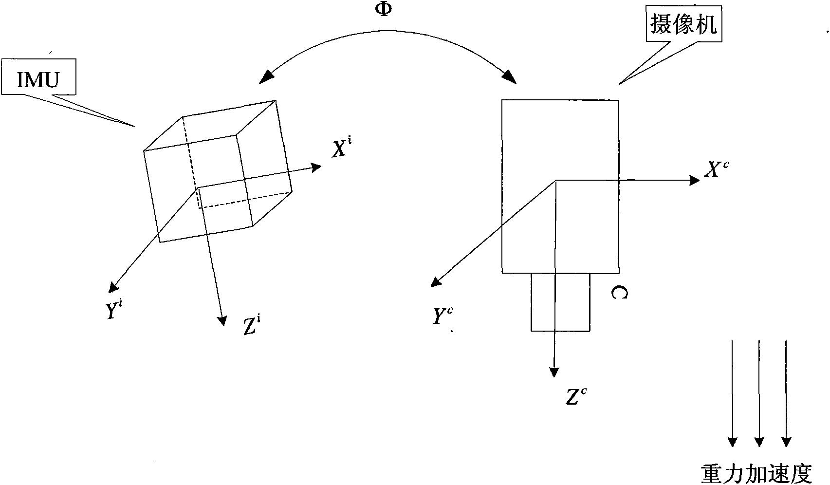
[0038] IMU coordinate system (o i x i the y i z i ): The coordinate system def...


PUM


Abstract

The invention relates to an unmanned aerial vehicle vision/inertia integrated navigation method in the unknown environment. The method relates to image processing, inertial navigation calculation and filtering estimation, so that the steps of defining coordinate system, aligning the coordinate system, setting up filter equation and the like are firstly carried out before the main navigation method is implemented. The navigation process of the method comprises five steps: acquiring and pretreating image; extracting feature points by a SIFT method; matching the feature points; updating the filter equation; and carrying out the filtering estimation on the updated filter equation. The method only needs the current ground image instead of specific external information for matching, so as to be used in any environment (including underwater, shelter, canyon, underground and the like) in theory; furthermore, the method has the advantages of good sheltered property and high accuracy.

Description

technical field [0001] The invention relates to the technical field of navigation, in particular to a vision / inertia combined navigation method for unmanned aerial vehicles in an unknown environment. Background technique [0002] UAV navigation refers to the technology that UAV relies on onboard navigation equipment and flight control system for positioning and control and finally completes the flight mission. It is one of the key technologies for UAV development. Commonly used methods in UAV navigation include: remote control command, inertial navigation system (Inertial Navigation System, INS), satellite navigation, integrated navigation, etc. [0003] At present, the research on visual navigation system is gradually carried out, but basically it is based on GPS satellite navigation and supplemented by several other navigation methods. However, due to the harsh electromagnetic environment of UAVs, especially small UAVs used in combat, the remote control communication link...

Claims


Application Information

Patent Timeline
Patent Type & Authority Applications(China)
IPC IPC(8): G01C21/24
Inventor 范耀祖徐超沈晓蓉张海
Owner BEIHANG UNIV
Why Eureka
Try Eureka