
A Method of Extracting Building Outlines from Satellite Remote Sensing Images

A technology for satellite remote sensing images and buildings, applied in image analysis, photo interpretation, image data processing, etc., can solve problems such as difficulty in distinguishing, and achieve the effects of high processing efficiency, reduced workload, and strong practicability

Inactive Publication Date: 2011-12-28
BEIJING JIAOTONG UNIV
View PDF5 Cites 0 Cited by
  • Summary
  • Abstract
  • Description
  • Claims
  • Application Information

AI Technical Summary

Problems solved by technology

Furthermore, it is difficult to distinguish the impervious ground with severe spectral confusion into roads, parking lots and buildings.

Method used


Image

  • A Method of Extracting Building Outlines from Satellite Remote Sensing Images
  • A Method of Extracting Building Outlines from Satellite Remote Sensing Images
  • A Method of Extracting Building Outlines from Satellite Remote Sensing Images

Examples


Embodiment Construction

[0057] The method of the present invention belongs to the field of surveying and mapping, digital remote sensing image processing, photogrammetry and remote sensing technology object information extraction and application. Therefore, before the specific implementation is illustrated, it is considered that the implementer has the necessary technical field to understand the method of the present invention Basic knowledge and skills related to technical theory and related processing procedures and algorithms, such as remote sensing technology and application, surveying and mapping, digital image processing, fuzzy mathematics, etc. In particular, basic knowledge of object-oriented image analysis should be possessed. Based on the above background knowledge and technical basis, the relevant basic technical means and functions involved in the method embodiment of the present invention will not be explained in detail. The implementer can refer to relevant textbooks, monographs or journa...


PUM


Abstract

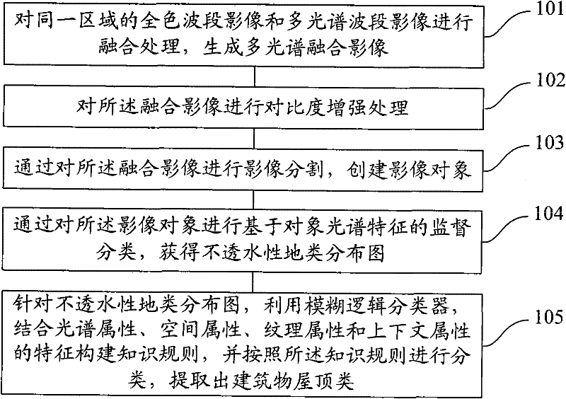
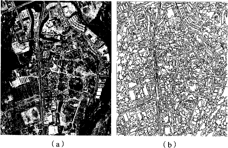
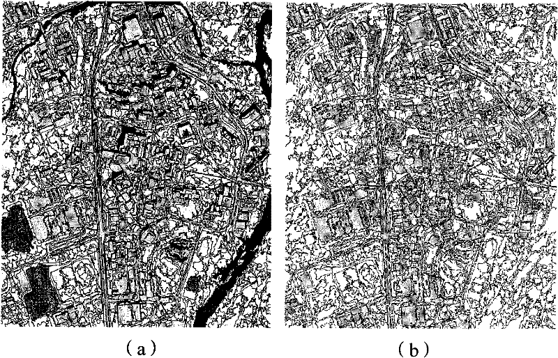
The invention provides a method for extracting building outlines from satellite remote sensing images, comprising: fusing panchromatic band and multispectral band images in the same area to generate a multispectral fusion image; performing contrast enhancement processing on the fusion image; Fusion images for image segmentation and creation of image objects; supervised classification of image objects based on spectral features to obtain impervious land type distribution maps; for impervious land type distribution maps, use fuzzy logic classifiers, combined with spectral attributes, spatial Attributes, texture attributes, and context attributes are used to construct knowledge rules, and they are classified according to knowledge rules to extract building roof classes. The present invention can realize building outline extraction for irregular or complex urban scenes without auxiliary data, and does not need to subdivide other impermeable land types except roofs in the classification, and the processing flow has practicability and flexibility. And the extraction accuracy is high.

Description

technical field [0001] The invention relates to the technical fields of surveying and mapping, digital remote sensing image processing, photogrammetry and remote sensing technology, object information extraction, and in particular to a method for extracting urban building outlines from satellite remote sensing images. Background technique [0002] In the prior art, detailed urban building distribution maps are mainly obtained through aerial photogrammetry or artificial ground measurement, and this conventional acquisition method requires high data costs. In recent years, the emergence of relatively cheap meter-level and better-than-meter-level commercial high-resolution multispectral satellite images (such as IKONOS and QuickBird) is expected to change the situation that aerial remote sensing images must be used for urban mapping. On high-resolution satellite remote sensing images, building roofs are the main features of urban building mapping, and the outline shape of groun...

Claims


Application Information

Patent Timeline
Patent Type & Authority Patents(China)
IPC IPC(8): G06T7/60G01C11/04
Inventor 谭衢霖魏庆朝杨松林胡吉平
Owner BEIJING JIAOTONG UNIV
Learn More