
Ship's inertial navigation and astronomical positioning method based on attitude measurement

A strapdown inertial navigation and astronomical positioning technology, applied in the field of navigation and positioning, can solve the problems of positioning error divergence and so on

Inactive Publication Date: 2010-11-10
HARBIN ENG UNIV
View PDF3 Cites 28 Cited by
  • Summary
  • Abstract
  • Description
  • Claims
  • Application Information

AI Technical Summary

Problems solved by technology

However, limited by the principle, the positioning error of the strapdown inertial navigation system diverges with the accumulation of time, and it is impossible to perform long-term, high-quality positioning; considering that the attitude output by the strapdown inertial navigation system does not diverge with the accumulation of time, How to use the non-divergent nature of the attitude in the strapdown inertial navigation and process the attitude measured by the CCD star sensor to obtain the position matrix, so as to obtain accurate position information is particularly necessary

Method used


Image

  • Ship's inertial navigation and astronomical positioning method based on attitude measurement
  • Ship's inertial navigation and astronomical positioning method based on attitude measurement
  • Ship's inertial navigation and astronomical positioning method based on attitude measurement

Examples


Embodiment Construction

[0105] The following examples describe the present invention in more detail:

[0106] (1) After the initial alignment of the strapdown inertial navigation system (coarse alignment and fine alignment), the output data of the fiber optic gyroscope and the quartz flexible accelerometer are collected;

[0107] (2) Gather the output of the CCD star sensor: the attitude information between the coordinate system of the CCD star sensor relative to the inertial coordinate system (i system: celestial coordinate system)

[0108] Transformation matrix between i system and ship carrier coordinate system (b system):

[0109] C i b = C s b C i s - - - ( 1 )

[0110] in: is the conversion matrix between the CCD star sensor coordinate system (s system) and the b system, which can...


PUM


Abstract

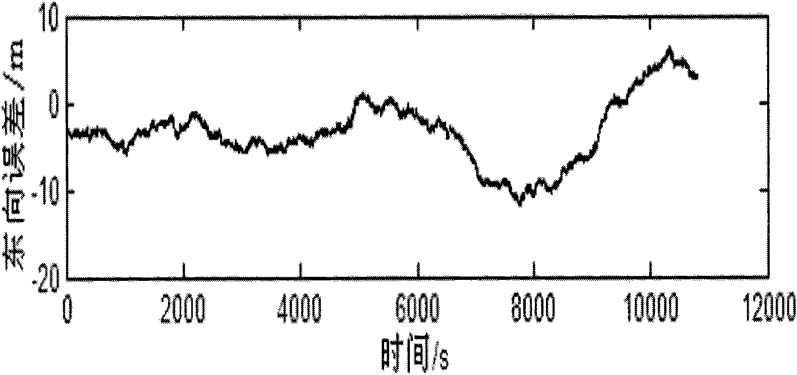
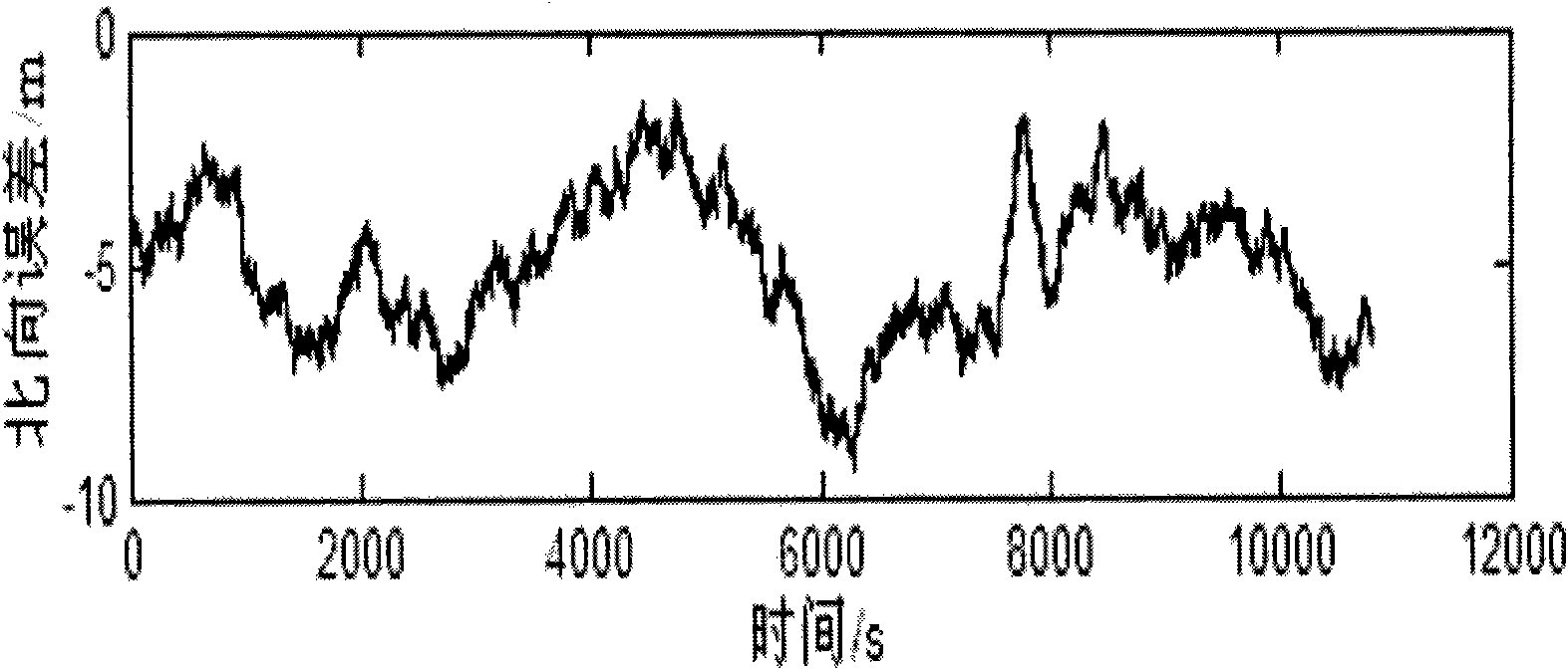
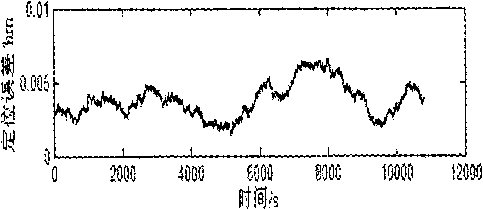
The invention provides a ship's inertial navigation and astronomical positioning method based on attitude measurement, comprising the following steps of: (1) collecting the output data of an optical fiber gyroscope and a quartz flexible accelerometer after the initial alignment of an inertial navigation system is finished; (2) collecting the output of a CCD (Charge Coupled Device) star sensor, namely the attitude information of the coordinate system of the CCD star sensor relative to an inertial coordinate system i; (3) collecting the attitude matrixes continuously output by the inertial navigation system; (4) resolving the conversion matrix of an earth based coordinate system e relative to the system i; and (5) calculating out the position matrix through the information in steps (1), (2), (3) and (4), and calculating out the position information according to the position matrix. The method is an accumulation-free navigation positioning algorithm and has high positioning precision.

Description

technical field [0001] The invention relates to a navigation positioning method, in particular to a strapdown inertial navigation and celestial navigation positioning technology. Background technique [0002] As a high-precision attitude measurement instrument, the CCD star sensor has the advantages of small size, strong adaptability, and no accumulation of measurement errors over time. It is not only used in space vehicles such as spacecraft and satellites, but also in ships and missiles. The applications are becoming more and more extensive. Traditional celestial navigation uses platform inertial navigation or platform compass to provide horizontal reference, and uses CCD star sensor to observe several stars in a certain position in space, and uses its own star library to compare and calculate the distance of the optical axis. Right ascension and declination, and then use the algorithm of astronomical triangle to calculate the geographic location (longitude and latitude) ...

Claims


Application Information

Patent Timeline
IPC IPC(8): G01C21/02G01C21/16G01C21/20
Inventor 张勇刚付建楠高伟奔粤阳徐博周广涛于强张鑫吴晓胡丹
Owner HARBIN ENG UNIV
Learn More