Pedestrian navigation path planning method and system thereof

A path planning and pedestrian navigation technology, applied to road network navigators and other directions, can solve the problem that the navigation device does not provide correct path planning for pedestrians

Inactive Publication Date: 2010-12-01
MITAC COMP (SHUN DE) LTD
View PDF0 Cites 15 Cited by
  • Summary
  • Abstract
  • Description
  • Claims
  • Application Information

AI Technical Summary

Problems solved by technology

[0004] The route planning in the current navigation system can be roughly divided into driving mode and walking mode. Because the content of the map information is currently provided for car navigation, the type of route planning is mostly for cars. For example, expressway priority , or fast road priority, but the traditional navigation device does not provide the correct path planning for pedestrians on foot

Method used


Image

  • Pedestrian navigation path planning method and system thereof
  • Pedestrian navigation path planning method and system thereof
  • Pedestrian navigation path planning method and system thereof

Examples


Embodiment Construction

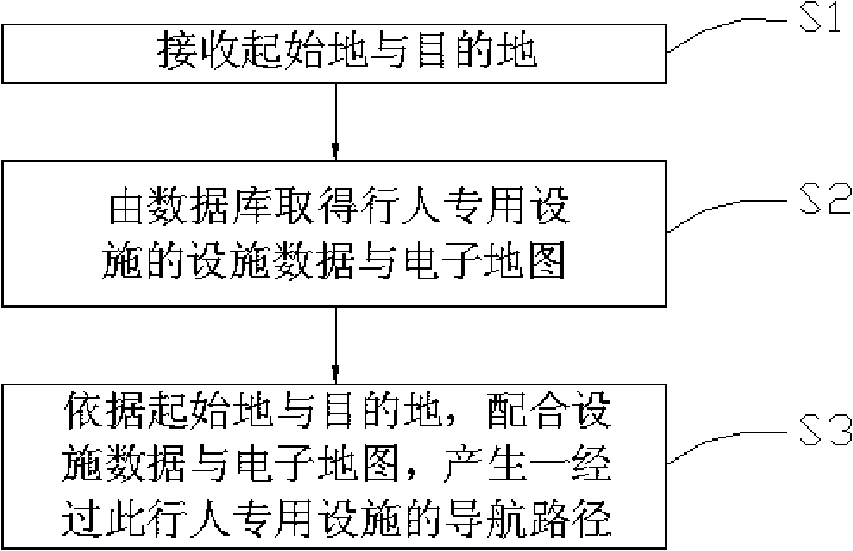
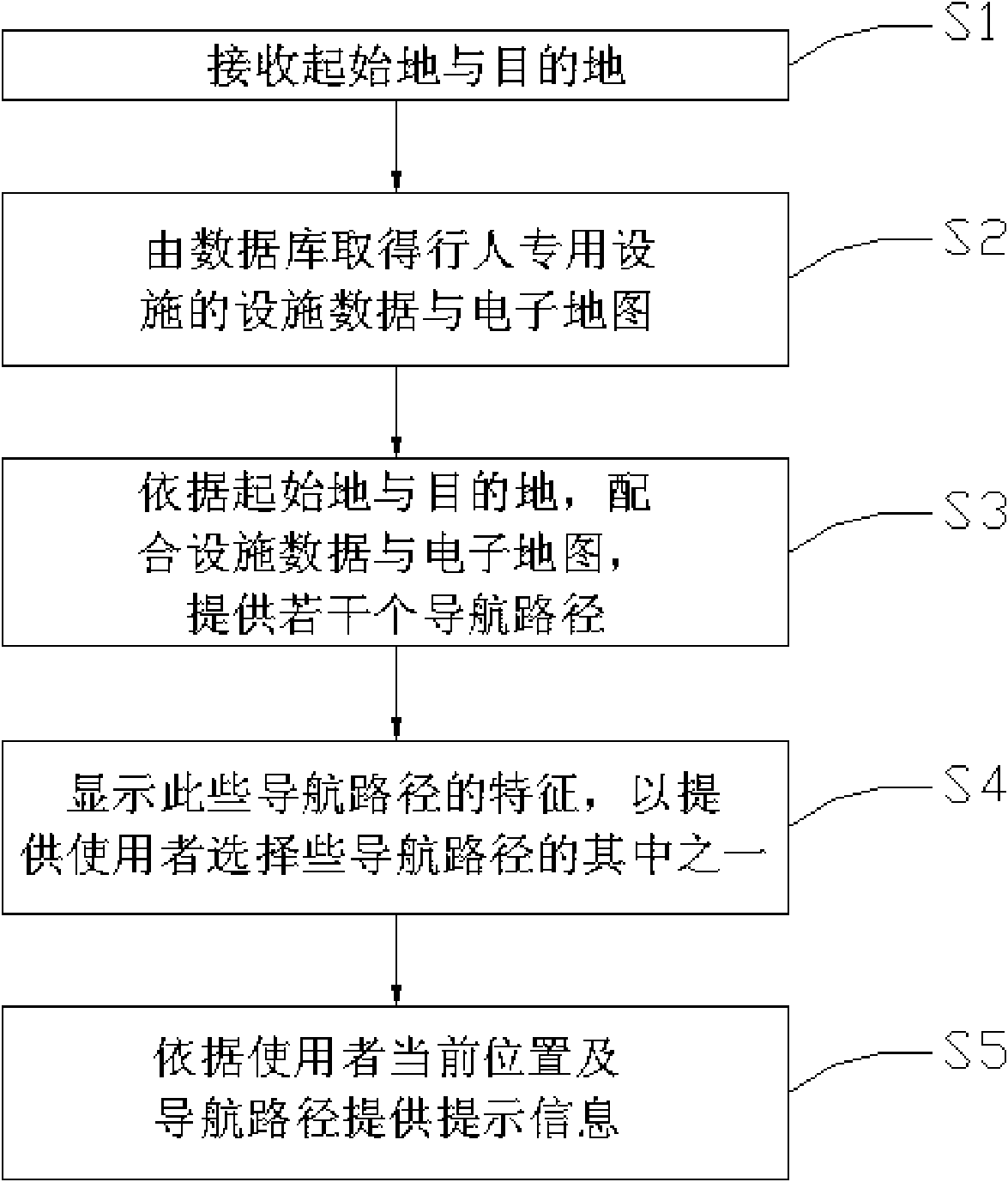
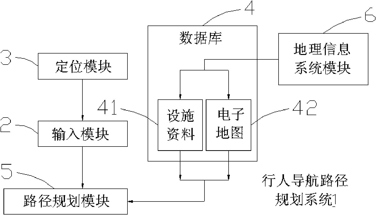
[0019] see figure 1 , which is a flow chart of the first embodiment of the pedestrian navigation route planning method of the present invention. First, the origin and destination are received in step S1. The starting point and destination can be input by the user, or the current location of the user can be obtained through the global satellite positioning system (GPS) as the starting point, which saves the inconvenience of inputting and setting.

[0020] Then, at step S2, the facility data and the electronic map of at least one pedestrian-only facility are obtained from the database. The electronic map records information related to regional roads, including detailed street maps, road names, and various facilities, such as libraries, post offices, hospitals, parks, etc., and the facilities for pedestrians are marked on pedestrian-only lanes, pedestrians, etc. The location of crossings (such as zebra crossings, pedestrian bridges, and pedestrian underpasses) on the map, this ...


PUM


Abstract

The invention discloses a pedestrian navigation path planning method and a system thereof. The invention is characterized by based on an electronic map with the pedestrian private facilities, the received initial position and the destination, making a plan of the navigation path by coordinating with the navigation path of the pedestrian private facilities on the road such as zebra crossing, overline bridge or underpasses and combining the electronic map, thereby enabling a user to correctly arrive the destination under the condition of according with the safe and traffic regulation. Additionally, in an embodiment, when the pedestrian position is close to the pedestrian private facilities, a prompt message is send out to remind the pedestrian of walking on the safer pedestrian private facilities to go across the road.

Description

【Technical field】 [0001] The present invention relates to a pedestrian navigation path planning method and system thereof, in particular to the technical field of planning a pedestrian safety-first navigation path. 【Background technique】 [0002] With the advancement of science and technology, various equipment that were originally used by cutting-edge technology have gradually been brought into daily life, thereby promoting the convenience of human daily life. As far as the Global Positioning System (Global Position System, GPS) is concerned, it has become increasingly popular in daily life and has been adopted and used by the public. [0003] The global satellite positioning system is a positioning device combining satellite and wireless technology, which can provide users with precise positioning coordinates. The global satellite positioning system was limited to military units in the early days, and its purpose was for military purposes, such as the precise positioning ...

Claims


Application Information

Patent Timeline
Patent Type & Authority Applications(China)
IPC IPC(8): G01C21/34
Inventor 刘能
Owner MITAC COMP (SHUN DE) LTD
Why Eureka
Try Eureka