Bidirectional satellite navigation and communication positioning method and system

A technology of navigation and positioning and satellite communication, applied in the field of satellite navigation and positioning and satellite communication, to achieve the effect of more functions, rich functions and less system investment

Inactive Publication Date: 2011-10-12
NAT ASTRONOMICAL OBSERVATORIES CHINESE ACAD OF SCI
View PDF7 Cites 24 Cited by
  • Summary
  • Abstract
  • Description
  • Claims
  • Application Information

AI Technical Summary

Problems solved by technology

In the system stated in the patent, the navigation center station can grasp the spatio-temporal information of each terminal, so that the system can only

Method used


Image

  • Bidirectional satellite navigation and communication positioning method and system
  • Bidirectional satellite navigation and communication positioning method and system
  • Bidirectional satellite navigation and communication positioning method and system

Examples


Example Embodiment

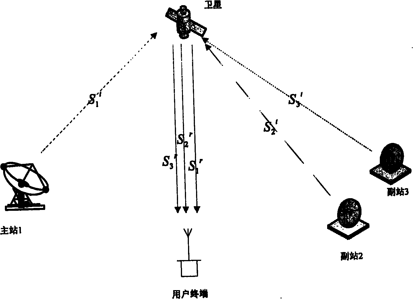
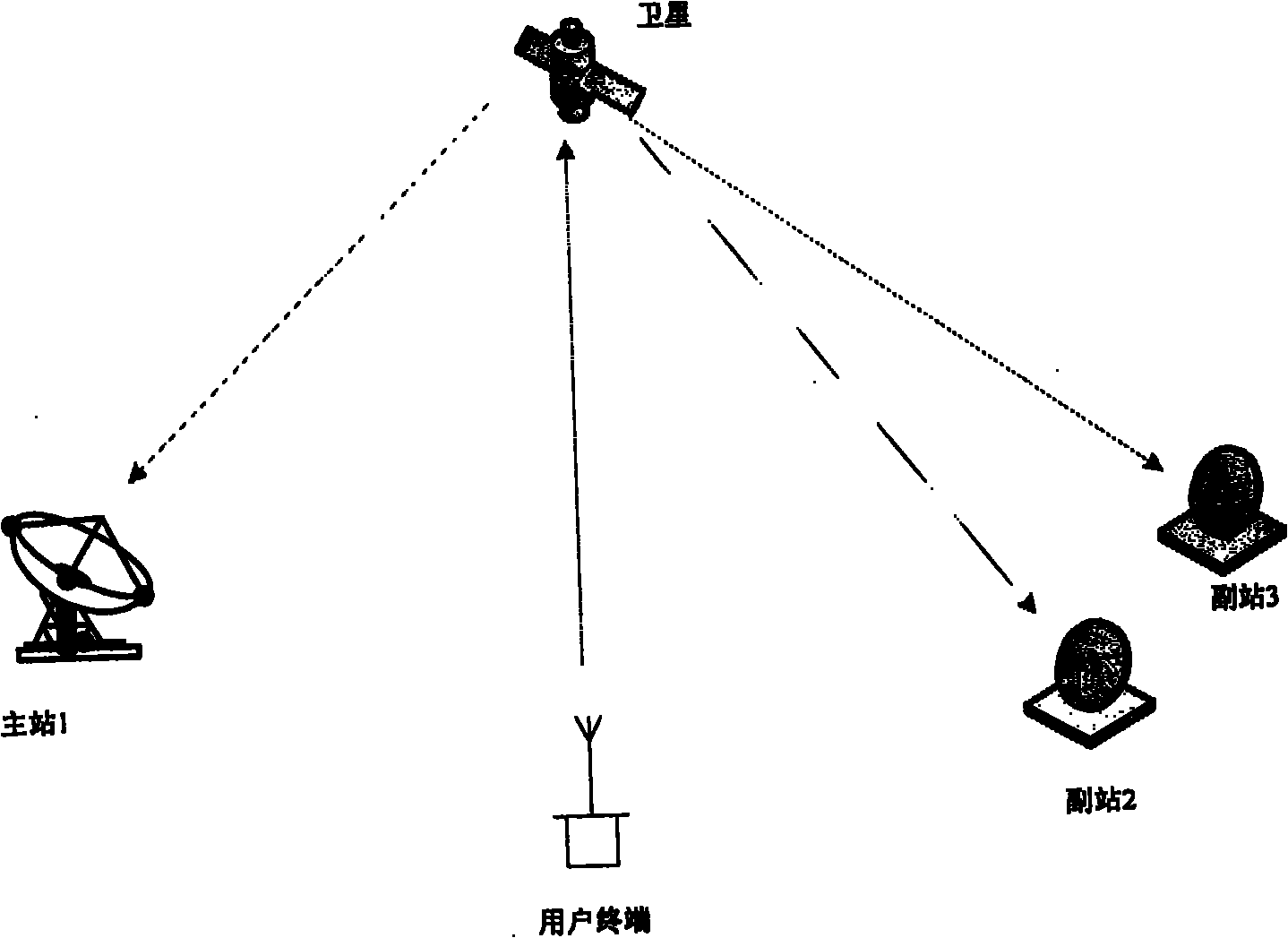
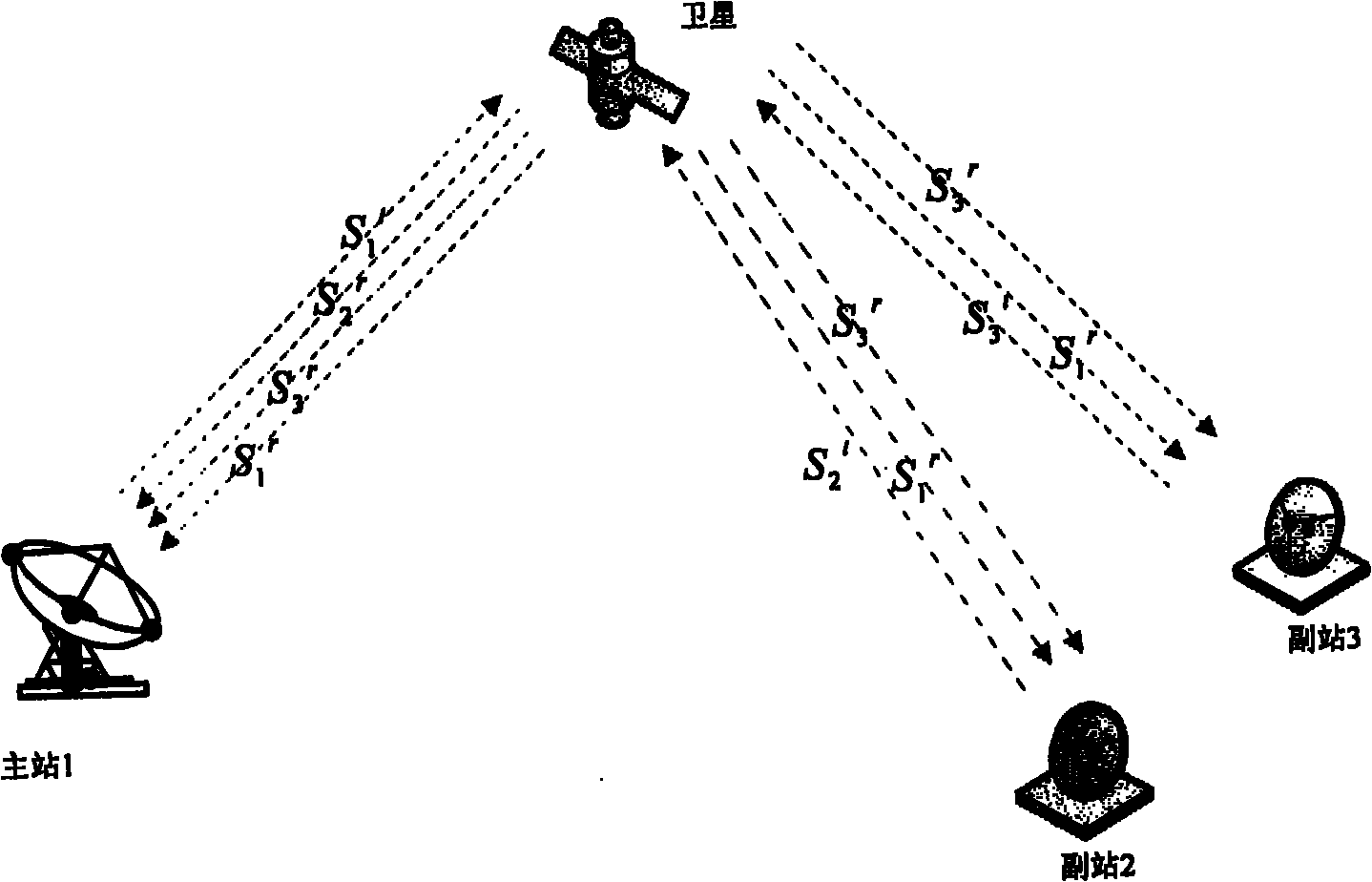
[0034] The two-way satellite navigation communication positioning system of the present invention is attached figure 1 As shown, it consists of a space segment and a ground segment. The space segment adopts communication satellites, the most suitable ones are commercial synchronous communication satellites (also including small inclination synchronous satellites that drift from late-life satellites), mobile communication satellites and other suitable satellites. It is emphasized that the use of communication satellites is because there are transponders on the communication satellites, which can be used to form a transmission link forwarded by the satellite. The ground segment consists of the main navigation communication station, auxiliary navigation communication station and user terminals. The main navigation station must be equipped with a high-stability terrestrial atomic clock, an antenna with a caliber of 7 meters or more, a transceiver, a navigation baseband and a commun...


PUM


Abstract

The invention discloses a bidirectional satellite navigation and communication positioning method and system, relating to a satellite technology. The system is provided with an outcoming and incoming positioning link and a communication link, comprises satellite ground stations (a master station and an auxiliary station), a synchronous communication satellite and various user terminals, is a highly-integrated navigation positioning and communication integrated bidirectional information system, has various functions, such as bidirectional pseudorange measurement, positioning, velocity measurement, posture measurement, direction finding, time service, help calling, monitoring, surveying, communication, search and rescue, service, and the like and has the characteristics of high precision (relative positioning precision: millimeter level (1Sigma); measuring frequency: 50Hz; velocity measurement precision: 0.01mm/s; bidirectional time service precision: superior to 0.1ns; and communication information transmission rate: 50bps-2400bps), less investment, short construction period, good completeness, high reliability, and the like.

Description

technical field [0001] The invention relates to the technical field of satellite navigation positioning and satellite communication, and is a two-way satellite navigation communication system, which can be applied to many fields such as scientific research, transportation, national security, engineering construction, agricultural cultivation, earthquake monitoring, disaster relief and mitigation, and daily life. . Background technique [0002] The existing satellite navigation and positioning systems in the world include the global satellite positioning system GPS of the United States, the global satellite navigation system GLONASS of Russia, the Beidou (BD) satellite positioning system of China, and the CAPS of China's regional satellite positioning system. Among these positioning systems, GPS, GLONASS, and the Galileo system being developed by the European Union are all satellite-based navigation and positioning systems. The high-stability satellite-borne atomic clock, th...

Claims


Application Information

Patent Timeline
IPC IPC(8): G01S19/01G01S19/03
Inventor 施浒立崔君霞景贵飞郝晋新韩延本裴军乔琪源马利华杜晓辉张丽荣
Owner NAT ASTRONOMICAL OBSERVATORIES CHINESE ACAD OF SCI
Why Eureka
Try Eureka