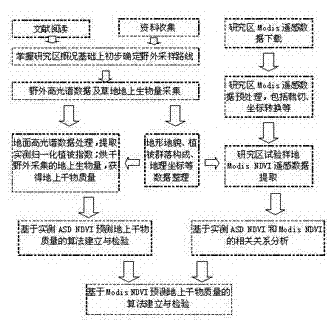
Grassland dry matter mass remote sensing estimating method
A dry matter quantity and remote sensing technology, applied in the field of remote sensing applications, can solve the problems of insufficient hyperspectral measurement data of grassland vegetation, lack of combination and connection points, etc.
- Summary
- Abstract
- Description
- Claims
- Application Information
AI Technical Summary
Problems solved by technology
Method used
Image
Examples
Embodiment Construction
[0069] The present invention will be further described below with reference to the accompanying drawings and specific embodiments.
[0070] Application case of remote sensing estimation method of dry matter mass on grassland
[0071] The experimental area of this invention mainly involves the Hulunbuir grassland. The sample plots are mainly distributed in the territory of Xinbaerhu Left Banner, Xinbaerhu Right Banner, Manzhouli City, Chenbaerhu Banner and Ewenki Autonomous Banner.
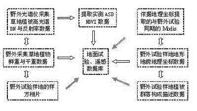
[0072] The field measurement work of the application examples of the present invention was carried out in late July and early August 2009, when vegetation was the most vigorous, and the sampling route covered the different productivity gradients of different plant communities in the Hulunbuir grassland as much as possible. The specific setting method of sample plots and small plots is as follows: first, based on the analysis of TM remote sensing images, land use status map and vegetation type ma...
PUM
 Abstract
Description
Claims
Application Information
 - R&D
- Intellectual Property
- Life Sciences
- Materials
- Tech Scout
- Unparalleled Data Quality
- Higher Quality Content
- 60% Fewer Hallucinations
Browse by: Latest US Patents, China's latest patents, Technical Efficacy Thesaurus, Application Domain, Technology Topic, Popular Technical Reports.
© 2025 PatSnap. All rights reserved.Legal|Privacy policy|Modern Slavery Act Transparency Statement|Sitemap|About US| Contact US: help@patsnap.com


