

Web publishing method of quantified remote sensing data
A remote sensing data and remote sensing technology, applied in the fields of electrical digital data processing, special data processing applications, instruments, etc., can solve the problems of insufficient remote sensing data network and data retention, and achieve the effect of improving data display.
- Summary
- Abstract
- Description
- Claims
- Application Information
AI Technical Summary
Problems solved by technology
Method used
Image

Examples
Embodiment
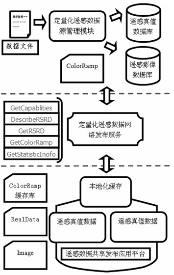
[0066] In the first step, according to the characteristics of remote sensing data sharing and release, it is determined that the data release meets the requirements of real-time update, large amount of data release, compatibility with multiple data releases, and support for visual expression and quantitative analysis of data.
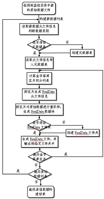
[0067] In the second step, according to the release characteristics of quantitative remote sensing data, design the data structure for the joint release of visual color matching information and real physical values of remote sensing data, including the real data of remote sensing RealData data, the color ramp data of visual rendering color information, and the true remote sensing value of configuration rendering information Data package ColoredRealData data: RealData file.rd file is composed of file header and file data. The file header contains information such as projection, latitude and longitude, and generation date of remote sensing data. The file ...
PUM
 Abstract
Description
Claims
Application Information