Method for managing multisource-isomerism aviation remote sensing data

A multi-source heterogeneous and data management technology, applied in multi-source heterogeneous aerial remote sensing data management, aerial remote sensing data management field, can solve manual management, failure to achieve image processing system connection, and affect rapid extraction of aerial remote sensing data information issues with use

Inactive Publication Date: 2012-09-12
苏州大地影像科技有限公司
View PDF3 Cites 29 Cited by
  • Summary
  • Abstract
  • Description
  • Claims
  • Application Information

AI Technical Summary

Problems solved by technology

Compared with the relatively mature satellite remote sensing data storage and distribution management technology, the current aerial remote sensing data storage and distribution management level is relatively lagging behind, most of which are in the manual management stage, which seriously affects the rapid extraction and utilization of aerial remote sensing data information
Although some research institutions have carried out research in this a

Method used


Image

  • Method for managing multisource-isomerism aviation remote sensing data
  • Method for managing multisource-isomerism aviation remote sensing data
  • Method for managing multisource-isomerism aviation remote sensing data

Examples


Embodiment Construction

[0023] The technical solution of the present invention will be further described in detail below in conjunction with the accompanying drawings and a preferred embodiment.

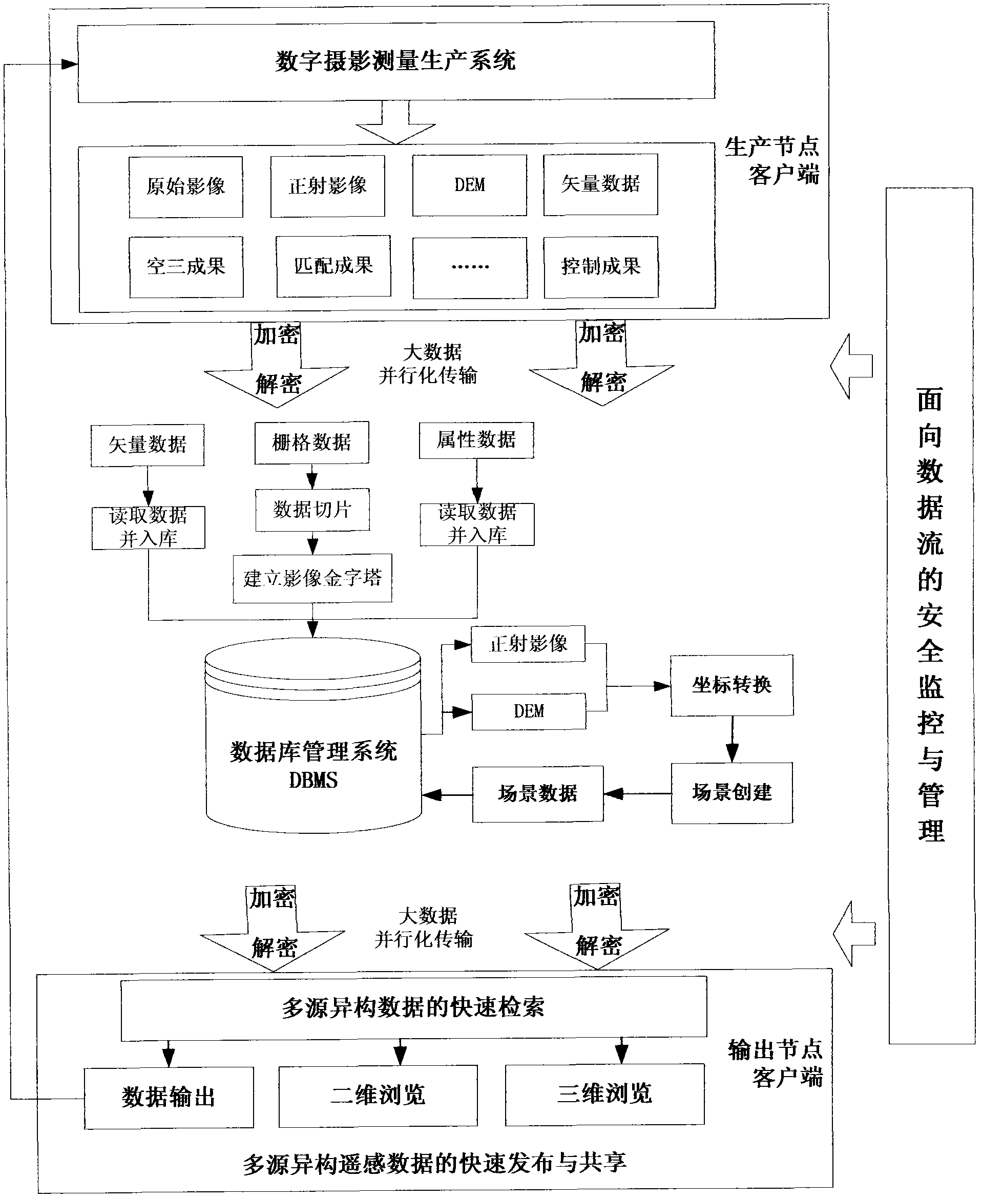
[0024] Referring to Figure 1, the multi-source heterogeneous aerial remote sensing data management method includes the following specific steps:

[0025] Step 1. The aerospace remote sensing data in the digital aerial photogrammetry production system, such as remote sensing images, POS data, control point information, camera parameters, etc., product data such as aerial three data, orthophoto, DEM, stitching line vector data, etc. According to the project organization, parallelization and mass transmission mechanism are adopted in the network environment, and 256-bit security encryption algorithm is used to encrypt and protect the transmission data from each production node to the oracle database;

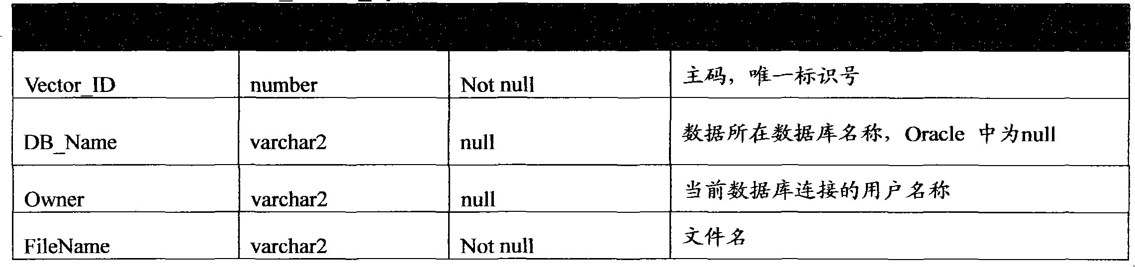
[0026] Step 2. Divide the data in the database into three categories: raster, vector and attribute according ...


PUM


Abstract

The invention discloses a method for managing multisource-isomerism aviation remote sensing data, which comprises the following steps: (1) using geographic regions and production engineering as units so as to realize aviation remote sensing data storage and management; and realizing high-efficient data storage and management served for aviation remote sensing data products by technologies such as tiles and the like; and (2) using a method for dynamically generating a continuous detail level model, establishing a corresponding high-efficient mechanism, and realizing three-dimensional visual issuing and sharing of the aviation remote sensing data products automatically and high-efficiently. According to the invention, the method effectively solves integrated storage and management problems of multisource, multi-time-phase, isomerism aviation remote sensing data in a digital aviation photography measurement producing system.

Description

technical field [0001] The invention relates to a management method of aerial remote sensing data, in particular to a management method of multi-source heterogeneous aerial remote sensing data serving digital aerial photogrammetry production, and belongs to the field of massive aerospace remote sensing data management. Background technique [0002] With the continuous development of aerial remote sensing technology, the ability to obtain aerial remote sensing data has been significantly improved, and the collection of data is developing in the direction of scale and intensification. Advanced storage and production processing systems put forward higher requirements. Compared with the relatively mature satellite remote sensing data storage and distribution management technology, the current aerial remote sensing data storage and distribution management level is relatively lagging behind, and most of them are in the manual management stage, which seriously affects the rapid ext...

Claims


Application Information

Patent Timeline
IPC IPC(8): G06F17/30
Inventor 凡亦文邓国荣刘亚文张文万幼川吴国青唐一乔
Owner 苏州大地影像科技有限公司
Why Eureka
Try Eureka