

Integrated horizontal well geosteering method
A geosteering, horizontal well technology, applied in directional drilling, earthwork drilling, wellbore/well components, etc., can solve the problems of complex underground geological conditions, easy target deviation, single geosteering, etc., and achieve timely correction and evaluation. Synchronize, eliminate inaccuracy, and improve the effect of processing ability
- Summary
- Abstract
- Description
- Claims
- Application Information
AI Technical Summary
Problems solved by technology
Method used
Image

Examples
Embodiment approach
[0047] As a preferred embodiment of the present invention, comprise the following steps:
[0048] a. Collect 3D seismic data in the service well area, 3D seismic time data in SEGY format, 3D seismic layering data and 3D seismic datum elevation data, perform in-depth conversion and reprocessing on the 3D seismic time data, and finely interpret structures and reservoir fluids Spread, extract attribute feature values, and clarify target features;
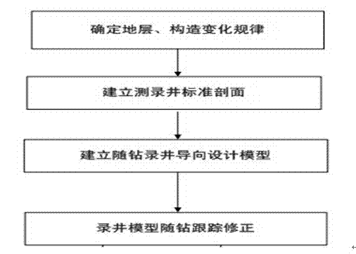
[0049]b. Analyze adjacent logging data, finely analyze lithology, oil, gas and water layers, special lithology and sub-layer marks, fine sub-layer comparison, clarify the lateral and vertical distribution characteristics of reservoirs, extract mud logging guidance scale marks, and establish Fine logging standard profile model;
[0050] c. Design the trajectory according to the geological target;
[0051] d. Utilize the underlying ORACLE database of the well site remote information platform to load the 3D seismic data and actual drill...
Embodiment 2
[0061] As the best implementation mode of the present invention, it comprises the following steps:
[0062] a. 3D geological modeling
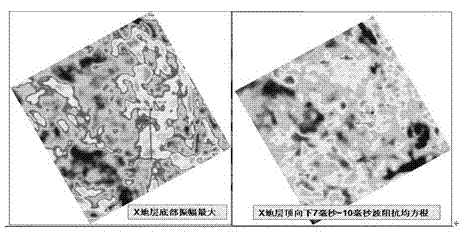
[0063] Collect 3D seismic SEGY data in the service well area, including time data, depth data, seismic layer data and seismic datum elevation data, etc. Reprocess the seismic data, finely interpret the structure and reservoir fluid distribution, extract attribute characteristic values, and clarify the characteristics of the target body. The results of 3D seismic processing and interpretation are shown in figure 1 .
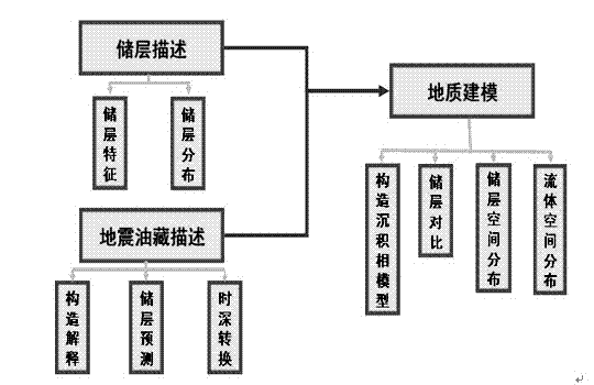
[0064] Make a fine description of the reservoir, combine geological research and adjacent logging data to establish a fine 3D geological model (sedimentary facies, reservoirs, fluids), optimize the geological target, see the 3D geological modeling process figure 2 .
[0065] b. Logging modeling
[0066] Analyze adjacent logging data, finely analyze lithology, oil, gas and water layers, special lithology and sub-layer signs, ...
PUM
 Abstract
Description
Claims
Application Information