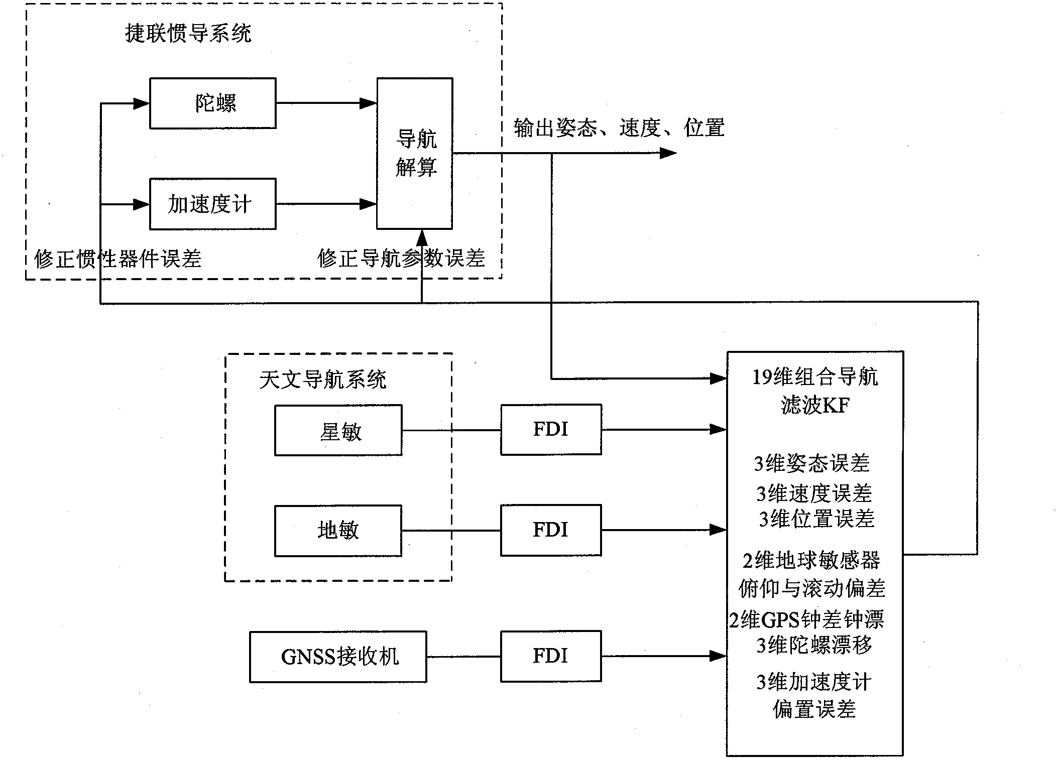
Integrated navigation system of strapdown inertial navigation system (SINS)/central nervous system (CNS)/global navigation satellite system (GNSS) of geostationary earth orbit (GEO) transfer vehicle
An integrated navigation system and orbit transfer technology, applied in the direction of navigation through speed/acceleration measurement, astronomical navigation, navigation calculation tools, etc., can solve the problems that have not yet collected data, no explanation or report has been found, and achieve high reliability, The effect of strong autonomy and high precision
- Summary
- Abstract
- Description
- Claims
- Application Information
AI Technical Summary
Problems solved by technology
Method used
Image
Examples
Embodiment Construction
[0008] The present invention will be described in further detail below in conjunction with the accompanying drawings. figure 1 It is a block diagram of the SINS / CNS / GNSS integrated navigation system of the GEO orbit transfer aircraft of the present invention, which is composed of a strapdown inertial navigation system, a celestial navigation system, and a GNSSS receiver.
[0009] The strapdown inertial navigation system mainly calculates the attitude, position and velocity of the aircraft based on the output of the gyroscope and the accelerometer. The coordinate transformation matrix between the aircraft body coordinate system b and the equatorial inertial coordinate system i can be calculated by the gyro output according to the following formulas calculate.
[0010] C b ′ ( k ) = C b ′ ( k ...
PUM
 Abstract
Description
Claims
Application Information
 - R&D
- Intellectual Property
- Life Sciences
- Materials
- Tech Scout
- Unparalleled Data Quality
- Higher Quality Content
- 60% Fewer Hallucinations
Browse by: Latest US Patents, China's latest patents, Technical Efficacy Thesaurus, Application Domain, Technology Topic, Popular Technical Reports.
© 2025 PatSnap. All rights reserved.Legal|Privacy policy|Modern Slavery Act Transparency Statement|Sitemap|About US| Contact US: help@patsnap.com


