Synthetic steering vector based beam forming meter-wave radar height measurement method
A technology of synthetic steering vector and meter-wave radar, which is applied in the field of beam-forming meter-wave radar altimetry based on synthetic steering vector, can solve the problems of indistinguishability, low measurement accuracy, and low altitude measurement speed, and avoid multi-beam clamping Angle problem, meet the calculation accuracy, reduce the effect of numerical range
- Summary
- Abstract
- Description
- Claims
- Application Information
AI Technical Summary
Problems solved by technology
Method used
Image
Examples
Embodiment 1
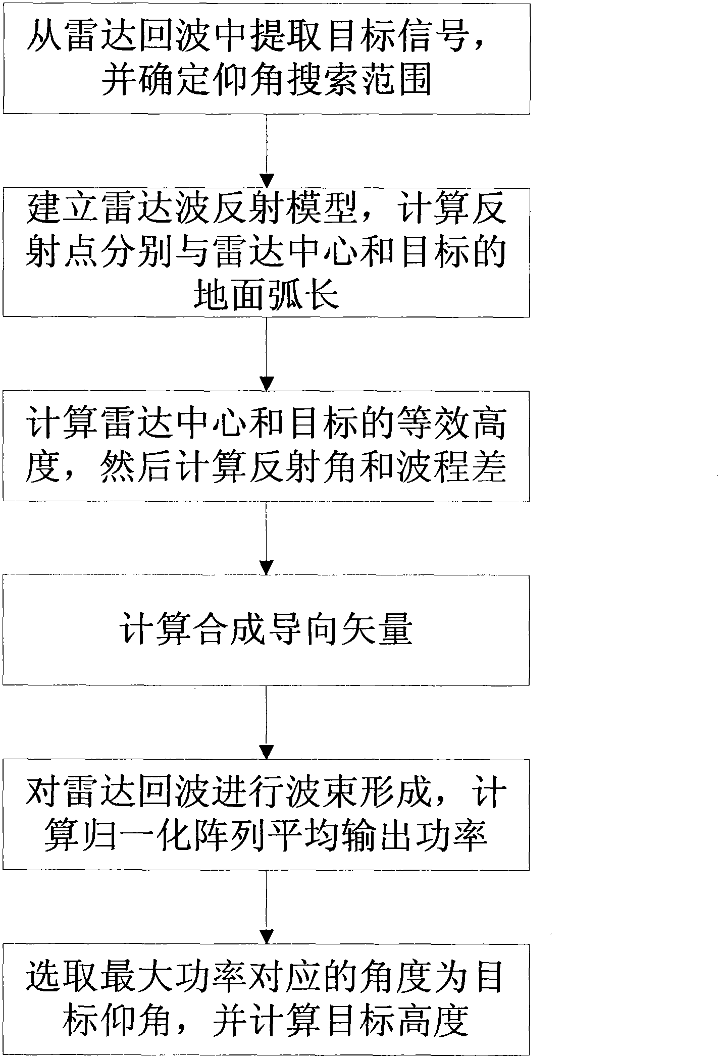
[0066] The present invention is a beamforming meter-wave radar altimetry method based on synthetic steering vectors. Meter-wave radar plays an important role in anti-stealth and anti-radiation missiles, and the meter-wave radar altimetry problem is one of the difficult problems that need to be solved urgently. , which can be used for radar target tracking, refer to figure 1 , the beamforming meter-wave radar altimetry method based on synthetic steering vector of the present invention comprises the following steps:
[0067] Step 1: Extract the target signal x(t from the echo received by the radar k ), and determine the target elevation angle search range according to the target distance information.
[0068] Extract the target signal x(t from the echo received by the radar k ) process is usually: after processing the echo received by the radar with analog-to-digital conversion, amplitude and phase correction, IQ channel separation, pulse compression, clutter suppression and e...
Embodiment 2
[0082] The beamforming meter-wave radar altimetry method based on the synthetic steering vector is the same as in embodiment 1,
[0083] Step 1: Extract the target signal x(t from the echo received by the radar k ), and determine the target elevation angle search range according to the target distance information.
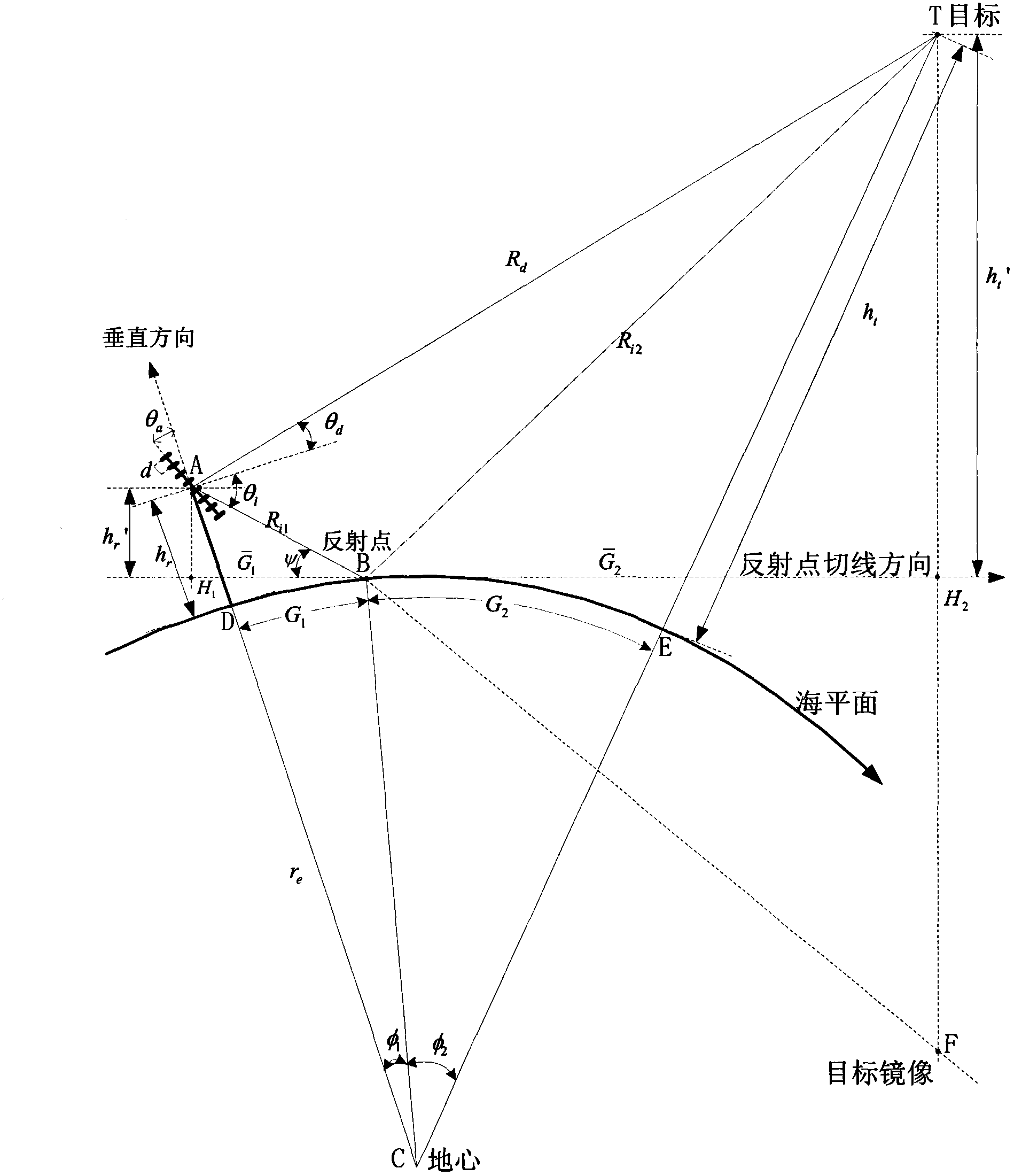
[0084] The model of radar receiving target signal among the present invention is as figure 2 shown. figure 2 A far-field narrowband signal is incident on a uniform linear array composed of M array elements, and the center A of the radar array is selected as the reference array element, h r is the radar center height, d is the radar array element spacing, θ a is the tilt angle of the antenna, r e is the equivalent earth radius, R d is the direct wave path from the target to the center of the radar, θ d is the search elevation angle from the direct wave to the center of the radar, θ i is the reflection angle from the reflected wave to the center of the radar...
Embodiment 3
[0148] The beamforming meter-wave radar altimetry method based on the synthetic steering vector is the same as that in Embodiment 1-2,
[0149] The effect of the present invention can be further illustrated by the following simulation.
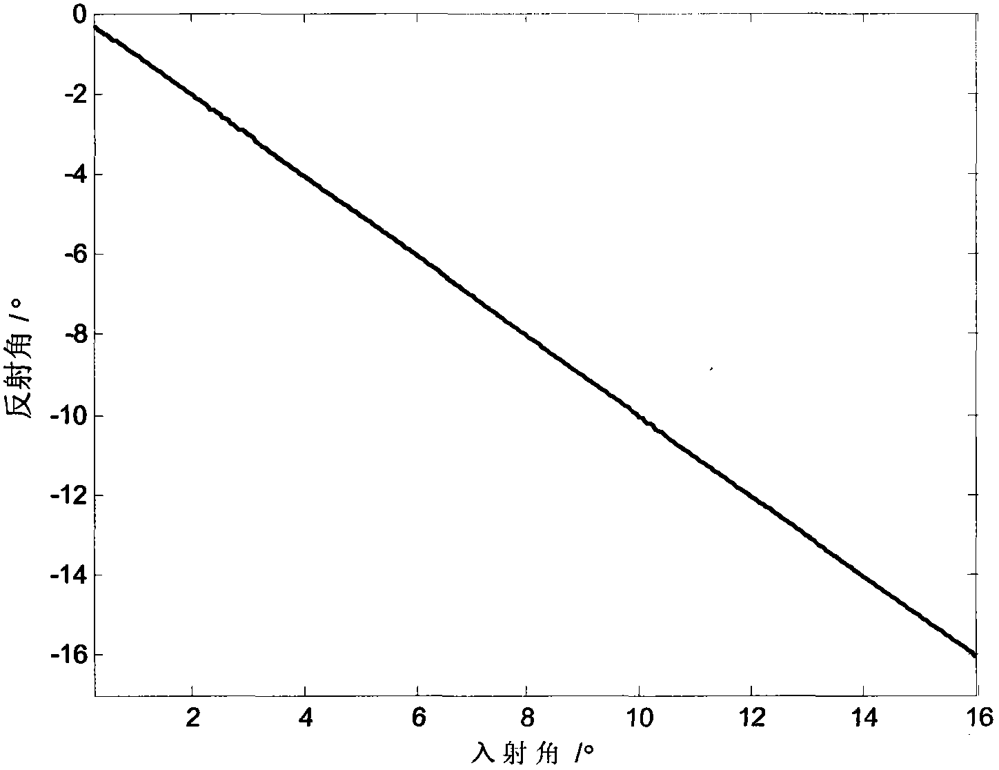
[0150] Simulation content: radar wave reflection model analysis.
[0151] Simulation conditions:
[0152] Suppose the target distance is 100 kilometers, the target elevation angle range is 0.25°~16°, and the angle step is 0.05°, and a total of 316 points are calculated. The DSP adopts ADSP-TS201, and the core frequency is 600MHz. The relative error of the defined reflection angle is err ( θ i ) = abs ( θ ^ i - θ i ) / θ i ...
PUM
 Abstract
Description
Claims
Application Information
 - R&D
- Intellectual Property
- Life Sciences
- Materials
- Tech Scout
- Unparalleled Data Quality
- Higher Quality Content
- 60% Fewer Hallucinations
Browse by: Latest US Patents, China's latest patents, Technical Efficacy Thesaurus, Application Domain, Technology Topic, Popular Technical Reports.
© 2025 PatSnap. All rights reserved.Legal|Privacy policy|Modern Slavery Act Transparency Statement|Sitemap|About US| Contact US: help@patsnap.com


