

Water environment analysis method and system based on geographic information system and delft3d-flow calculation engine
A geographic information system and computing engine technology, applied in the field of water environment analysis methods and systems, can solve the problems of configuration models, inability to combine spatial analysis and environmental simulation, and cumbersome problems, so as to improve accuracy and optimize human-computer interaction friendliness Effect
- Summary
- Abstract
- Description
- Claims
- Application Information
AI Technical Summary
Problems solved by technology
Method used
Image

Examples
Embodiment Construction
[0042] Embodiments of the present invention will be described in detail below with reference to the accompanying drawings.
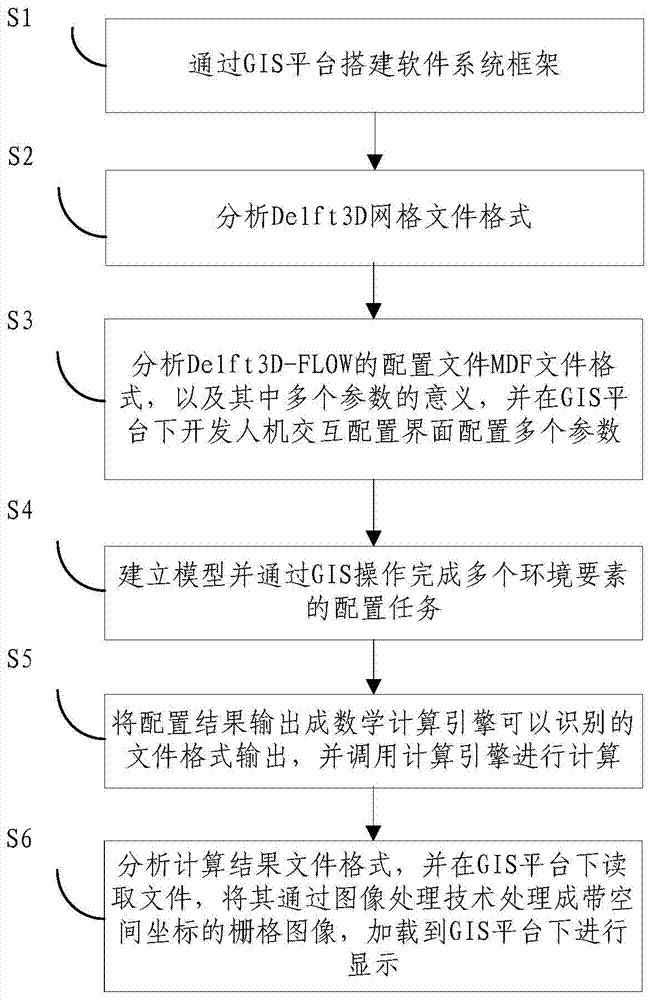
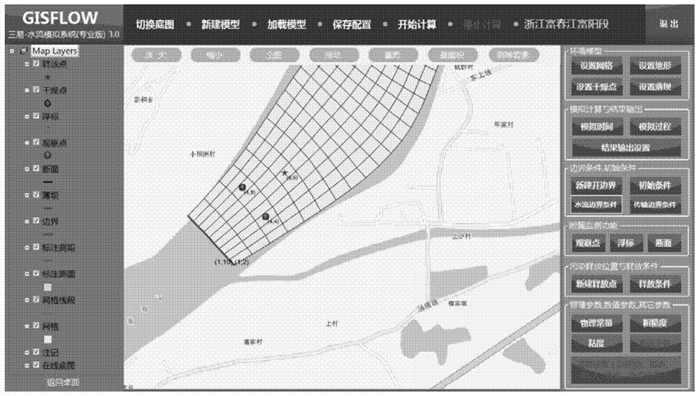
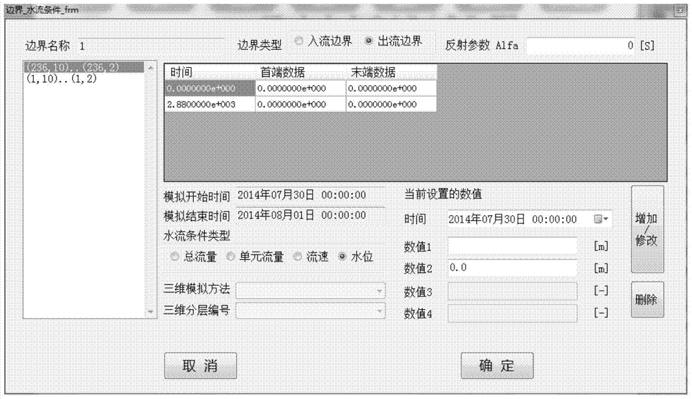
[0043] Such as figure 1 As shown, the present invention provides a water environment analysis method based on geographic information system and DELFT3D-FLOW computing engine, comprising the following specific steps:
[0044] Step S1: Build the software system framework through the GIS platform.
[0045]Step S2: Analyze the Delft3D grid file format. Further, step S2 further includes: reading the grid file; converting the read grid file into a polygonal grid with spatial coordinates; and loading the polygonal grid onto the GIS platform.
[0046] Furthermore, the same type of hydrodynamic-water quality models, in addition to Delft3D in the Netherlands, also includes PART, ECO, WAQ, EFDC, SELFE in the United States, etc. For the above-mentioned different models, the different operations lie in the analysis and reading and writing of grid files in the back...
PUM
 Abstract
Description
Claims
Application Information