The Method of Layered Settlement Monitoring Using the Layered Settlement Monitoring System Based on Satellite Positioning and Static Leveling
A technology of layered settlement and static leveling, applied in the direction of hydrostatic pressure, etc., can solve the problems of increasing workload, reducing efficiency, and difficult to build base points in stable areas.
- Summary
- Abstract
- Description
- Claims
- Application Information
AI Technical Summary
Problems solved by technology
Method used
Image
Examples
Embodiment Construction
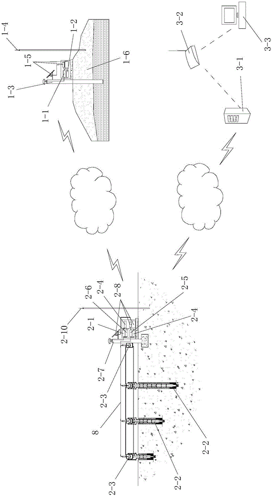
[0066]Such as figure 1 A layered subsidence monitoring system based on satellite positioning and static leveling is shown, including a reference station arranged on the ground, a monitoring station arranged in the subsidence monitoring area, and a wireless communication system that communicates with the monitoring station. In the monitoring center, the reference station communicates with the monitoring station in a wireless communication manner.
[0067] The reference station is a Beidou satellite ground base station, and it includes a first Beidou satellite signal receiver 1-1 and a first wireless communication device 1-2 connected with the first Beidou satellite signal receiver 1-1.
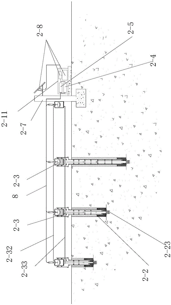
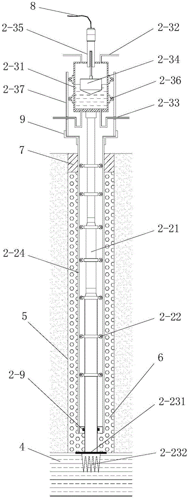
[0068] The monitoring station includes a second Beidou satellite signal receiver 2-1, a data transmission unit 2-4, a second wireless communication device 2-6, and a plurality of layered subsidence marks 2-1 respectively buried in the subsidence monitoring area. 2 and a static leveling system ...
PUM
 Abstract
Description
Claims
Application Information
 - R&D
- Intellectual Property
- Life Sciences
- Materials
- Tech Scout
- Unparalleled Data Quality
- Higher Quality Content
- 60% Fewer Hallucinations
Browse by: Latest US Patents, China's latest patents, Technical Efficacy Thesaurus, Application Domain, Technology Topic, Popular Technical Reports.
© 2025 PatSnap. All rights reserved.Legal|Privacy policy|Modern Slavery Act Transparency Statement|Sitemap|About US| Contact US: help@patsnap.com


