Single-side synchronous bidirectional ranging method

A two-way ranging and one-sided technology, applied in electrical components, wireless communication, etc., can solve the problems of positioning method measurement errors, unfavorable errors, and calculation signal arrival time errors, etc., to reduce requirements, reduce burdens, and improve calculation efficiency. Effect

Inactive Publication Date: 2015-02-25
GUANGDONG MECHANICAL & ELECTRICAL COLLEGE
View PDF3 Cites 14 Cited by
  • Summary
  • Abstract
  • Description
  • Claims
  • Application Information

AI Technical Summary

Problems solved by technology

However, there are measurement errors in this positioning method: first, due to the large number of base stations, time synchronization between base stations is very difficult, especially some base stations are set in tunnels or underground, and cannot be synchronized through GPS; secondly, due to the large number of base stations and vehicle signal transmission The crystal oscillator of the device has clock drift, which cannot be avoi

Method used


Image

  • Single-side synchronous bidirectional ranging method
  • Single-side synchronous bidirectional ranging method
  • Single-side synchronous bidirectional ranging method

Examples


example 1

[0043] This example takes a system composed of a base station and a mobile unit vehicle as an example to describe the unilateral synchronous two-way ranging method in detail. In this example, the actual distance between the base station and the vehicle of the mobile unit is 750m, the base station is RSPU-B001, the roadside positioning base station of the Internet of Vehicles, and the crystal oscillator deviation of the vehicle-connected vehicle locator VOP-A010 installed on the vehicle is 10ppm.

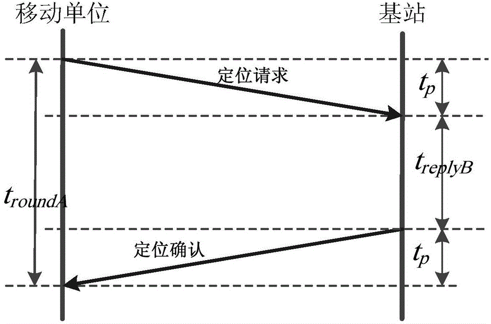
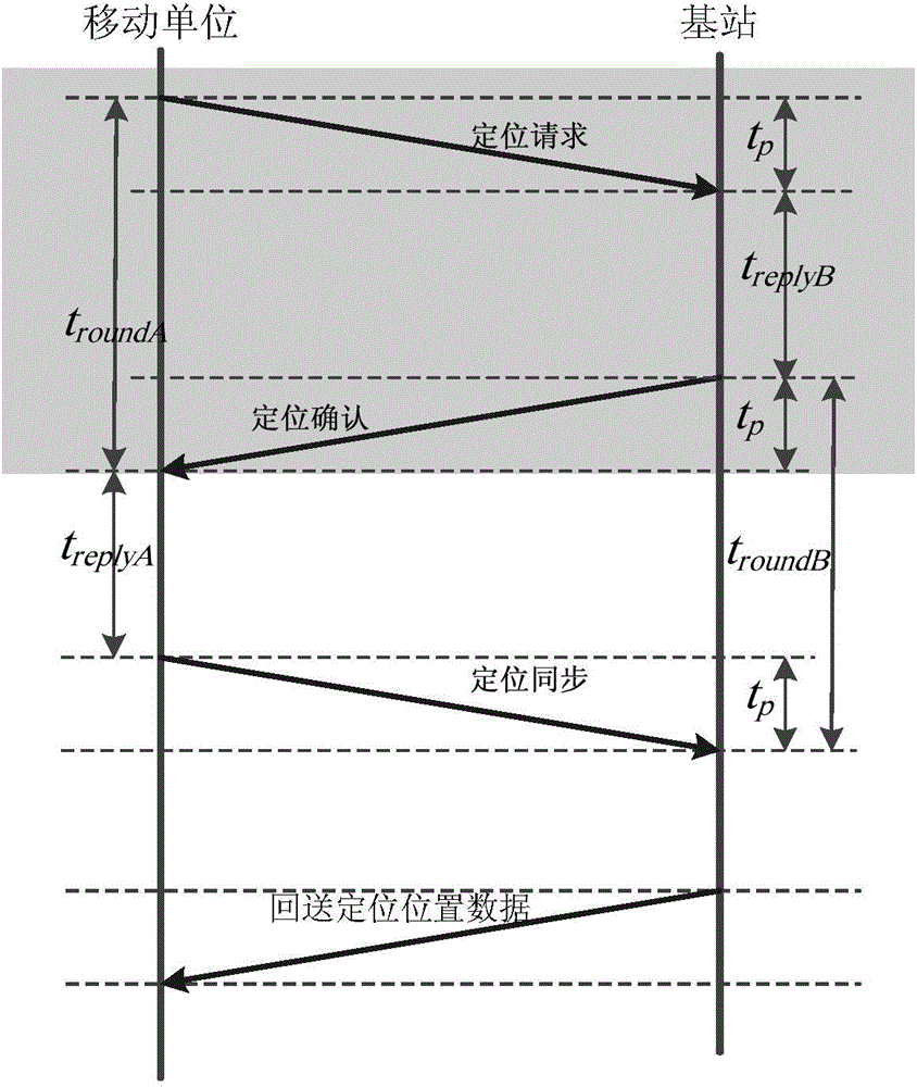
[0044] See attached image 3 , the steps to detect the distance between the base station and the vehicle are as follows:

[0045] (1) The locator sends a "location request" data packet to the base station at a certain moment, and records the sending time;

[0046] (2) After the base station receives the "positioning request" data packet, it processes the received data and records the duration. After the processing is completed, it feeds back the "positioning confirmation" data packe...

example 2

[0050] Example 2 (comparison experiment of communication times)

[0051] 1. Experimental equipment and conditions

[0052] The hardware system in this example also consists of a base station and a mobile unit vehicle. The actual distance between the base station and the mobile unit vehicle is 500m, and the crystal oscillator deviation of the VOP-A020 installed on the vehicle is 20ppm.

[0053] The experimental environment is an open area with a diameter of 2 kilometers, the weather is cloudy, and the temperature is 30°; a vehicle network roadside positioning base station RSPU-B001 base station is used to communicate with a vehicle equipped with a vehicle network vehicle locator VOP-A020 locator In the experiment, the packet size is set to 200 bytes.

[0054] 2. Experimental method

[0055] 1) 50 times of ranging experiments: using the method of the present invention from the beginning of the network connection to the end of the ranging experiment, a total of 62 data packets ...

example 3

[0059] Example 3 (Comparative experiment on the impact of crystal oscillator deviation on ranging error)

[0060] In order to compare the performance of the symmetrical two-way bilateral ranging method described in the present invention and the prior art in actual vehicle positioning applications, this example adopts the method of the present invention and the symmetrical two-way bilateral ranging method to use four base stations to carry out 100 The second positioning experiment is used to verify that the crystal oscillator deviation of the base station has no influence on the method of the present invention, but has a great influence on the existing method. The vehicle network vehicle positioning instrument VOP-A020 is installed on the experimental vehicle, and the four base stations are the vehicle network roadside positioning base station RSPU-B001. The coordinates of the vehicle, crystal oscillator specifications and coordinates of the four base stations are shown in the ...


PUM


Abstract

A single-side synchronous bidirectional ranging method includes the steps: a mobile unit transmits a positioning request and records transmitting time, a base station returns a response and makes a delay after processing, the mobile unit receives the response and starts timing, a synchronous response is transmitted again if delay duration of the base station is equal to processing time, the mobile unit receives the synchronous response, calculating is performed according to timing duration of the mobile unit and first trip time of a data packet transmitted by the mobile unit to obtain signal propagation time, and ranging is then completed according to a product of electromagnetic wave velocity and the signal propagation time. The single-side synchronous bidirectional ranging method has the advantages that network burden can be relieved, and the influence of base station crystal oscillation deviations upon ranging results can be avoided.

Description

technical field [0001] The invention relates to the technical field of wireless distance measurement, in particular to a two-way distance measurement method. Background technique [0002] In the active safety application of the Internet of Vehicles, it is necessary to know the absolute position of each vehicle in the network and the relative position between each vehicle. However, in the urban environment, the road conditions are complex, and overpasses, underground passages and vehicle movement will have a great impact on positioning. Therefore, a positioning method based on ground base stations has been produced. This method can determine the position of the mobile unit by measuring the propagation time of the signal transmitted by the mobile unit to multiple base stations. However, there are measurement errors in this positioning method: first, due to the large number of base stations, time synchronization between base stations is very difficult, especially some base sta...

Claims


Application Information

Patent Timeline
IPC IPC(8): H04W64/00
CPCH04W64/00
Inventor 刘建圻李志杰李建波张严林
Owner GUANGDONG MECHANICAL & ELECTRICAL COLLEGE
Why Eureka
Try Eureka