Geographic coordinate compensation method for seabed oil-gas pipeline detection positioning system
A technology of pipeline detection system and positioning system, which is applied in the field of detection and positioning of submarine oil and gas pipelines, and can solve problems such as the inability to achieve high-precision positioning of long-distance oil and gas pipelines
- Summary
- Abstract
- Description
- Claims
- Application Information
AI Technical Summary
Problems solved by technology
Method used
Image
Examples
Embodiment Construction
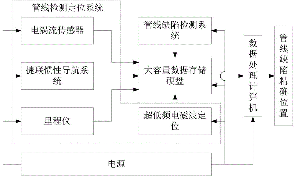
[0054] The patent of the present invention will be described in more detail below with reference to the accompanying drawings. It should be noted that the gyroscope, accelerometer, pipeline defect detection system, ultra-low frequency electromagnetic wave positioning, odometer and system control circuit used in the system are all typical devices and The circuit connection is no longer described in its schematic diagram:
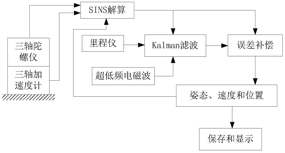
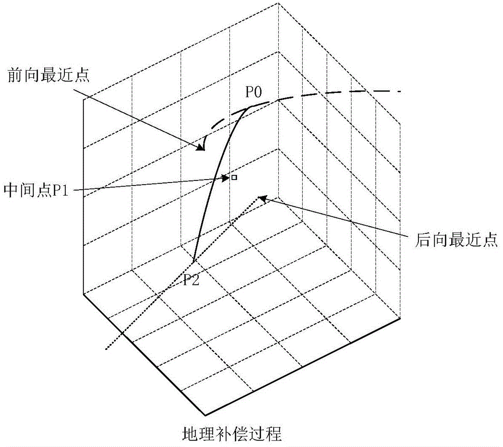
[0055] First, the number of metal welds detected by the eddy current sensor is used to determine the steel pipe section where the pipeline detection system is located to achieve rough positioning. Then, the odometer / ultra-low frequency electromagnetic wave correction method is used to calculate and compensate the error of the strapdown inertial navigation system for pipeline positioning. The mileage increment and the ultra-low frequency electromagnetic wave positioning signal are used as observation values, and the state error is used as a state variable, and ...
PUM
 Abstract
Description
Claims
Application Information
 - R&D
- Intellectual Property
- Life Sciences
- Materials
- Tech Scout
- Unparalleled Data Quality
- Higher Quality Content
- 60% Fewer Hallucinations
Browse by: Latest US Patents, China's latest patents, Technical Efficacy Thesaurus, Application Domain, Technology Topic, Popular Technical Reports.
© 2025 PatSnap. All rights reserved.Legal|Privacy policy|Modern Slavery Act Transparency Statement|Sitemap|About US| Contact US: help@patsnap.com


