
Modified geosynchronous orbit SAR (synthetic aperture radar) frequency-domain imaging method

A technology of geosynchronous orbit and imaging method, applied in the direction of reflection/re-radiation of radio waves, use of re-radiation, measurement devices, etc. Applicable, frequency domain algorithms cannot process GEOSAR echo data, etc., to achieve the effect of good focusing performance and large scene focusing

Active Publication Date: 2015-07-01
BEIJING INSTITUTE OF TECHNOLOGYGY
View PDF8 Cites 2 Cited by
  • Summary
  • Abstract
  • Description
  • Claims
  • Application Information

AI Technical Summary

Problems solved by technology

However, at the orbital position where the Doppler FM slope is zero, since the azimuth spectrum is severely compressed at this time, and the azimuth spectrum is folded, the frequency domain algorithm cannot directly process the echo data of GEO SAR, because at this time There is no one-to-one correspondence between the frequency points in the azimuth direction and the distance migration, and the time-frequency relationship in the azimuth direction is already nonlinear. Therefore, the traditional frequency-domain imaging algorithm cannot be applied, and a new solution needs to be proposed

Method used


Image

  • Modified geosynchronous orbit SAR (synthetic aperture radar) frequency-domain imaging method
  • Modified geosynchronous orbit SAR (synthetic aperture radar) frequency-domain imaging method
  • Modified geosynchronous orbit SAR (synthetic aperture radar) frequency-domain imaging method

Examples


Embodiment Construction

[0034] The present invention will be described in detail below with reference to the accompanying drawings and examples.

[0035] The invention provides an improved geosynchronous orbit SAR frequency domain imaging method.

[0036] The Doppler FM slope is composed of an acceleration component in the slant distance direction and a velocity component in the flight direction. In some special orbital positions, the Doppler frequency modulation slope caused by the acceleration component and the velocity component of the satellite platform along the slant distance cancel each other out, resulting in zero Doppler frequency modulation slope at these orbital positions. Simultaneously, considering that only the velocity component along the flight direction of the satellite platform contributes to the azimuth resolution, while the acceleration component along the slant-range direction does not contribute to the azimuth resolution, the geosynchronous orbit SAR frequency domain imaging met...


PUM


Abstract

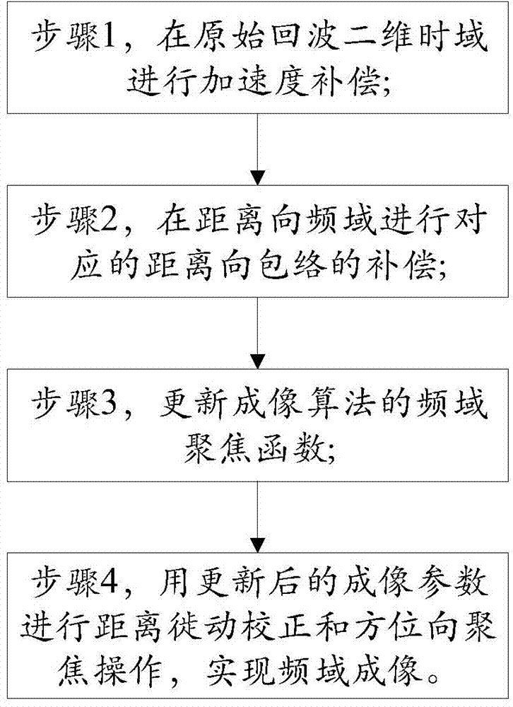
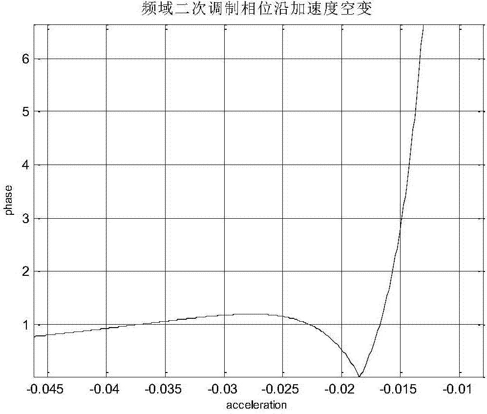
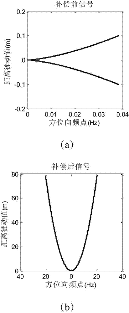
The invention discloses a modified geosynchronous orbit SAR (synthetic aperture radar) frequency-domain imaging method. A part with zero Doppler frequency rate can be effectively imaged by the method, with good focusing effect; meanwhile, for the part with non-zero Doppler frequency rate, the method allows better focusing performance than the traditional frequency-domain algorithm does. According to the method, the Doppler frequency rate caused by an acceleration component along a slant range direction is compensated, nonlinear azimuth time-frequency relation of raw echo is converted into linear time-frequency relation, and thus, in following operations, the SAR frequency-domain imaging algorithm can be used to correct a range migration in range Doppler. Meanwhile, an acceleration value subjected to compensational optimization is selected by numerical retrieval, variance of azimuth is greatly reduced, and focusing of a larger scene can be achieved during azimuth focusing. Verifications show that the method is suitable for imaging different parts of a GEO (geosynchronous orbit) SAR rail.

Description

technical field [0001] The invention relates to the technical field of synthetic aperture radar (SAR) imaging, in particular to an improved geosynchronous orbit SAR frequency domain imaging method. Background technique [0002] Geosynchronous Orbit Synthetic Aperture Radar (GEO SAR) is an all-weather and all-time modern high-resolution microwave side-looking imaging radar operating in geosynchronous orbit. It comprehensively utilizes synthetic aperture technology, pulse compression technology and data processing technology. A large survey zone can be obtained by using a medium-caliber antenna, which is an advanced ground-to-ground telemetry technology in the microwave field today. Like low-orbit spaceborne SAR, GEO SAR has increasingly shown strong advantages in scientific fields such as surveying and mapping, crop yield estimation, ocean and hydrological observation, environment and disaster monitoring, resource exploration, and military reconnaissance, and has played a mor...

Claims


Application Information

Patent Timeline
Patent Type & Authority Applications(China)
IPC IPC(8): G01S13/90
CPCG01S13/9011G01S13/904G01S13/9047G01S13/9004G01S13/9058
Inventor 丁泽刚曾涛舒博正龙腾尹伟
Owner BEIJING INSTITUTE OF TECHNOLOGYGY
Learn More