
Method for measuring and calculating intervals between rib sills of soft foundation energy dissipation type debris flow drainage groove and application
A technology for debris flow and drainage channels, which is applied in sea area engineering, construction, instruments, etc., can solve problems such as large calculation results, failure to consider the influence of rib-sill spacing, non-compliance, etc., and achieve the effect of simple calculation
- Summary
- Abstract
- Description
- Claims
- Application Information
AI Technical Summary
Problems solved by technology
Method used
Image

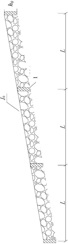
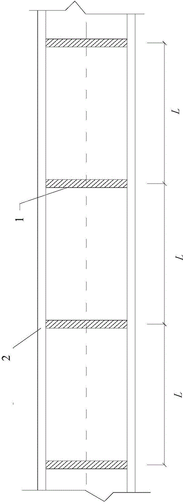
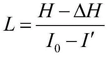
Examples
Embodiment 1
[0030] Such as figure 1 , figure 2 shown. A debris flow ditch is a branch ditch on the right bank of Dajinchuan, the main stream of the upper Dadu River, with a drainage area of 8.5km 2 , the main ditch is 6.20km long, the highest point of the basin is 3650m above sea level, and the lowest point is 2700m above sea level. It has the topographical characteristics of high mountains, deep valleys and steep slopes, which provide favorable topographic and geomorphic conditions for the formation and activities of debris flows.
[0031] In order to alleviate local debris flow disasters, it is planned to build a soft foundation energy dissipation debris flow drainage channel in the main channel of debris flow. And the row groove side wall 2 on both sides thereof. Next, measure and calculate the distance between rib sills 1 of the row of guide grooves, and the specific steps are as follows:
[0032] The first step is to determine the longitudinal gradient I of the row guide groov...
Embodiment 2
[0035] Such as figure 1 , figure 2 shown. A debris flow ditch is a tributary ditch on the right bank of the Sunshui River, a tributary of the Anning River. The main ditch is 4.20km long and the drainage area is 4.10km 2 , flowing through a certain county, is a frequent disastrous debris flow ditch. The gully debris flow formation area is steep, the slopes on both banks are extremely unstable, and there are landslides, and disastrous debris flows often break out in the ditch. If the blocking project is adopted, the engineering quantity and investment are quite large, and the effect is not very obvious.
[0036] In order to alleviate local debris flow disasters, it is planned to build a soft foundation energy dissipation debris flow drainage channel in the debris flow channel accumulation area. 1 and the row guide groove side wall 2 on both sides thereof. Next, measure and calculate the distance between rib sills 1 of the row of guide grooves, and the specific steps are as...
PUM
 Abstract
Description
Claims
Application Information