

Method of Typhoon Positioning Based on Historical Satellite Images on Current Satellite Images
A satellite image and typhoon technology, applied in image enhancement, image analysis, image data processing and other directions, can solve the problems of high labor intensity of meteorological staff, shortening the time for typhoon positioning, and complicated operation steps, so as to reduce the amount of calculation and shorten the time, the effect of increasing computational efficiency
- Summary
- Abstract
- Description
- Claims
- Application Information
AI Technical Summary
Problems solved by technology
Method used
Image

Examples
Embodiment Construction
[0047] The technical scheme of the present invention will be introduced below in conjunction with the accompanying drawings.
[0048] The present invention carries out the method for typhoon positioning on the current satellite image according to the historical satellite image comprising the following steps:
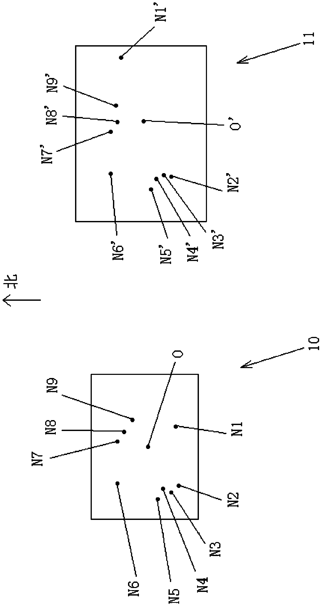
[0049] (1) if figure 1 As shown, take the typhoon center O in the historical satellite images as the center, intercept the picture 10 covering the typhoon cloud system, and extract the scale invariant feature transform (Scale Invariant Feature Transform, hereinafter referred to as SIFT) feature of the picture 10, to obtain the picture Several SIFT feature points of 10, the following is figure 1 A total of 9 SIFT feature points shown in N1-N9 are introduced;
[0050] (2) Intercept the search area 11 on the current satellite image, suppose the time interval between the current satellite image and the historical satellite image is T hours, the resolution of the satellite ...
PUM
 Abstract
Description
Claims
Application Information