Directional sensor network coverage method in complex three-dimensional scene environment

A sensor network and three-dimensional scene technology, applied in the field of wireless sensor networks, to achieve the effect of simple and easy to understand, improve flexibility, and enhance coverage

Active Publication Date: 2015-12-30
NANJING UNIV OF POSTS & TELECOMM
View PDF3 Cites 14 Cited by
  • Summary
  • Abstract
  • Description
  • Claims
  • Application Information

AI Technical Summary

Problems solved by technology

At present, there are few related research works on the coverage of directional sensor networks for complex 3D scenes. Therefore, it is necessary to conduct in-

Method used


Image

  • Directional sensor network coverage method in complex three-dimensional scene environment
  • Directional sensor network coverage method in complex three-dimensional scene environment
  • Directional sensor network coverage method in complex three-dimensional scene environment

Examples


Embodiment Construction
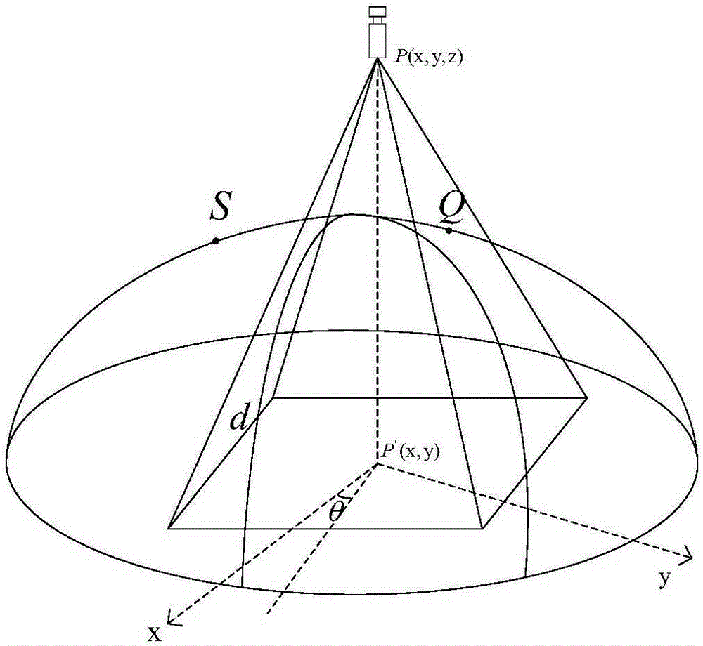
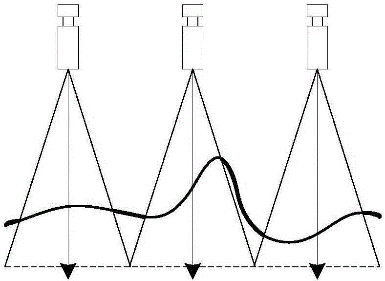
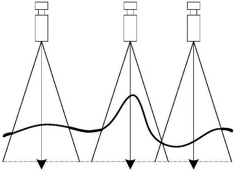
[0052] The core design idea of ​​the implementation scheme of the directional sensor network surface coverage method for complex 3D terrain is: apply the collaborative processing method to the wireless directional sensor network coverage of curved surface terrain, aiming at the monitoring of 3D terrain by directional sensor nodes and 2D The difference between planes improves the perception model of directional sensor nodes in 3D terrain; based on the idea of ​​grid division, calculates the number of nodes that need to be deployed in the monitored 3D terrain area and performs initial deployment of directional sensor nodes in the area; more Further based on the idea of ​​simulated annealing, the design strategy optimizes the deployment coordinates of sensor nodes, and increases the coverage area of ​​each node to a certain extent to reduce the blind area of ​​the entire monitoring area; based on the idea of ​​local optimality, the deviation angle of sensor nodes To optimize, incr...


PUM


Abstract

The invention discloses a directional sensor network coverage method in a complex three-dimensional scene environment, for improving the perception mode of directional sensor nodes in a three-dimensional landform in a wireless directional sensor network environment due to distinctions between monitoring of the three-dimensional landform by the directional sensor nodes and monitoring of a two-dimensional plane. Based on a grid division idea, the quantity of nodes needing to be disposed for a monitored three-dimensional landform area is calculated and initial disposition of the directional sensor nodes is carried out on the area; furthermore, based on an analog annealing idea, a strategy is designed for optimizing disposed coordinate positions of the sensor nodes, such that the coverage area of each node itself is increased to a certain degree and the blind area of the whole monitoring area is reduced; and based on a local optimization idea, the deviation angles of the sensor nodes are optimized so as to increase the integral coverage area of the nodes and adjacent nodes and accordingly increase the coverage rate of the whole monitoring area. By using the method brought forward by the invention, the utilization rate of the three-dimensional landform information perceived by the nodes in a directional sensor network can be improved.

Description

technical field [0001] The present invention is a curved surface coverage scheme applicable to directed sensor networks (DirectonalSensorNetworks). The scheme is based on a three-dimensional perception model of directed sensor nodes, uses grid division, simulated annealing, and local collaborative optimization ideas, and adjusts the nodes by optimizing Coordinate position and deflection angle to improve area coverage, so as to achieve enhanced area coverage of complex 3D scenes. It lays a foundation for efficient transmission of wireless sensor network data, and the technology belongs to the field of wireless sensor network. Background technique [0002] With the rapid development and maturity of wireless communication technology, micro-electromechanical technology, and computer network technology, the wireless sensor network formed by the self-organization of low-cost, low-energy small sensing devices through short-range wireless communication has attracted extensive attent...

Claims


Application Information

Patent Timeline
IPC IPC(8): H04W16/20H04W16/22H04W84/18
CPCH04W16/20H04W16/225H04W84/18
Inventor 肖甫杨谢琨杨萌孙力娟王汝传郭剑韩崇周剑
Owner NANJING UNIV OF POSTS & TELECOMM
Why Eureka
Try Eureka