Remote sensing satellite system and video image real-time transmission method thereof

A remote sensing satellite and video image technology, applied in the field of remote sensing satellites, can solve the problems of lack of timeliness of data and long time required for satellites to acquire images, and achieve the effect of improving timeliness, speed and shortening cycle

Active Publication Date: 2016-02-24
NAT UNIV OF DEFENSE TECH
View PDF2 Cites 12 Cited by
  • Summary
  • Abstract
  • Description
  • Claims
  • Application Information

AI Technical Summary

Problems solved by technology

[0005] The purpose of the present invention is to provide a remote sensing satellite system and a method for real-time transmission of video images thereof. The present invention mainly solves the technical problems that the time required for satellites to acquire images is relatively long and the acquired data lack timeliness in the prior art.

Method used


Image

  • Remote sensing satellite system and video image real-time transmission method thereof
  • Remote sensing satellite system and video image real-time transmission method thereof

Examples


Embodiment Construction

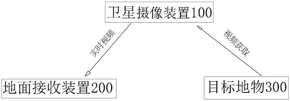
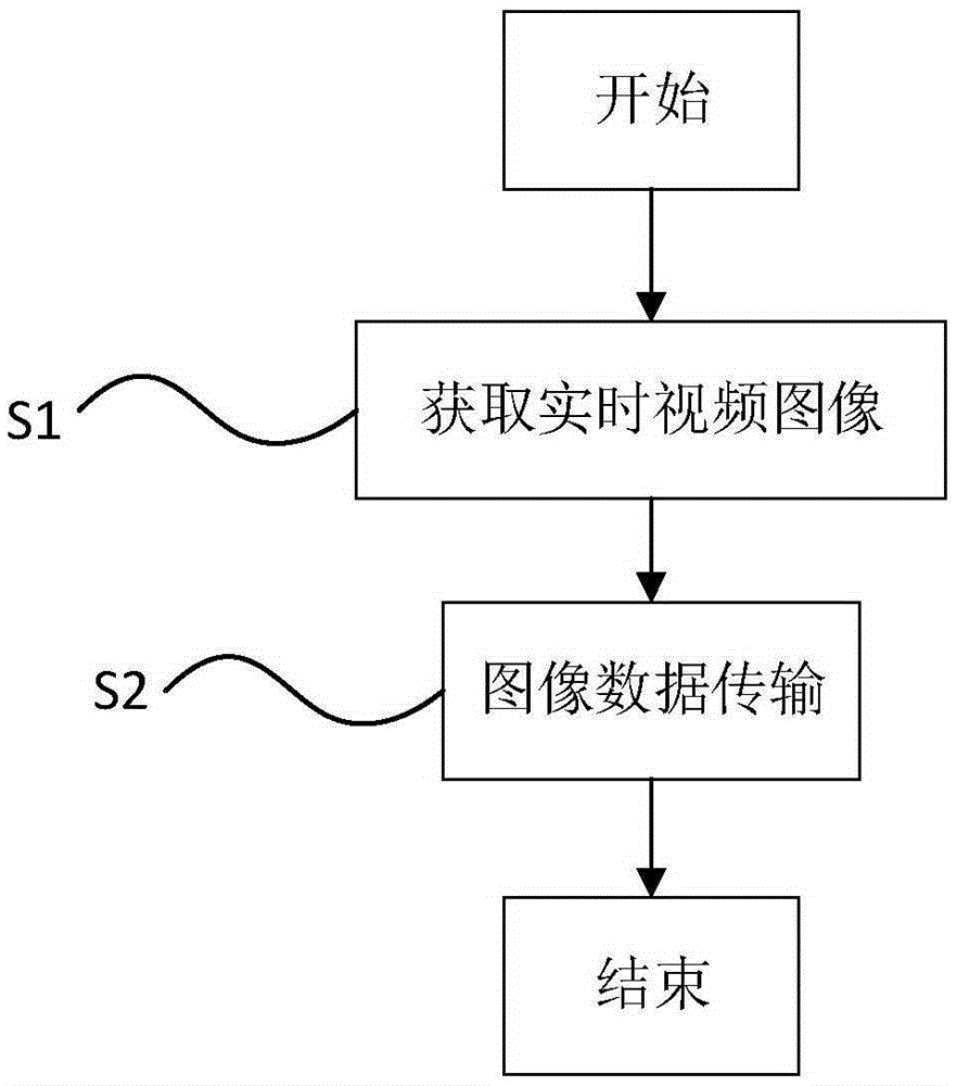
[0022] join figure 1 , the present invention provides a remote sensing satellite system, the remote sensing satellite system has: a satellite camera device 100, mounted on the satellite, for real-time acquisition of video images of target features 300; ground receiving device 200, arranged on the ground, for Receive the video image in real time; the data transmission device is mounted on the satellite and used to transmit the video image to the ground receiving device 200 . The video data acquired by the satellite camera device 100 mounted on the satellite contains more information than a single static image, and can acquire the dynamic attributes of the target, thereby detecting the occurrence of dynamic events. The obtained dynamic video can be reconstructed based on the sequence images in this video image to obtain a higher resolution image. This system is very suitable for the detection and identification of dynamic targets. Using the acquired real-time video data, it can ...


PUM


Abstract

The invention provides a remote sensing satellite system and a video image real-time transmission method thereof. The remote sensing satellite system comprises a satellite imaging device mounted on a satellite and used for acquiring a video image of a target object in real time; a ground receiving device arranged on the ground and used for receiving a video image in real time; and a data transmission device mounted on the satellite and used for transmitting the video image to the ground receiving device. The remote sensing satellite system and the video image real-time transmission method thereof provided by the invention solve the problems of dynamic target detection, recognition and tracking, and satellite rapid application and so on that are difficult to be realized by the existing satellites, so that users can quickly acquire video information of a target area, and the rapid application ability of the satellites in response to unexpected things can be improved drastically.

Description

technical field [0001] The invention relates to the technical field of remote sensing satellites, in particular to a remote sensing satellite system and a real-time video image transmission method thereof. Background technique [0002] Satellite remote sensing is an important technical means to obtain earth observation information, which is widely used in land surveying and mapping, environmental monitoring, disaster emergency response and military operations. Remote sensing satellites are divided into two categories: optical remote sensing and microwave remote sensing satellites. The existing optical remote sensing performs remote sensing control by acquiring images of the target to be observed. [0003] my country's existing space-based information acquisition satellites are generally at the strategic application level, and cannot well meet the urgent needs of regional and sudden application tasks. Existing ground imaging reconnaissance satellites generally can only acqu...

Claims


Application Information

Patent Timeline
Patent Type & Authority Applications(China)
IPC IPC(8): H04N7/18H04N7/20H04N21/61
CPCH04N7/18H04N7/20H04N21/6143
Inventor 张育林曾国强项军华韩大鹏张为华刘昆吴国福税海涛李志军袁福连一君高玉东
Owner NAT UNIV OF DEFENSE TECH
Why Eureka
Try Eureka