System for marking positions along road in map and method thereof
A technology of road marking and satellite positioning system, which is applied to the system and its fields along the road marking position in the map, which can solve the problems of cumbersome and difficult navigation, and achieve low maintenance cost, convenient positioning and navigation, and fast production speed Effect
- Summary
- Abstract
- Description
- Claims
- Application Information
AI Technical Summary
Problems solved by technology
Method used
Image
Examples
Embodiment 1
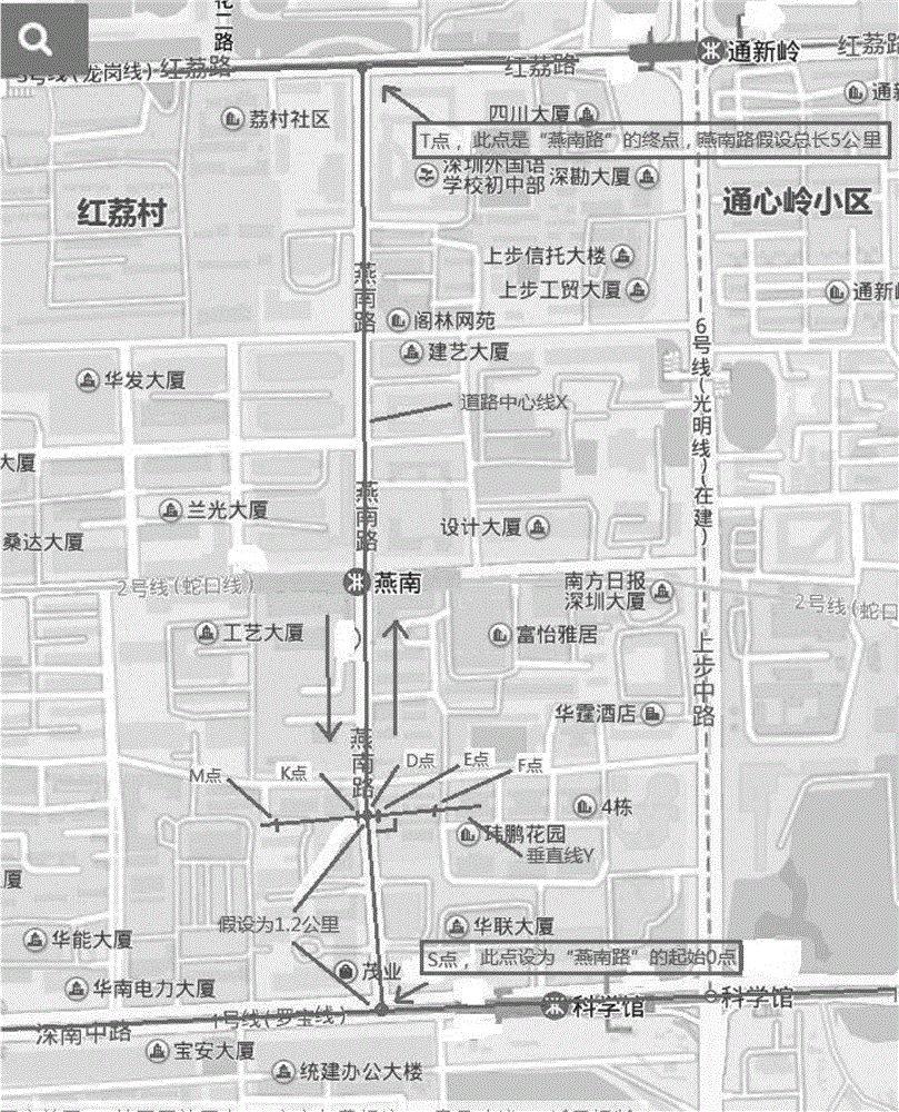
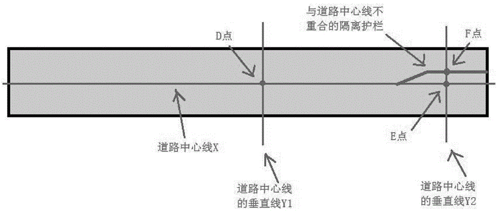
[0037] refer to figure 1 As shown, for Yannan Road in this embodiment, the starting point at the southern end of Yannan Road is taken as point 0 (point S in the figure), and the distance is calculated along the road centerline X. Point D in the figure is on the center line, assuming that the distance from point S to the starting point 0 is 1.2 kilometers, then point D is marked as "Yannan Road 1.200". In the figure, after point D, there are four points E, F, K, and M on the Y line perpendicular to the X line. Among them, points E and K are on the road, and the distance from point D along the vertical line Y is assumed to be 2 meters. Points F and M are outside the road, and the distance from point D to point D along the vertical line Y is assumed to be 30 meters. Then the positions of points E and K are respectively marked as "Yannan Road A1.200V2" and "Yannan Road B1.200V2", where V indicates that the horizontal marking point is in "Yannan Road". For the position on the roa...
Embodiment 2
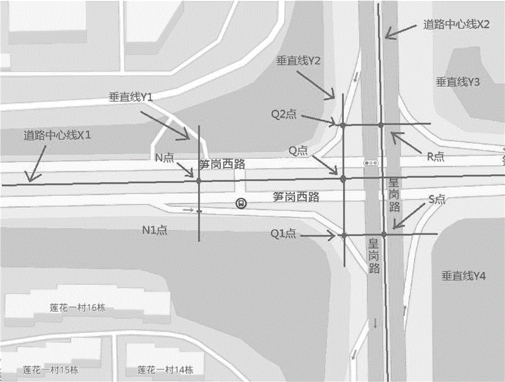
[0039] refer to figure 2 As shown, the difference between the second embodiment and the first embodiment is that since some roads have side roads and branch roads, how to mark the position of the side roads? The position on the auxiliary road is determined according to the direction of the vertical line of the position point of the road centerline on the main road, instead of calculating the actual distance from the starting point 0 on the auxiliary road. Such as figure 2 , assuming that the position of point N on the road centerline X1 is "Sungang West Road 3.651", and the distance between point N1 and point N along the vertical line Y1 is 15 meters, then the position of point N1 is marked as "Sungang West Road A3.651V15 ". Assume that the position of point Q on the road centerline X1 is "Sungang West Road 4.123", the distance between point Q1 and point Q along the vertical line Y2 is 23 meters, and the distance between point Q2 and point Q along the vertical line Y2 is 2...
Embodiment 3
[0044] According to the method of marking the location mentioned above, the location has a simple and clear text description, so when setting the navigation destination, there is no need to fuzzy search for similar destinations first, and then manually select a desired destination , but directly enter the exact navigation destination. With the voice recognition technology, it is possible to realize full-voice navigation destination input, so that the navigation destination can be changed at will while the vehicle is driving, and the navigation route can be re-planned.
PUM
 Abstract
Description
Claims
Application Information
 - R&D
- Intellectual Property
- Life Sciences
- Materials
- Tech Scout
- Unparalleled Data Quality
- Higher Quality Content
- 60% Fewer Hallucinations
Browse by: Latest US Patents, China's latest patents, Technical Efficacy Thesaurus, Application Domain, Technology Topic, Popular Technical Reports.
© 2025 PatSnap. All rights reserved.Legal|Privacy policy|Modern Slavery Act Transparency Statement|Sitemap|About US| Contact US: help@patsnap.com


