Multi-sensor deep sea square cabin based on seabed geodetic control network

A multi-sensor and control network technology, applied to underwater operation equipment, transportation and packaging, ships, etc., can solve the problems of few documents, time-consuming and labor-intensive regional control network construction, unfavorable long-term operation and maintenance of submarine control network, etc., to achieve The effect of convenient and flexible use, simple structure, low cost of manufacture and use

Active Publication Date: 2017-07-18
NAT DEEP SEA CENT
View PDF6 Cites 3 Cited by
  • Summary
  • Abstract
  • Description
  • Claims
  • Application Information

AI Technical Summary

Problems solved by technology

In terms of network deployment scheme, Japan adopted the network deployment principle of land geodetic surveying, that is, firstly laying out I control network points, and then encrypting and forming II and III control networks on this basis, but how to adapt to the seabed environment and the characteristics of acoustic ranging There are few international literatures on network site selection, network structure and shape design that meet the requirements of positioning accuracy; in terms of the construction of submarine geodetic control network, countries in the world often use the control network measurement method combining GNSS and acoustic positioning technology, among which Japan has adopted the comprehensive observation technology of sea surface platform + GNSS + SBL + submarine Beacon + submarine cable, South Korea has adopted the measurement technology combining GNSS and underwater acoustic positioning (LBL + SBL), and the US submarine network is only used for underwater navigation and monitoring. GNSS positioning technology is adopted for the survey of the submarine control network. The above positioning technology is effective for the construction of a single control network, but it is time-consuming and laborious for the construction of the regional control network, which is not conducive to the long-term operation and maintenance of the submarine control network.

Method used


Image

  • Multi-sensor deep sea square cabin based on seabed geodetic control network
  • Multi-sensor deep sea square cabin based on seabed geodetic control network

Examples


Embodiment Construction

[0017] The present invention will be further described below in conjunction with the accompanying drawings and embodiments.

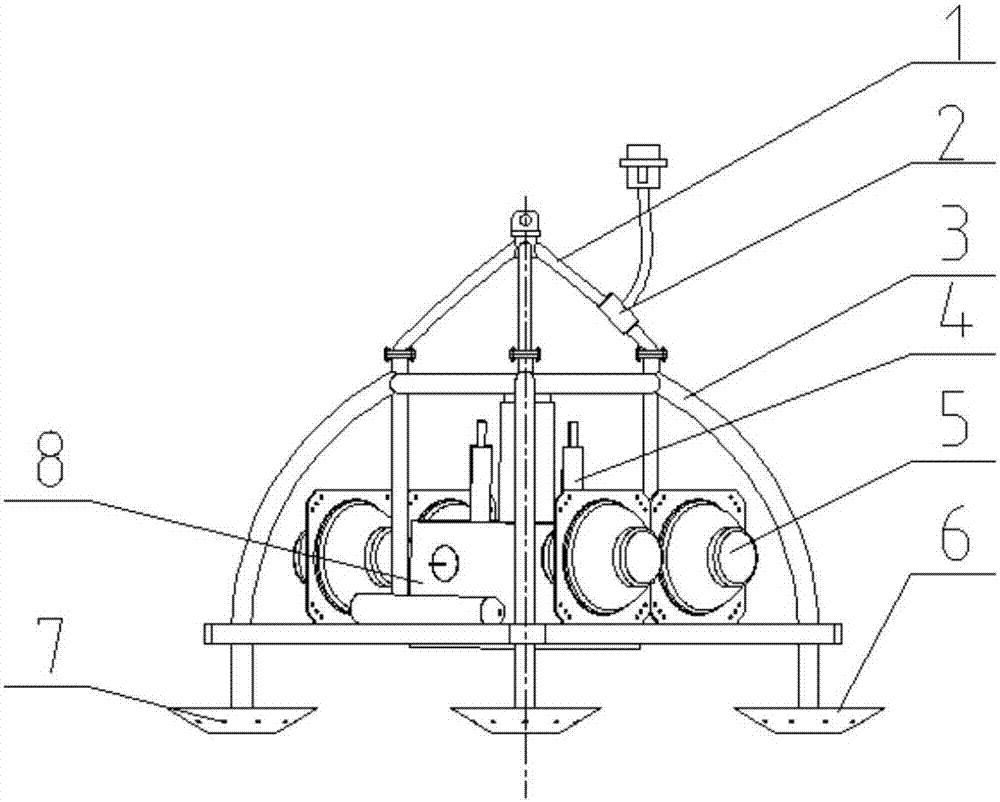
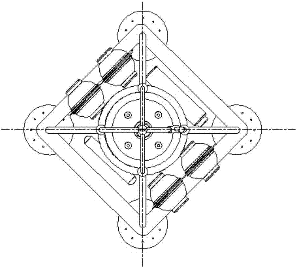
[0018] Such as figure 1 As shown, the multi-sensor deep-sea shelter based on the submarine geodetic control network of the present invention includes a deep-sea shelter main body, an acoustic transducer 2, a seabed observation device and a floating ball 5, and the deep-sea shelter main body is a split structure, including The top bracket 1 and the base 3, the top bracket 1 is located above the base 3, and the top bracket 1 and the base 3 are fixedly connected by threaded connection. The split structure is beneficial to the installation and deployment of the seabed observation device and the floating ball 5 on the base 3, and it provides the possibility to increase the carrying device in the future. Both the top bracket 1 and the base 3 are conical structures with a large bottom and a small top, so that the overall center of gravity of the shelter is lo...


PUM


Abstract

The invention relates to seabed platforms, in particular to a multi-sensor deep sea square cabin based on a seabed geodetic control network. The multi-sensor deep sea square cabin based on the seabed geodetic control network comprises a deep sea square cabin body, an acoustic transducer, a seabed observation device and floating balls, the deep sea square cabin body comprises a top supporting frame and a base, the top supporting frame is located above the base and the top supporting frame is fixedly connected with the base; the acoustic transducer is mounted above the top supporting frame, and the acoustic transducer is fixedly connected with the top supporting frame; the seabed observation device and the floating balls are all fixed to the base, the floating balls are located on outer side of the seabed observation device, and the floating balls are symmetrically arranged on the base; a plurality of bottom-sitting legs are fixed to the bottom of the base, the tops of the bottom-sitting legs are fixedly connected with the bottom face of the base, the bottoms of the bottom-sitting legs are circular conical surfaces big at the top and small at the bottom, and bottom-sitting buffer holes are formed in the circular conical surfaces. The multi-sensor deep sea square cabin based on the seabed geodetic control network is simple in structure, convenient to use, low in manufacturing and using cost, convenient to lay and accurate in layout position, and can achieve overall stable and reliable operation of the system.

Description

technical field [0001] The invention relates to a seabed platform, in particular to a multi-sensor deep-sea shelter based on a seabed geodetic control network. Background technique [0002] The report of the 18th National Congress of my country has clearly proposed to build a marine power strategy with the core of improving the development of marine resources, developing the marine economy, protecting the marine ecological environment, and resolutely safeguarding the national marine rights and interests; the "China Ocean Development Report (2013)" pointed out: "The future In 20 years, China's ocean work will be based on resources and go beyond resources, to expand the national strategic development space, increase the national strategic resource reserves, promote deep-sea technology to reach the world's leading level, and establish China's powerful status in ocean affairs as the strategic goal. However, it can be seen that the implementation of this strategy has encountered s...

Claims


Application Information

Patent Timeline
Patent Type & Authority Applications(China)
IPC IPC(8): B63C11/52
CPCB63C11/52
Inventor 高翔杨雷刘坤杜志元杨磊
Owner NAT DEEP SEA CENT
Why Eureka
Try Eureka