

Crop recognition method based on multi-spectral satellite images
A technology of satellite imagery and recognition method, which is applied in the field of multi-spectral information processing, can solve the problems of high cost and low efficiency of crop recognition technology, and achieve the effect of expanding the number, accurate recognition and improving recognition efficiency
- Summary
- Abstract
- Description
- Claims
- Application Information
AI Technical Summary
Problems solved by technology
Method used
Image

Examples
Embodiment 1
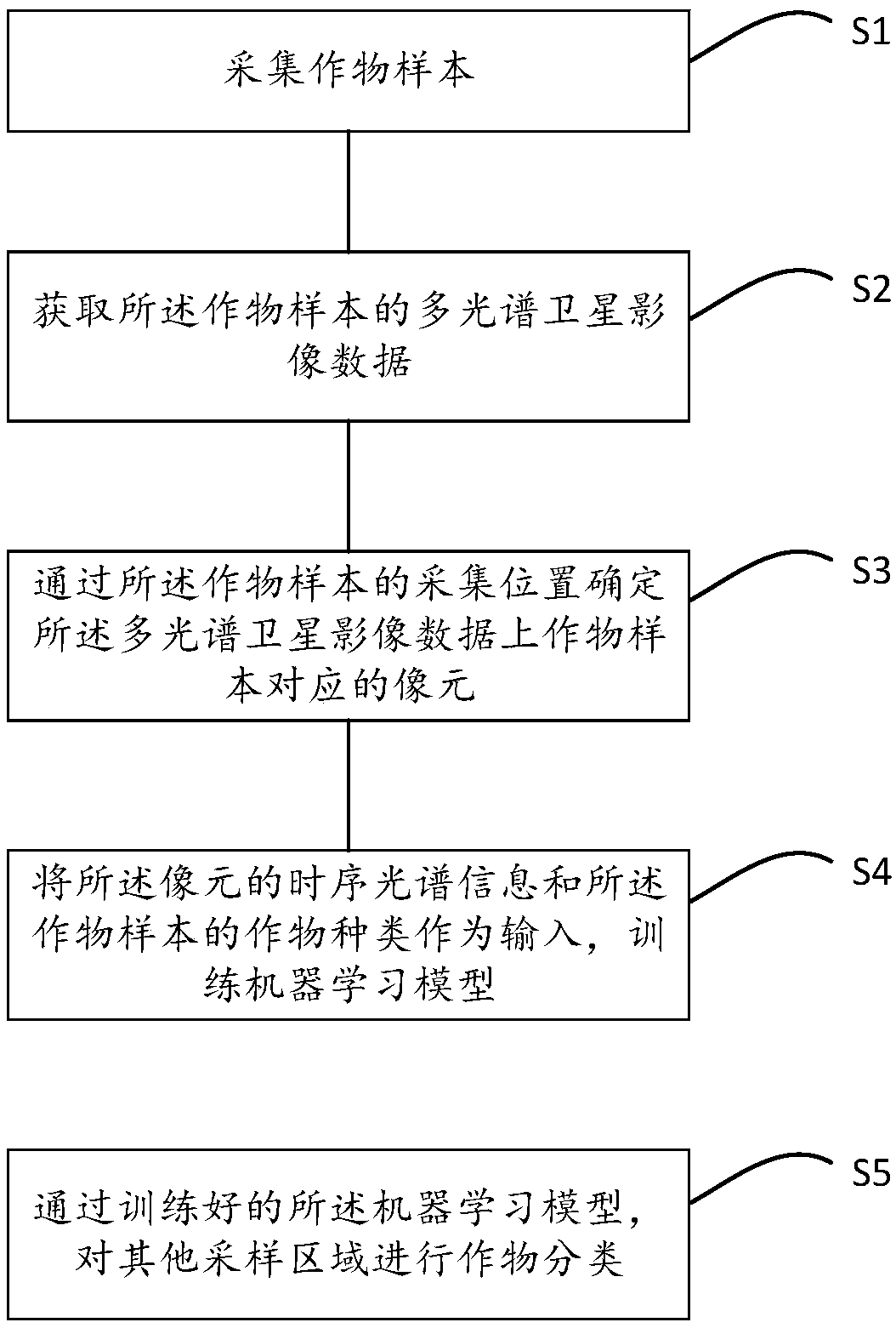
[0039] A method for crop identification based on multi-spectral satellite images provided by a preferred embodiment of the present invention, such as figure 1 shown, including the following steps:
[0040] S1, collecting crop samples;
[0041] Collect crop samples, and record the collection time, location and type of crops; for a range of 100km×100km, the number of samples for each crop should be at least 100, and should be scattered as much as possible;
[0042] S2. Acquiring multi-spectral satellite image data of the crop samples;
[0043] The multispectral satellite image data is the number of multispectral satellite images from the collection time of crop samples to the 60 days before the collection time; the longer the time period, the more multispectral satellite images are obtained, and more spectral Information is more helpful to improve the accuracy of crop classification. Therefore, in order to ensure the accuracy of crop classification, this embodiment preferably ...
PUM
 Abstract
Description
Claims
Application Information