Method and device for extracting land surface water body based on remote sensing image

A remote sensing image and water body extraction technology, which is applied in the field of remote sensing image recognition, can solve the problems of large recognition error, low extraction accuracy, and difficulty in determining the extraction threshold, and achieve the effect of improving accuracy and accuracy

Inactive Publication Date: 2019-03-15
SOUTH UNIVERSITY OF SCIENCE AND TECHNOLOGY OF CHINA
View PDF5 Cites 7 Cited by
  • Summary
  • Abstract
  • Description
  • Claims
  • Application Information

AI Technical Summary

Problems solved by technology

[0004] However, the single-band method is often only for a specific type of water body and cannot be applied on a large scale
Although the calculation of the dual-band method is convenient, it is easily affected by the shadow area with low reflectivity when extracting water bodies, and the identification error is large
The multi-band index in the existing multi-band method is mostly based on the simple combination of multi-bands. When the effect of the bimodal distribution histogram is not good, it is difficult to determine the extraction threshold, so the extraction accuracy is low.

Method used


Image

  • Method and device for extracting land surface water body based on remote sensing image
  • Method and device for extracting land surface water body based on remote sensing image
  • Method and device for extracting land surface water body based on remote sensing image

Examples


Embodiment 1

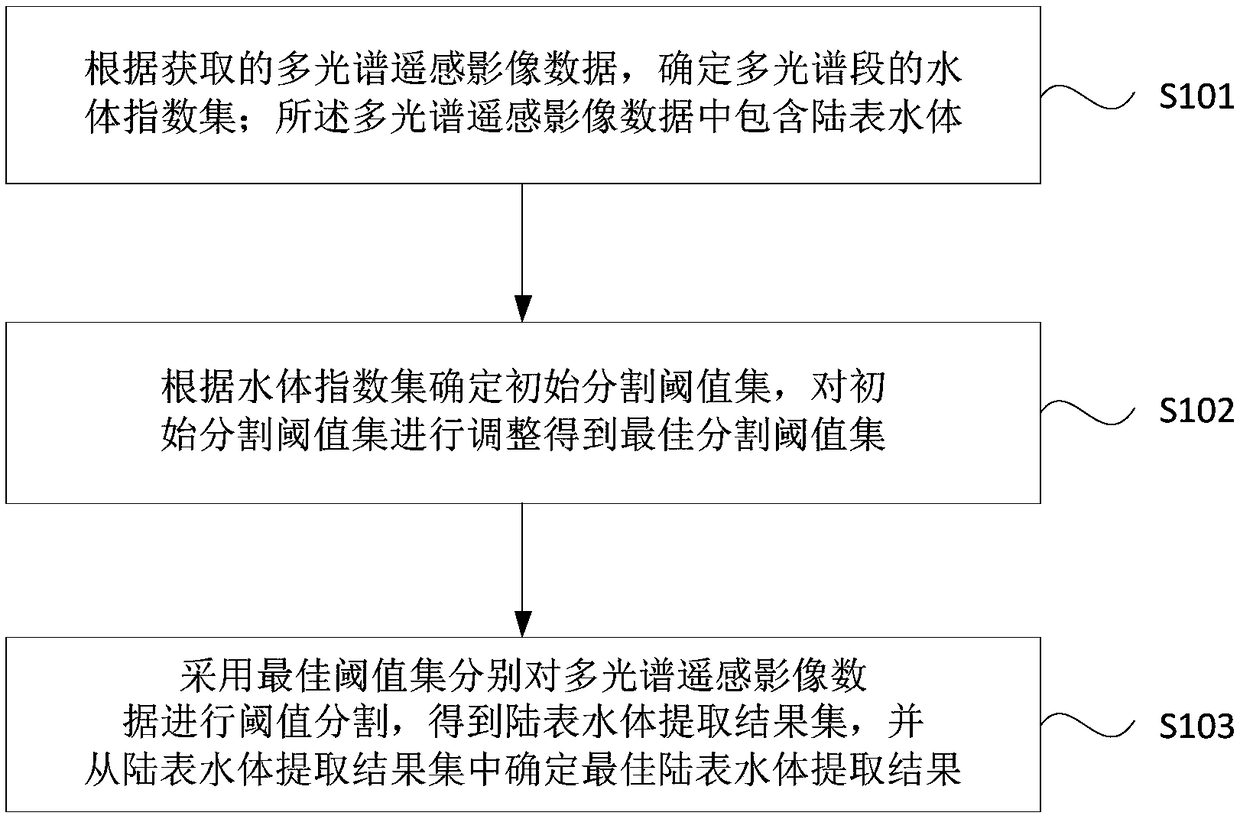
[0024] figure 1 A flowchart of a method for extracting land surface water bodies based on remote sensing images provided in Embodiment 1 of the present invention. This embodiment is applicable to the case of extracting land surface water body regions from multi-spectral remote sensing image data containing land surface water bodies. The method can be executed by the device for extracting land surface water body based on remote sensing image provided by the embodiment of the present invention, and the device can be realized by means of hardware and / or software. Such as figure 1 As shown, it specifically includes the following steps:

[0025] S101, according to the acquired multi-spectral remote sensing image data, determine a water body index set of multi-spectral segments; the multi-spectral remote sensing image data includes land surface water bodies.

[0026] Among them, the multi-spectral remote sensing image data can be the image data obtained by monitoring the surface o...

Embodiment 2

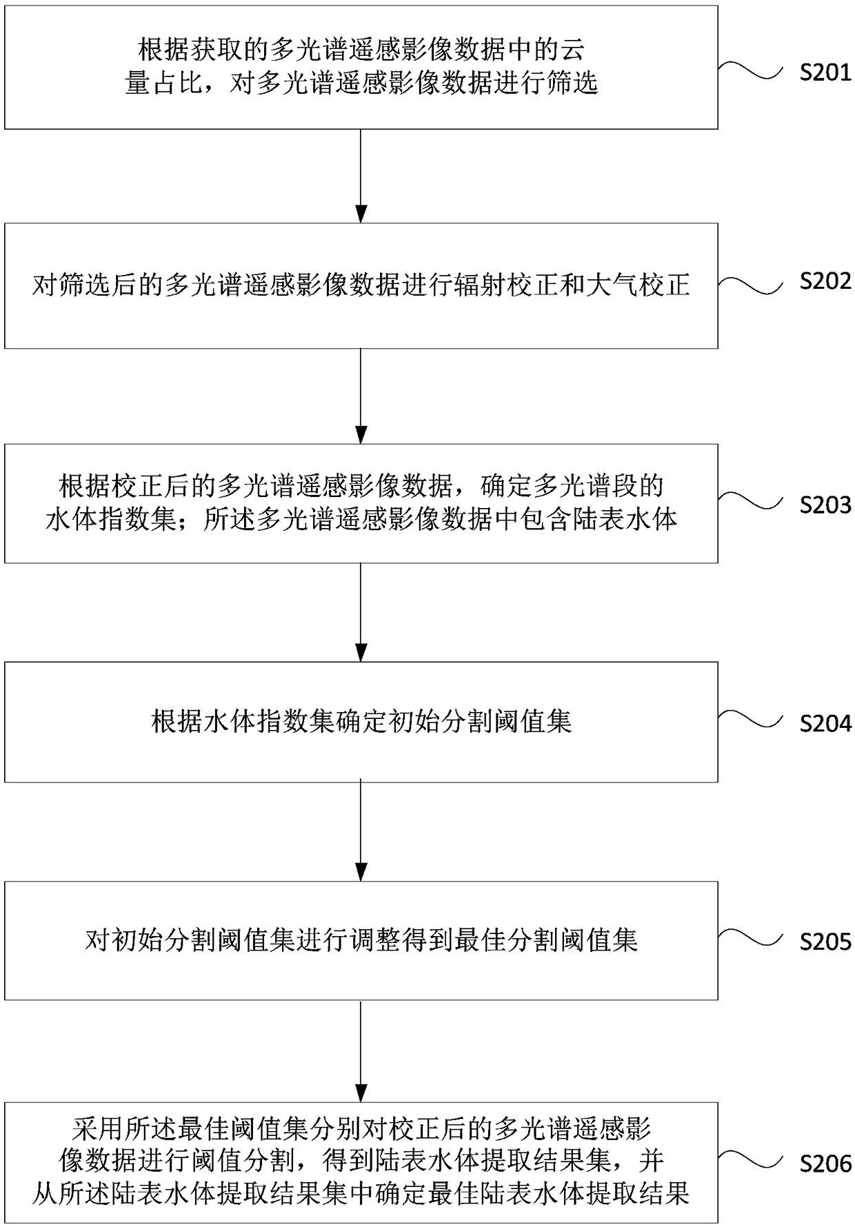
[0044] figure 2 It is a flow chart of a method for extracting land surface water bodies based on remote sensing images provided in Embodiment 2 of the present invention. This embodiment is further optimized on the basis of the foregoing embodiments. see figure 2 , the method specifically includes:

[0045] S201. Filter the multi-spectral remote sensing image data according to the proportion of cloud cover in the acquired multi-spectral remote sensing image data.

[0046] Exemplarily, since remote sensing image data is usually taken by telemetry instruments on satellite or aviation platforms, and it is inevitable that the ground is covered by clouds, cloud areas usually exist in the acquired remote sensing image data. If the cloud area in an image is large or the cloud area just blocks the land surface water area, the remote sensing image data cannot accurately identify and extract the land surface water area. Therefore, it is possible to obtain multiple sets of multi-spe...

Embodiment 3

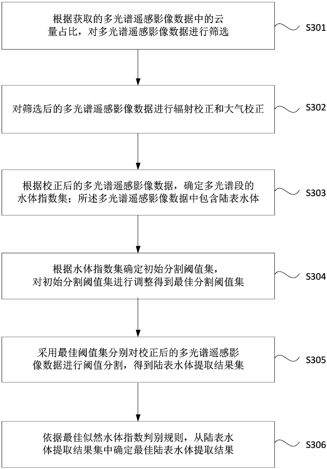
[0071] image 3 It is a flowchart of a method for extracting land surface water bodies based on remote sensing images provided in Embodiment 3 of the present invention. This embodiment provides a preferred embodiment on the basis of the above-mentioned embodiments, and specifically introduces the specific situation of determining the optimal land surface water body extraction result from the land surface water body extraction result set.

[0072] The multispectral remote sensing image data acquired in this embodiment may be located in the urban area of ​​Beijing, and the spatial range is between 116.15° east longitude and 116.60° east longitude, and between 39.75° north latitude and 40.20° north latitude. The area contains various types of land surface water bodies such as natural rivers, artificial channels, large and small lakes and reservoirs. The area also includes the core urban area of ​​Beijing, which is densely populated with high-rise buildings, and the shadows of th...


PUM


Abstract

The invention discloses a method and a device for extracting land surface water body based on remote sensing images. The method comprises the following steps: according to the acquired multi-spectralremote sensing image data, determining the water body index set of the multi-spectral section; The multi-spectral remote sensing image data comprises a land surface water body; Determining an initialsegmentation threshold set according to the water body index set, and adjusting the initial segmentation threshold set to obtain an optimal segmentation threshold set; The multispectral remote sensingimage data are threshold segmented by the optimal threshold set to obtain a land surface water extraction result set, and the optimal land surface water extraction result set is determined from the land surface water extraction result set. It can effectively avoid the problem of large recognition error when the remote sensing image data is not good, and improve the accuracy of land surface waterextraction in remote sensing images.

Description

technical field [0001] Embodiments of the present invention relate to remote sensing image recognition technology, in particular to a method and device for extracting land surface water bodies based on remote sensing images. Background technique [0002] Fresh water resources are closely related to human survival and development. At present, fresh water resources suitable for development and utilization are usually distributed on the earth's land surface. Determining the location and area of ​​land surface water bodies is the basis for water resource assessment, water quality monitoring, urban and rural planning, environmental protection, and natural resource investigation. Therefore, accurately and efficiently extracting the location of land surface water bodies is an important direction of current research. [0003] At present, the commonly used methods for extracting land surface water bodies based on remote sensing images include: single-band method, dual-band method a...

Claims


Application Information

Patent Timeline
Patent Type & Authority Applications(China)
IPC IPC(8): G06T7/136G06T5/00
CPCG06T5/006G06T2207/10036G06T2207/30184G06T7/136
Inventor 王子丰刘俊国
Owner SOUTH UNIVERSITY OF SCIENCE AND TECHNOLOGY OF CHINA
Why Eureka
Try Eureka