

A modeling method of large geological building information model
A technology of building information model and modeling method, applied in 3D modeling, image data processing, instruments, etc., to achieve the effect of improving management level, advanced methods, and facilitating decision-making
- Summary
- Abstract
- Description
- Claims
- Application Information
AI Technical Summary
Problems solved by technology
Method used
Image

Examples
Embodiment Construction
[0046] The present invention will be further described below in conjunction with the accompanying drawings and specific embodiments.
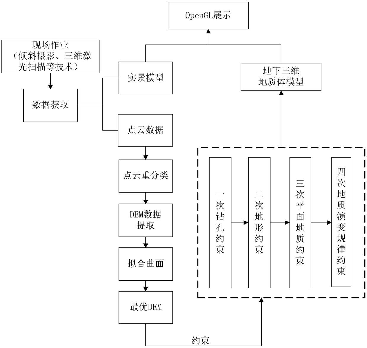
[0047] A modeling method of a large geological building information model, comprising the following steps:
[0048] Step 1. Obtain the real scene data of the working area through oblique photography and 3D laser scanning technology, and construct the 3D real scene model and point cloud data set of the working area surface;
[0049] Step 2. Using the virtual grid filter algorithm based on slope correction, the extraction of DEM data is realized through computer programming, which specifically includes the following steps:
[0050] (1) First construct the structure PStrut of the point cloud={x, y, z} (wherein, PStrut: the structure data of the point cloud; x: the x coordinate of the point cloud point; y: the y coordinate of the point cloud point; z : the z coordinate of the point cloud point), standardize all point cloud data within the working ...
PUM
 Abstract
Description
Claims
Application Information