Unmanned aerial vehicle SAR imaging method and apparatus
An imaging method and unmanned aerial vehicle technology, applied in the field of SAR imaging, can solve the problems of poor imaging quality and low resolution, and achieve the effect of weight reduction, high resolution and good imaging quality
- Summary
- Abstract
- Description
- Claims
- Application Information
AI Technical Summary
Problems solved by technology
Method used
Image
Examples
Embodiment Construction
[0025] In order to make the objectives, technical solutions and advantages of the present invention clearer, the present invention will be further described in detail below with reference to specific embodiments and accompanying drawings.
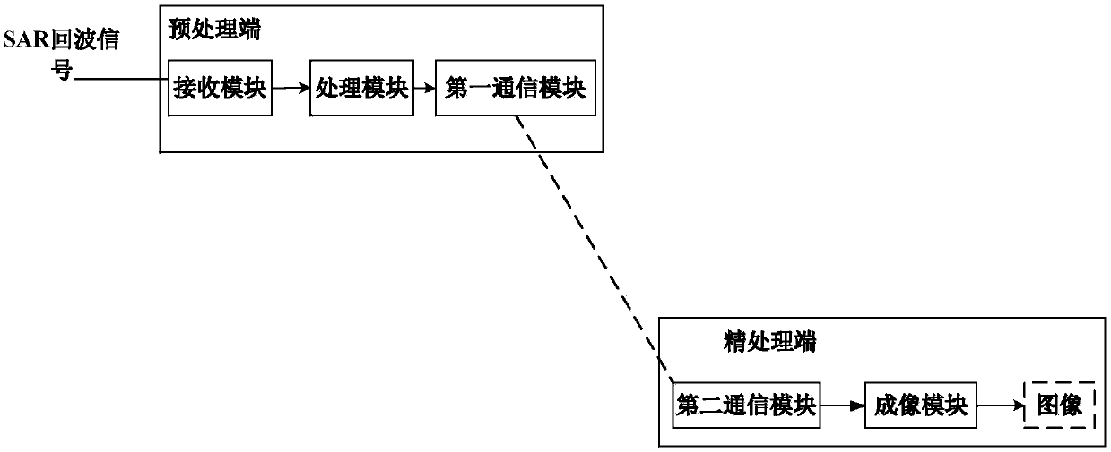
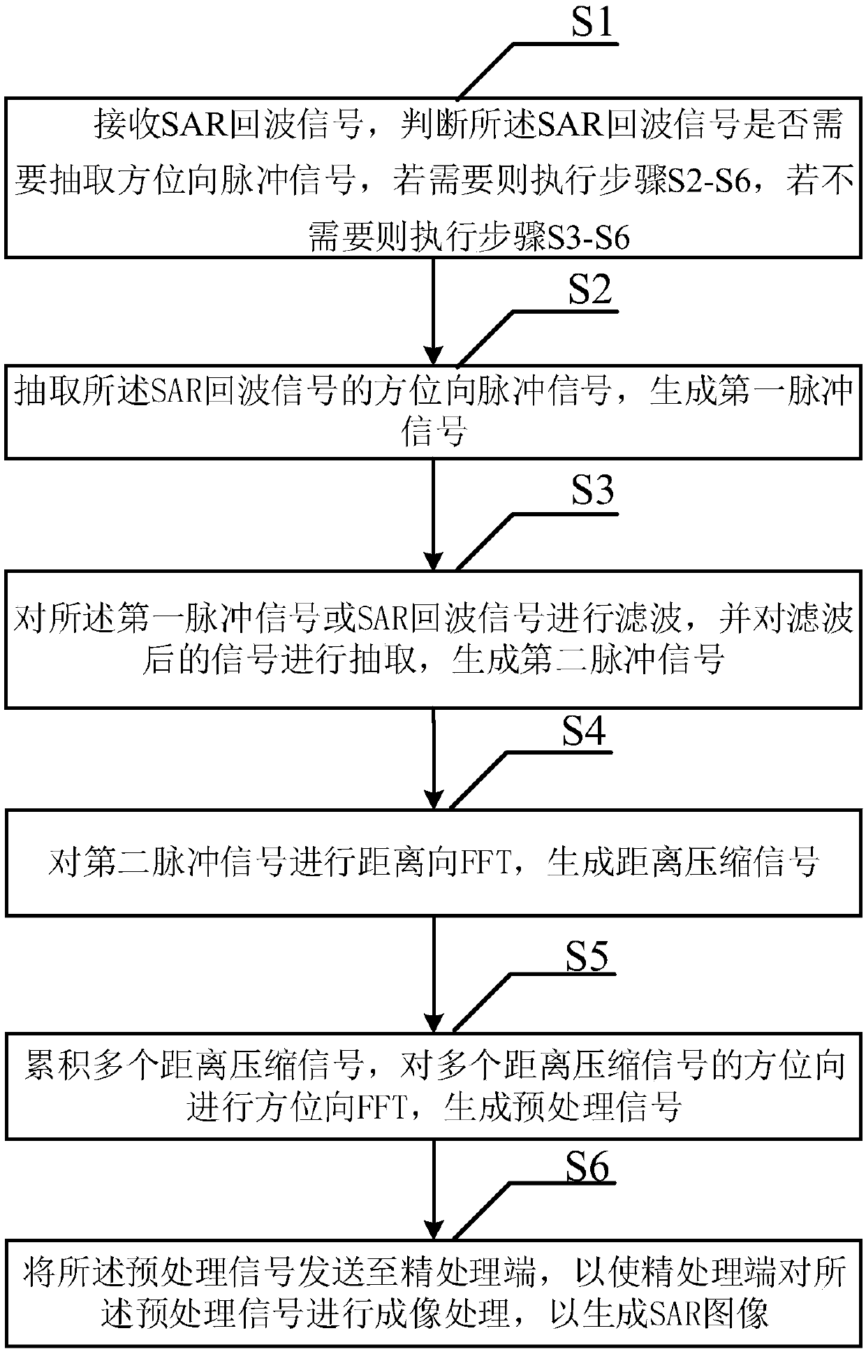
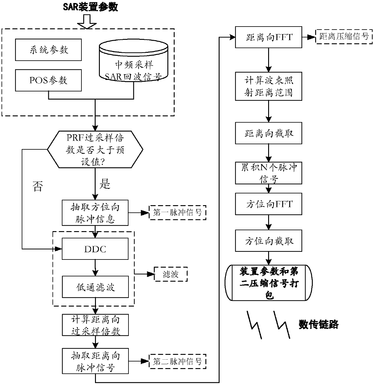
[0026] In the SAR imaging algorithm, the Range Doppler (RD) algorithm utilizes the decoupling of range processing and azimuth processing under certain conditions, and simplifies the imaging processing into two one-dimensional pulse compression processes, range compression and azimuth compression. Therefore, the RD algorithm greatly improves the computational efficiency and has a higher resolution. While using the SAR algorithm, the present invention divides the UAV SAR imaging system into two parts, such as figure 1 As shown in the figure, the preprocessing end and the fine processing end, in which the preprocessing end is located on the UAV and is mainly used to preprocess the SAR echo data and reduce its transmission rate. Under the prem...
PUM
 Abstract
Description
Claims
Application Information
 - R&D
- Intellectual Property
- Life Sciences
- Materials
- Tech Scout
- Unparalleled Data Quality
- Higher Quality Content
- 60% Fewer Hallucinations
Browse by: Latest US Patents, China's latest patents, Technical Efficacy Thesaurus, Application Domain, Technology Topic, Popular Technical Reports.
© 2025 PatSnap. All rights reserved.Legal|Privacy policy|Modern Slavery Act Transparency Statement|Sitemap|About US| Contact US: help@patsnap.com


