

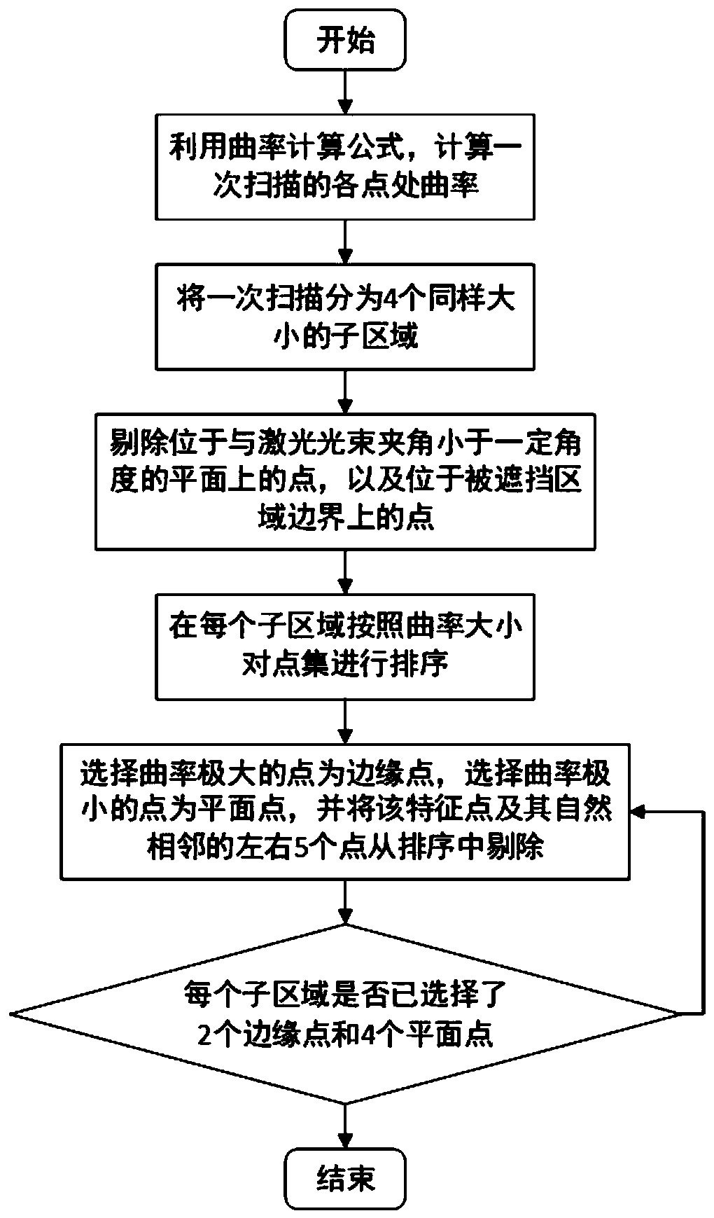
Three-dimensional point cloud reconstruction method based on laser radar
A technology of lidar and 3D point cloud, applied in the field of 3D reconstruction based on lidar, which can solve the problems of poor real-time mapping, expensive sensors, and motion distortion.
- Summary
- Abstract
- Description
- Claims
- Application Information
AI Technical Summary
Problems solved by technology
Method used
Image


Examples
Embodiment 2
[0153] In this embodiment, a street is taken as an example, and real-time mapping is carried out through the 3D point cloud reconstruction method described in Embodiment 1. The mapping result is as follows Figure 6 and Figure 7 shown, where Figure 6 An oblique view reconstructed from the 3D point cloud of the street, Figure 7 It is a top view, in which the point cloud color corresponds to the vertical height from low to high according to the distribution of gray value from high to low, that is, the point cloud representing the ground is the lightest in color, and the points representing higher positions such as vehicles, trees, walls and buildings Clouds are darker in color. From the results of the map construction, this method has a good effect on the 3D reconstruction of the street.
Embodiment 3
[0155] In this embodiment, a corresponding scanning system is established for the three-dimensional point cloud reconstruction method described in Embodiment 1. The scanning system includes a two-dimensional laser scanning device and a data processor. Please refer to Figure 8 , the scanning device includes: a single-line laser radar 1 and a driving body 2, the single-line laser radar 1 is installed on the rotating shaft of the driving body 2, and the driving body 2 is used to drive the single-line laser radar 1 and its two-dimensional scanning plane around The rotating shaft of the driving body 2 rotates, controls its rotational speed and returns the rotation angle information to the data processor in real time. The driving body 2 includes a Cortex-M4 control board 7, a stepping motor 6, a reducer 5 and an encoder 8, The single-line laser radar 1 is installed on the upper bracket 3, and the upper bracket 3 is connected to the output shaft of the stepper motor 6 through the red...
PUM
 Abstract
Description
Claims
Application Information