Monitoring method of farmland cotton aphid damage grade model based on unmanned aerial vehicle imaging
An unmanned aerial vehicle and imaging technology, applied in radio wave measurement system, spectrometry/spectrophotometry/monochromator, measuring device, etc. Yarn and other problems, to achieve fast and non-destructive and accurate investigation results, and improve the accuracy of the model
- Summary
- Abstract
- Description
- Claims
- Application Information
AI Technical Summary
Problems solved by technology
Method used
Image
Examples
Embodiment Construction
[0026] The present invention will be further described below with reference to the accompanying drawings and specific embodiments. The present embodiment provides a detailed implementation manner on the premise of the technical solution of the present invention.
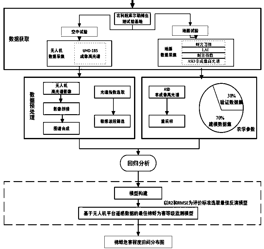
[0027] The method for monitoring the damage grade model of cotton aphid in farmland based on UAV imaging according to the present invention includes the following steps: 1) data collection; 2) data preprocessing; 3) regression analysis; 4) model building.
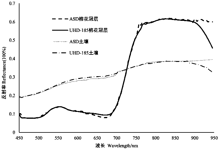
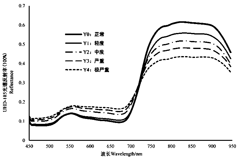
[0028] The data collection includes human-machine aerial imaging hyperspectral data collection and ground non-imaging hyperspectral data collection. Before data collection, it is necessary to determine the data collection area. In the present invention, a test plot with serious occurrence of aphids in the field is selected, and any pesticides that inhibit the growth of aphids are not applied during the test. 20 ridges are selected as the data collection region in t...
PUM
 Abstract
Description
Claims
Application Information
 - R&D
- Intellectual Property
- Life Sciences
- Materials
- Tech Scout
- Unparalleled Data Quality
- Higher Quality Content
- 60% Fewer Hallucinations
Browse by: Latest US Patents, China's latest patents, Technical Efficacy Thesaurus, Application Domain, Technology Topic, Popular Technical Reports.
© 2025 PatSnap. All rights reserved.Legal|Privacy policy|Modern Slavery Act Transparency Statement|Sitemap|About US| Contact US: help@patsnap.com


