Floodplain elevation determination method based on wavelet analysis
A determination method and wavelet analysis technology, applied in complex mathematical operations, instruments, design optimization/simulation, etc., can solve problems such as heavy workload, deviation of beach-trough boundary line, etc., and achieve accurate results, simple operation, and accurate calculation results Effect
- Summary
- Abstract
- Description
- Claims
- Application Information
AI Technical Summary
Problems solved by technology
Method used
Image
Examples
Embodiment Construction
[0030] Embodiments of the invention are described in detail below, examples of which are illustrated in the accompanying drawings. The embodiments described below by referring to the figures are exemplary only for explaining the present invention and should not be construed as limiting the present invention.
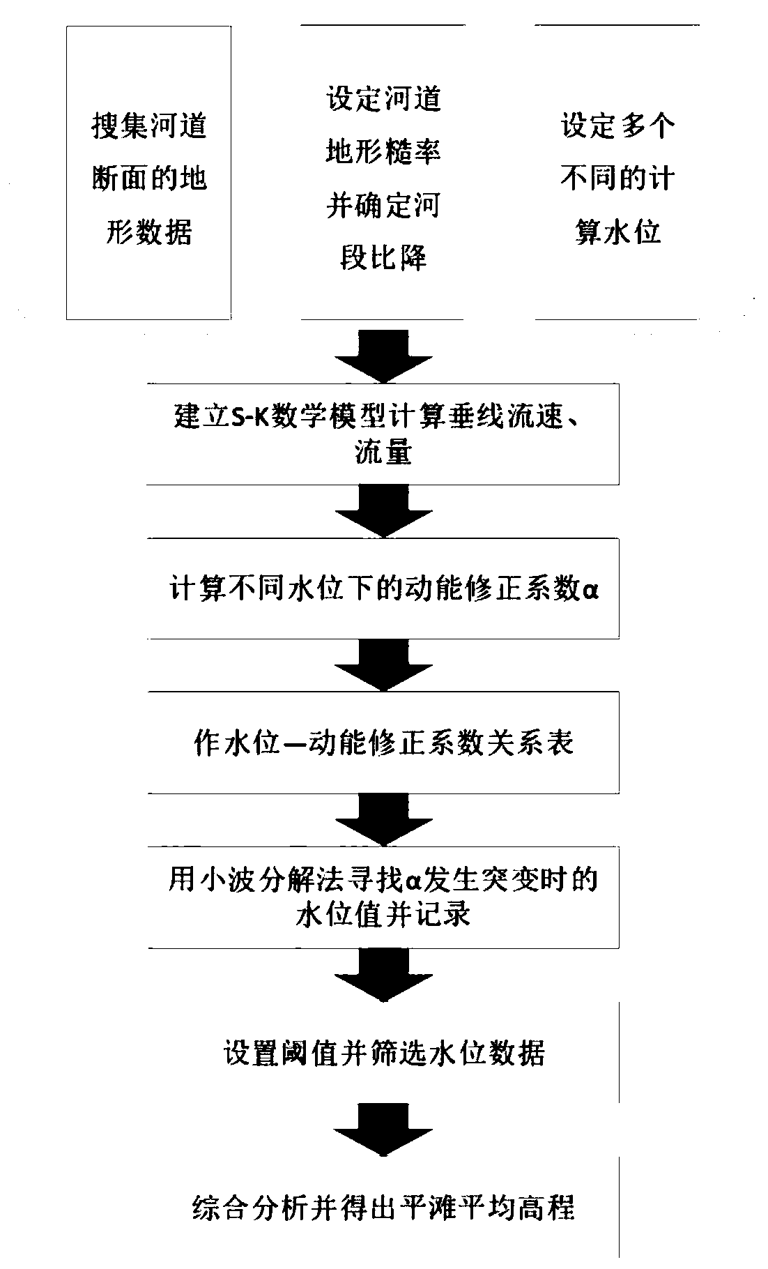
[0031] Such as figure 1 As shown, the specific steps of a floodplain elevation determination method based on wavelet analysis are as follows:
[0032] Step 1. Collect digital topographic data of the river section and arrange measuring points. The measuring points are marked as D from left to right i (i=1, 2,..., n), the corresponding elevation is z bi (i=1,2,...,n), where D 1 =0, record D i to D i+1 The width between two measuring points is B i (i=1,2,...,n-1);
[0033] Step 2, according to the characteristics of the selected channel and the collected data, set the channel roughness and determine the gradient of the river bed;
[0034] Step 3, set the minimum cal...
PUM
 Abstract
Description
Claims
Application Information
 - R&D
- Intellectual Property
- Life Sciences
- Materials
- Tech Scout
- Unparalleled Data Quality
- Higher Quality Content
- 60% Fewer Hallucinations
Browse by: Latest US Patents, China's latest patents, Technical Efficacy Thesaurus, Application Domain, Technology Topic, Popular Technical Reports.
© 2025 PatSnap. All rights reserved.Legal|Privacy policy|Modern Slavery Act Transparency Statement|Sitemap|About US| Contact US: help@patsnap.com


