

A method and system for adaptive fault-tolerant processing of spatial information data
A processing method and technology for spatial information, applied in geographic information databases, special data processing applications, error detection by signal spatial coding, etc. The effect of retrieval and reading speed, improving data stability, and reducing data deviation
- Summary
- Abstract
- Description
- Claims
- Application Information
AI Technical Summary
Problems solved by technology
Method used
Image

Examples
Embodiment Construction
[0040] The concept, specific structure and technical effects of the present disclosure will be clearly and completely described below in conjunction with the embodiments and drawings, so as to fully understand the purpose, scheme and effect of the present disclosure. It should be noted that, in the case of no conflict, the embodiments in the present application and the features in the embodiments can be combined with each other.
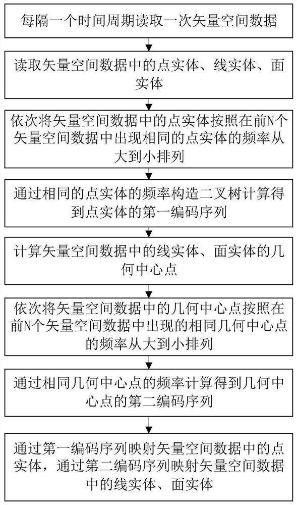
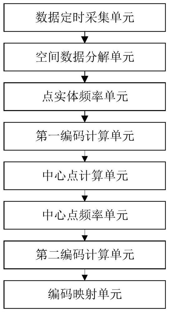
[0041] like figure 1 Shown is a flow chart of a method for adaptive fault-tolerant processing of spatial information data according to the present disclosure, combined below figure 1 A method according to an embodiment of the present disclosure will be described.
[0042] The present disclosure proposes an adaptive fault-tolerant processing method for spatial information data, which specifically includes the following steps:
[0043] S100: Read the vector space data every other time period; wherein, one time period is 5 seconds, which can be adjusted...
PUM
 Abstract
Description
Claims
Application Information