Epidemic infectious disease virus field visualization method and system based on space-time trajectory data

A space-time trajectory and infectious disease technology, applied in the field of visualization method and system of epidemic infectious disease virus field based on space-time trajectory data, can solve the problems of indistinct symptoms and long incubation period

Pending Publication Date: 2020-06-09
汤一平
View PDF4 Cites 25 Cited by
  • Summary
  • Abstract
  • Description
  • Claims
  • Application Information

AI Technical Summary

Problems solved by technology

[0010] This 2019-nCoV infectious disease is very occult; ①The coronavirus is nano-scale, invisible to the naked eye, and has a long incubation period; ②The symptoms are not obvious, and the incuba

Method used


Image

  • Epidemic infectious disease virus field visualization method and system based on space-time trajectory data
  • Epidemic infectious disease virus field visualization method and system based on space-time trajectory data
  • Epidemic infectious disease virus field visualization method and system based on space-time trajectory data

Examples


Embodiment Construction

[0064] The present invention will be further described below in conjunction with the accompanying drawings.

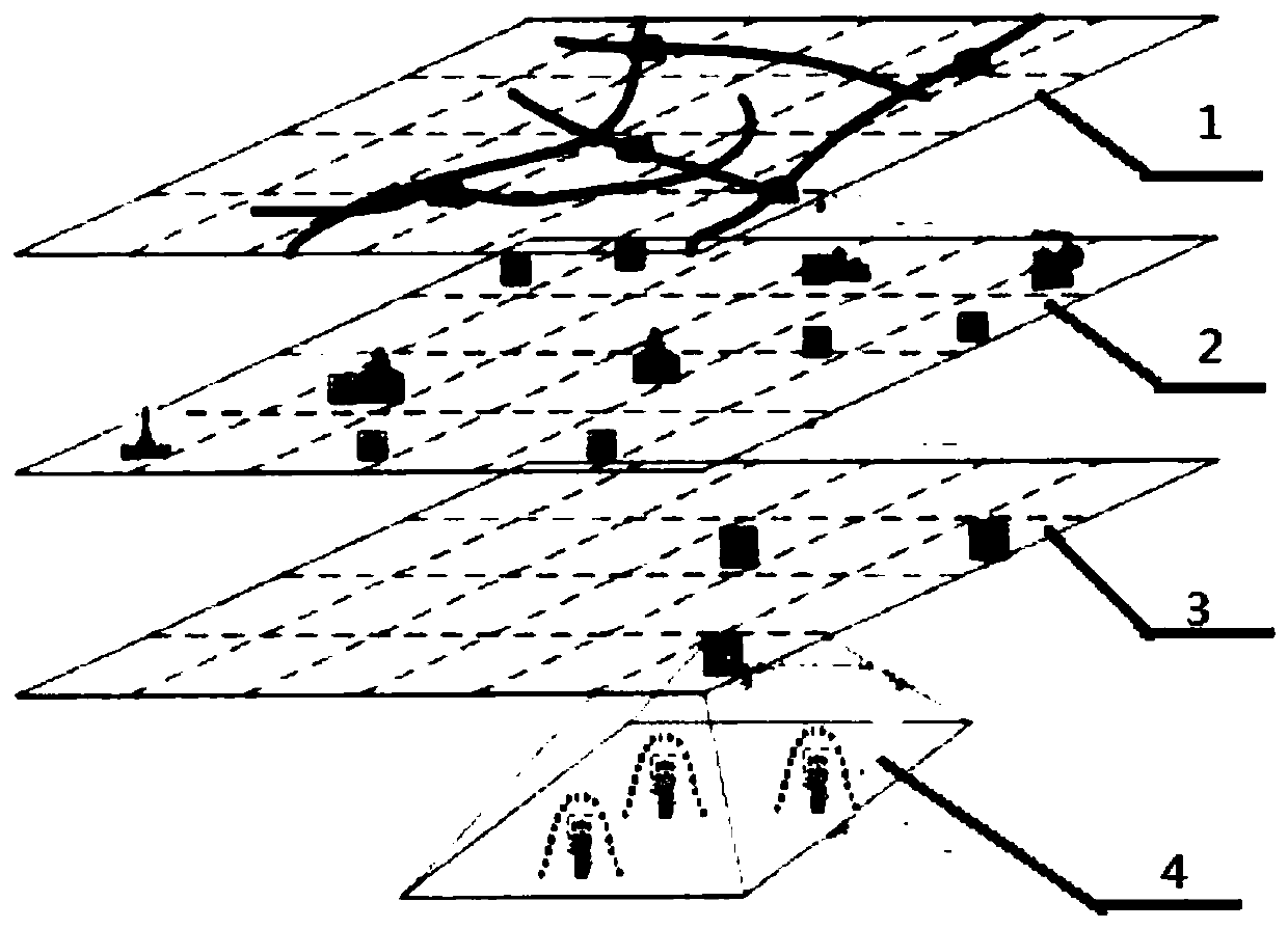
[0065] refer to Figure 1 ~ Figure 3 , a visualization system for the virus field of epidemic infectious diseases based on spatiotemporal trajectory data, including an airborne infectious disease urban diffusion modeling unit, a collection, cleaning and processing unit of spatiotemporal trajectory data and infection incidence data of virus-carrying populations, and the location of virus carriers The semantic information acquisition unit, the virus distribution density calculation unit with the virus carrier as the center of the location, the time, space and virus distribution density data mapping unit of the virus carrier population, and the construction unit of the cloud platform of epidemic infectious disease virus field based on temporal GIS.

[0066] Such as image 3 As shown, the important processing steps are as follows:

[0067] S1: Modeling urban spread of ai...


PUM


Abstract

The invention discloses an epidemic infectious disease virus field visualization method based on space-time trajectory data. The method comprises the following steps: S1, airspread infectious diseaseurban diffusion modeling; s2, collecting, cleaning and processing space-time trajectory data and infection attack data of virus carrying crowds; s3, obtaining position semantic information of a viruscarrier; s4, calculating the virus distribution density by taking the virus carrier as the position center; s5, mapping the time, space and virus distribution density data of the virus carrying population; and S6, constructing an epidemic infectious disease virus field cloud platform based on temporal GIS. The invention further provides an epidemic infectious disease virus field visualization system based on the space-time trajectory data. According to the method, space-time trajectory data and infection attack data of virus carrying crowds are processed into a virus distribution density map with the virus carrier as the position center, spatial position semantic information is added and mapped to a temporal GIS, and an epidemic infectious disease virus field is visually processed.

Description

technical field [0001] The invention relates to the application of mobile phone positioning, temporal GIS, big data and cloud computing in the field of prevention and control of epidemic infectious diseases, in particular to a method and system for visualizing virus field of epidemic infectious diseases based on spatiotemporal trajectory data. Background technique [0002] The core of an infectious disease outbreak lies in its contagiousness, which can be transmitted directly or indirectly from one person to another or more people. To deal with such sudden outbreaks of infectious diseases, humans have mastered a very old but extremely effective method-that is, isolation. [0003] There are three cores of isolation: [0004] The first is to find and manage the source of infection. Scientists have confirmed that the new coronavirus is the pathogen of this infectious disease outbreak, and it can spread from person to person, so the rapid identification and isolation of those ...

Claims


Application Information

Patent Timeline
IPC IPC(8): G16H50/80
CPCG16H50/80
Inventor 汤一平汤晓燕窦文博
Owner 汤一平
Why Eureka
Try Eureka