River ecological buffer zone remote sensing monitoring method and device based on grid division technology
A grid division and remote sensing monitoring technology, applied in character and pattern recognition, instruments, computer components, etc., can solve the problems of high cost of manpower and material resources, unclear point representation, low efficiency, etc., and achieve the goal of improving work efficiency Effect
- Summary
- Abstract
- Description
- Claims
- Application Information
AI Technical Summary
Problems solved by technology
Method used
Image
Examples
Embodiment 1
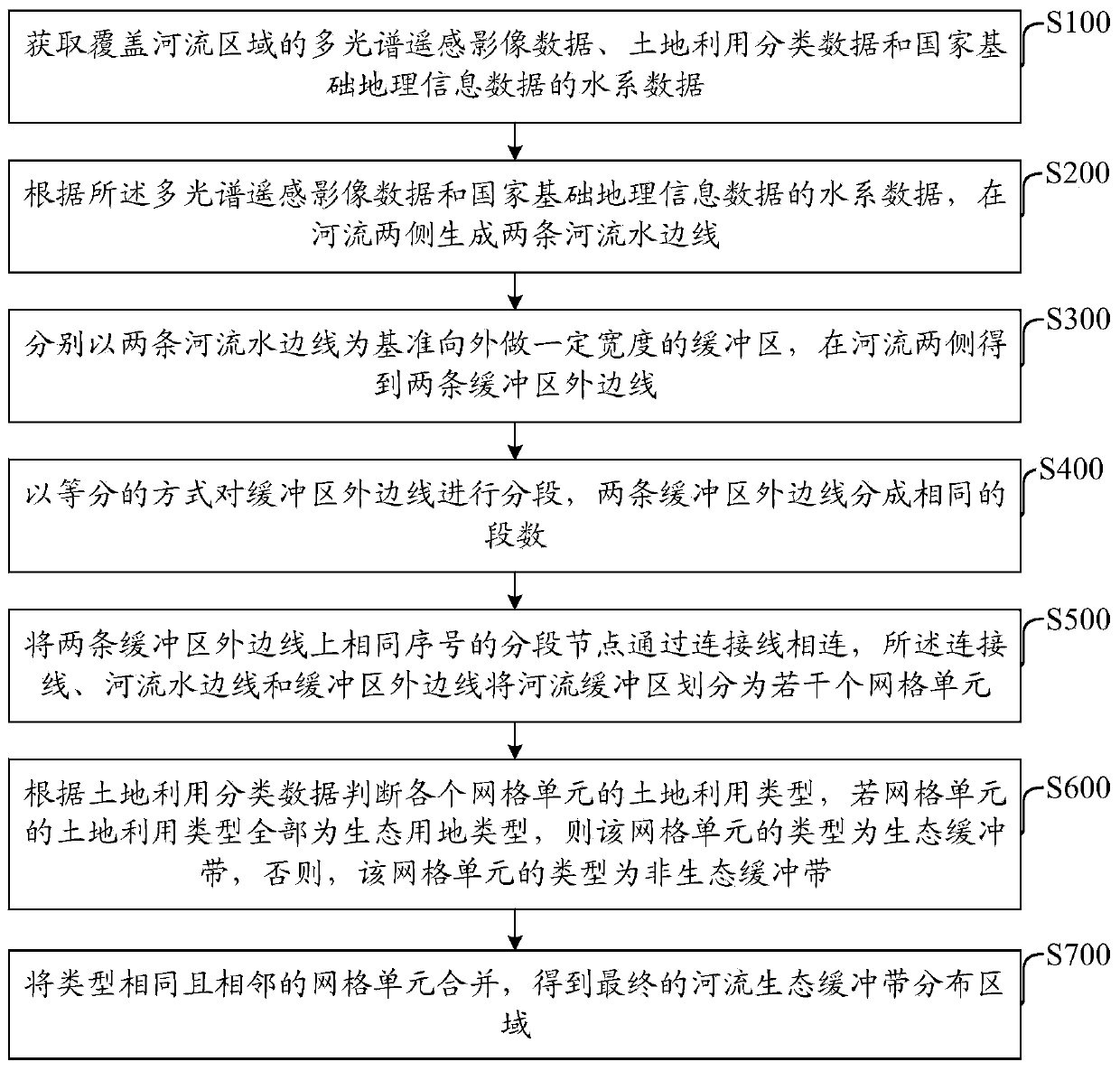
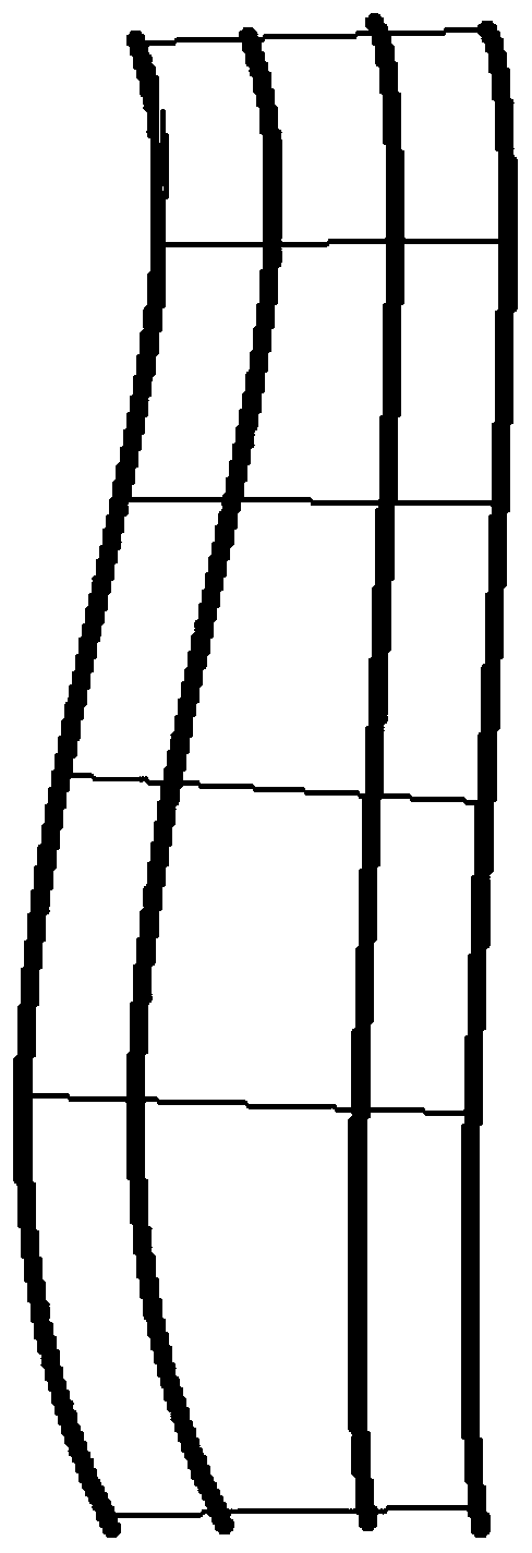
[0061] Embodiments of the present invention provide a method for remote sensing monitoring of river ecological buffer zones based on grid division technology, such as figure 1 As shown, the method includes:
[0062] S100: Obtain multi-spectral remote sensing image data covering river areas, land use classification data, and water system data of national basic geographic information data.
[0063] The multi-spectral remote sensing image data is preferably the remote sensing imaging data in the wet season of the river. The water system data of the land use classification data and the national basic geographic information data should be consistent with the time phase of the multi-spectral remote sensing image data. The time phase consistency refers to the time gap. As short as possible, it can be all the data in recent years.
[0064] The ratio of water system data in national basic geographic information data is 1:250,000, and the spatial resolution of multispectral remote sens...
Embodiment 2
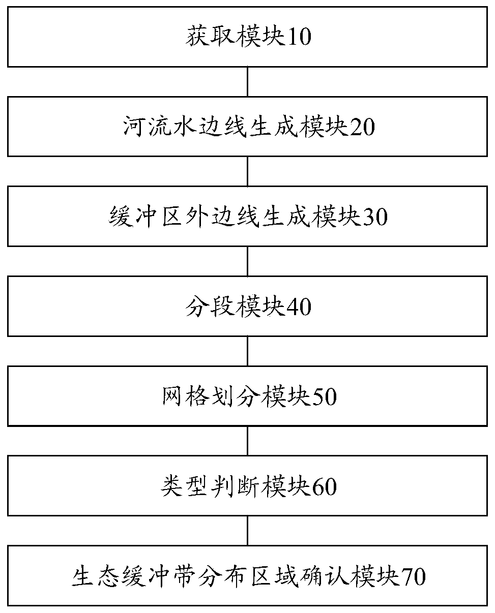
[0102] An embodiment of the present invention provides a remote sensing monitoring device for a river ecological buffer zone based on grid division technology, such as image 3 As shown, the device includes:
[0103] The acquisition module 10 is used to acquire multi-spectral remote sensing image data covering river areas, land use classification data and water system data of national basic geographic information data.
[0104] The river waterline generation module 20 is used to generate two river waterlines on both sides of the river according to the multi-spectral remote sensing image data and the water system data of the national basic geographic information data.
[0105] The buffer outer boundary line generation module 30 is used to make a buffer zone with a certain width based on the water edges of the two rivers, and obtain two buffer outer boundary lines on both sides of the river.
[0106]The segmentation module 40 is configured to segment the outer border of the buf...
Embodiment 3
[0128] The methods described in the above-mentioned embodiments provided in this specification can implement business logic through computer programs and record them on a storage medium, and the storage medium can be read and executed by a computer to achieve the effect of the solution described in Embodiment 1 of this specification. Therefore, the present invention also provides a computer-readable storage medium for remote sensing monitoring of river ecological buffer zones, including a memory for storing processor-executable instructions. Steps in the method of remote sensing monitoring of river ecological buffer zones.
[0129] Based on the grid division technology, the present invention reasonably segments the buffer zone, and analyzes the status quo of the river ecological buffer zone in a large area based on the existing multi-spectral remote sensing image data, land use classification data, and water system data of the national basic geographic information data. and hi...
PUM
 Abstract
Description
Claims
Application Information
 - R&D
- Intellectual Property
- Life Sciences
- Materials
- Tech Scout
- Unparalleled Data Quality
- Higher Quality Content
- 60% Fewer Hallucinations
Browse by: Latest US Patents, China's latest patents, Technical Efficacy Thesaurus, Application Domain, Technology Topic, Popular Technical Reports.
© 2025 PatSnap. All rights reserved.Legal|Privacy policy|Modern Slavery Act Transparency Statement|Sitemap|About US| Contact US: help@patsnap.com


