IoT multi-dimensional data fusion system and method

A technology of multi-dimensional data and data fusion, applied in the field of Internet of Things data

Active Publication Date: 2022-08-09
FU ZHOU INTERNET OF THINGS OPEN LAB
View PDF2 Cites 0 Cited by
  • Summary
  • Abstract
  • Description
  • Claims
  • Application Information

AI Technical Summary

Problems solved by technology

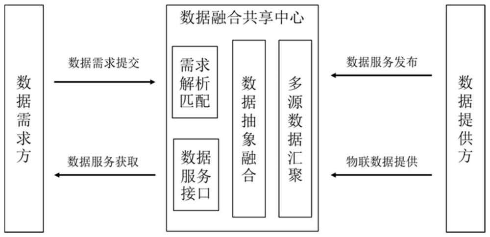
[0003] The present invention proposes an Internet of Things data fusion and sharing system and method that combines Beidou grid codes as space domain identifiers in order to solve the needs of Internet of Things spatio-temporal data fusion in applications such as smart transportation and smart cities.

Method used


Image

  • IoT multi-dimensional data fusion system and method
  • IoT multi-dimensional data fusion system and method
  • IoT multi-dimensional data fusion system and method

Examples


Embodiment Construction

[0031] In order to make the purposes, technical solutions and advantages of the embodiments of the present application clearer, the technical solutions in the embodiments of the present application will be clearly and completely described below with reference to the accompanying drawings in the embodiments of the present application.

[0032] IoT data corresponds to sensing devices in the real world. In digital construction, IoT data fusion requirements based on the real-world geospatial information domain are often put forward. Therefore, the application of IoT data needs to be closely integrated with geographic information data. Beidou grid code is a discretized, multi-scale regional location identification system developed on the basis of GeoSOT geospatial division theory. Arbitrary grids with an accuracy of 1.5 cm endow the world with a unique one-dimensional integer code. The Beidou grid code can automatically establish the spatial association between physical objects a...


PUM


Abstract

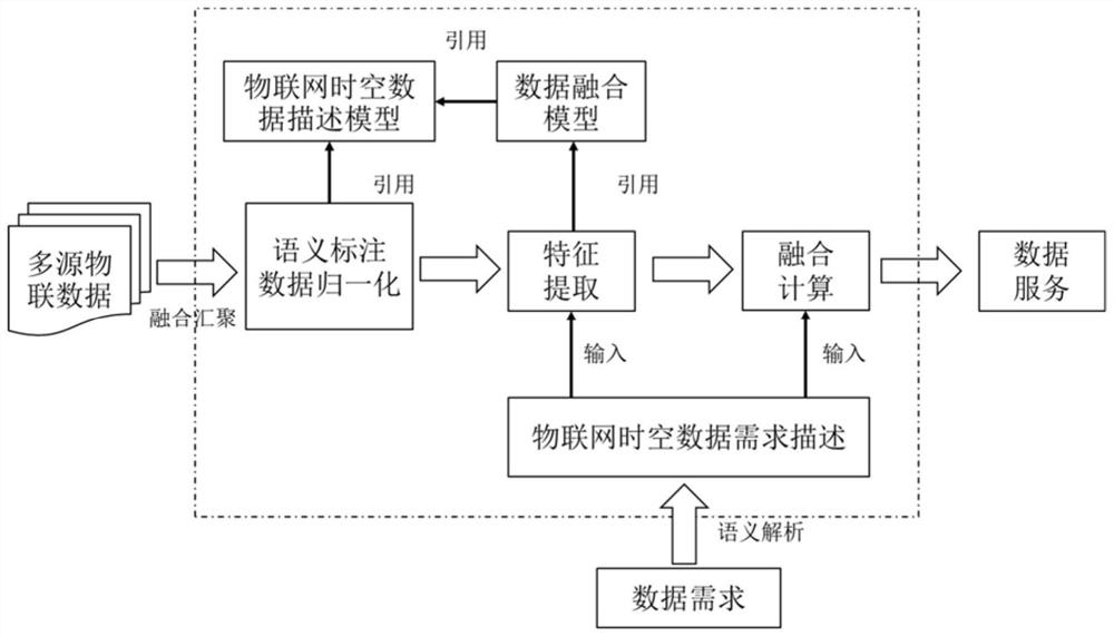
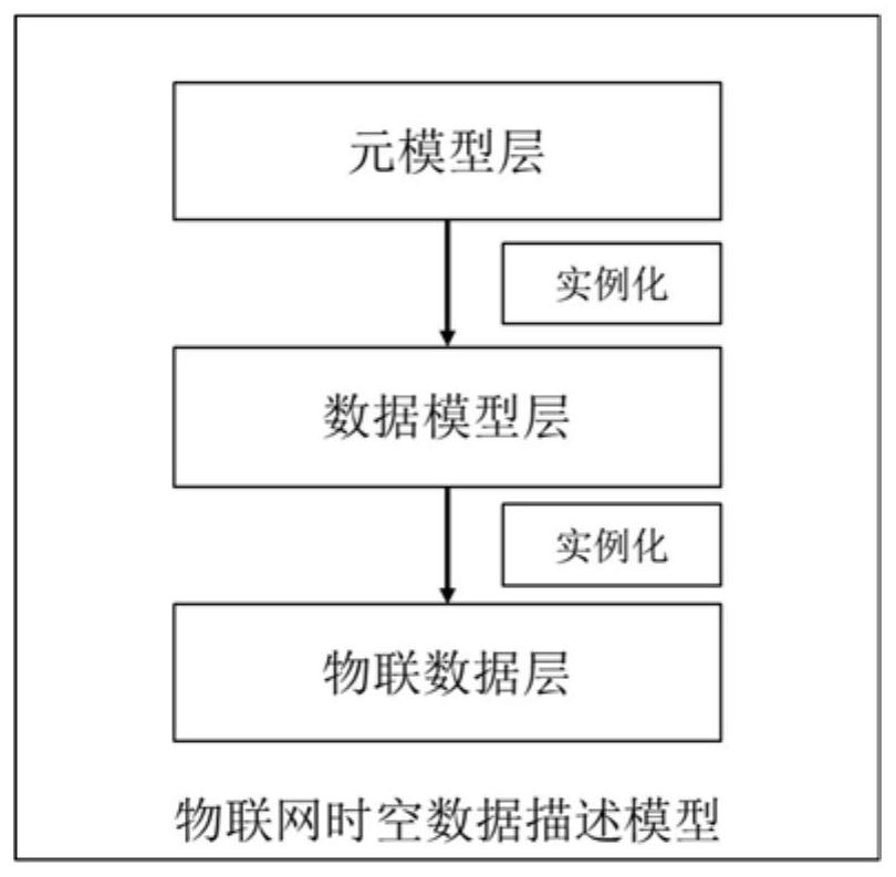
The invention discloses a system and method for multi-dimensional data fusion of the Internet of Things. The data providing direction to a data fusion and sharing center is provided by Internet of Things data or publishing data services, and the data demand direction is to submit data requirements to the data fusion and sharing center. The data fusion and sharing center integrates the Internet of Things space-time. Data description model and data fusion model. The Internet of Things spatiotemporal data description model uses the Beidou grid code as the spatial domain identifier, and maps the Internet of Things data of different data standards to complete the normalization of data resources; The detailed characteristics of the required data are described in a unified manner, and the feature vector based on the geospatial information domain is extracted according to the description of the spatiotemporal data requirements of the Internet of Things, and then the Beidou grid code is used as the spatial domain identifier. The invention improves the efficiency of the fusion of the spatiotemporal data of the Internet of Things in the geographic space information domain.

Description

technical field [0001] The invention relates to the technical field of Internet of Things data, in particular to a multi-dimensional data fusion system and method of the Internet of Things. Background technique [0002] At present, driven by the national informatization development strategy in the new era, the digital construction of smart cities, smart transportation, smart manufacturing and other fields is steadily advancing. Digital construction involves multi-departmental collaboration and coordination of various systems, which puts forward higher requirements for the fusion processing of spatiotemporal data of the Internet of Things. However, due to the practical constraints of IoT applications such as massive sensing nodes, isomerization of sensing data, and islanding of system construction, there is a bottleneck in the fusion of multi-source heterogeneous IoT data fusion based on the geospatial information domain. The Internet of Things spatiotemporal data fusion tec...

Claims


Application Information

Patent Timeline
Patent Type & Authority Patents(China)
IPC IPC(8): G06F16/29G06F16/25G16Y40/60
CPCG06F16/29G06F16/258G16Y40/60Y02D10/00
Inventor 章世景陈弼梅韩其龙高腾
Owner FU ZHOU INTERNET OF THINGS OPEN LAB
Why Eureka
Try Eureka