Phase-control-free live-action three-dimensional modeling surveying and mapping method and system based on unmanned aerial vehicle

A three-dimensional modeling and unmanned aerial vehicle technology, applied in the field of unmanned aerial vehicles, can solve the problems of restricting the service life of oblique photography cameras, unable to guarantee the completion of image acquisition, and difficult to control the weight of the whole machine, so as to reduce the vibration amplitude of equipment and reduce hanging. The effect of reducing the load and improving the work efficiency

Pending Publication Date: 2021-06-18
云南向量创新科技有限公司
View PDF10 Cites 1 Cited by
  • Summary
  • Abstract
  • Description
  • Claims
  • Application Information

AI Technical Summary

Problems solved by technology

[0004] Limited by the inherent performance of traditional digital cameras, current oblique photography cameras cannot avoid the jelly effect of photos caused by the operation mode of the Sensor (image sensor) using rolling shutter exposure
[0005] At the same time, in order to minimize the impact of the jelly effect in the photo, the current oblique photography camera completely uses a mechanical shutter to achieve exposure control. As the fastest-wearing component of the camera system, the mechanical shutter restricts the service life of the oblique photography camera.
[0006] Independent digital camera splicing During the photo shooting process, the images collected by different cameras are calculated and generated by independent main control modules to generate independent photos. It is impossible to guarantee that all cameras will complete the image collection in an absolute instant, resulting in the UAV in a certain spatial position. After the photo command is given, the positions where different cameras complete the shooting, with the movement and posture changes of the drone, the completed shooting positions of different cameras are no longer in the shooting plan position
[0007] Multiple digital cameras are spliced ​​to transform the tilt camera. The weight of the tilt camera depends on the selected digital camera model. A large number of redundant components make the weight of the whole machine difficult to control

Method used


Image

  • Phase-control-free live-action three-dimensional modeling surveying and mapping method and system based on unmanned aerial vehicle
  • Phase-control-free live-action three-dimensional modeling surveying and mapping method and system based on unmanned aerial vehicle
  • Phase-control-free live-action three-dimensional modeling surveying and mapping method and system based on unmanned aerial vehicle

Examples


Embodiment Construction

[0044] The present invention will be further described below in conjunction with the accompanying drawings and embodiments, so that those skilled in the art can understand the present invention in detail, but the present invention is not limited in any way. Any transformation or improvement made according to the technical inspiration of the present invention belongs to the protection scope of the present invention.

[0045] The present invention will be further elaborated below in conjunction with the accompanying drawings.

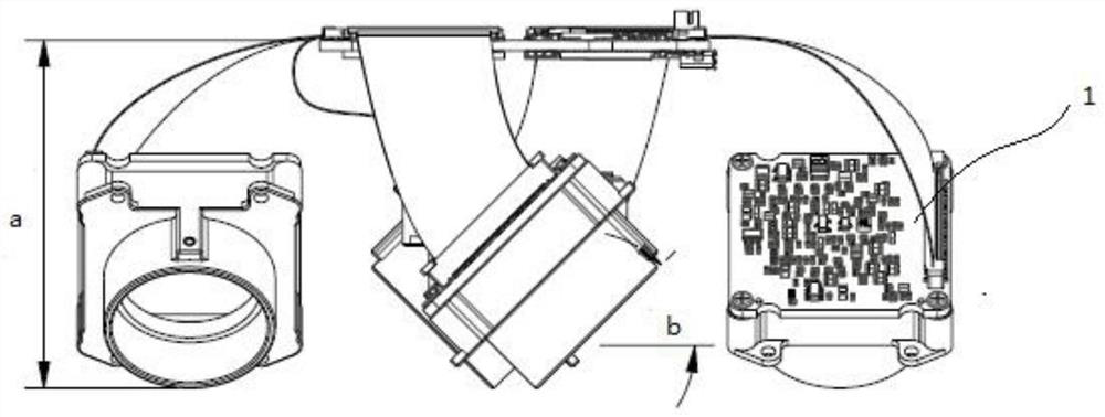
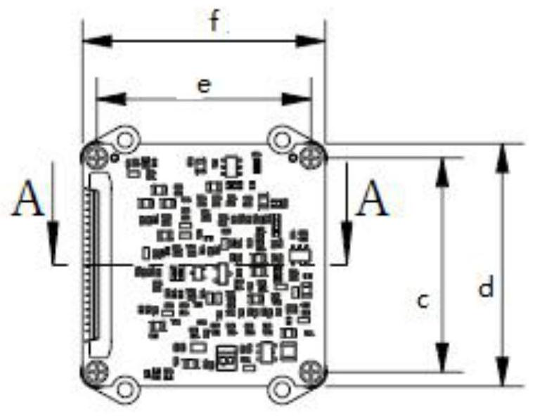
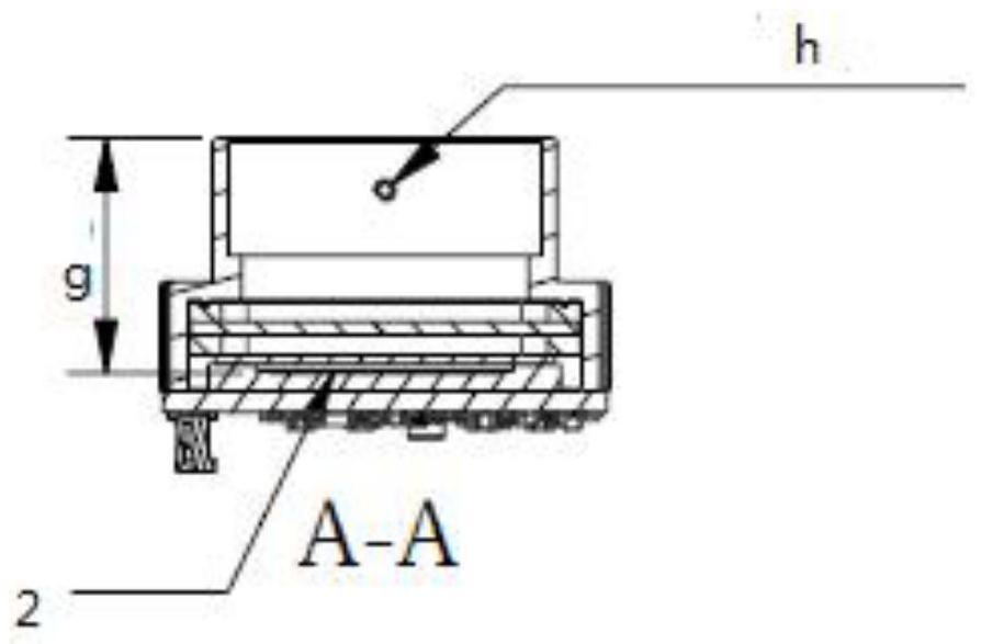
[0046] like Figure 1~13 As shown, the present invention provides a method for three-dimensional modeling and mapping based on unmanned aerial vehicle-free phase control, and the method includes the following steps:

[0047] S1. Collect real-scene image data information to be modeled and mapped;

[0048] S2. Obtain the spatial position and flight attitude data of the drone corresponding to the real-scene image data information;

[0049] S3. Combining t...


PUM


Abstract

The invention belongs to the technical field of unmanned aerial vehicles, and particularly relates to a phase-control-free live-action three-dimensional modeling surveying and mapping method, system and platform based on an unmanned aerial vehicle. According to the scheme of the invention, live-action image data information to be modeled and mapped is collected; the spatial position and flight attitude data of the unmanned aerial vehicle corresponding to the live-action image data information are obtained; in combination with the live-action image data information, the position of the live-action image data information and the flight attitude data of the unmanned aerial vehicle are analyzed and processedin real time; and a live-action three-dimensional plot is generated in real time. Oblique photography or picture taking can be achieved, distortion of camera photos can be avoided, the service life of a camera shutter can be prolonged, and the equipment shaking amplitude can be reduced. According to the system in the scheme, the device is light in weight, and flight operation can be conducted according to a preset route.

Description

technical field [0001] The invention belongs to the technical field of unmanned aerial vehicles, and in particular relates to a method, system and platform for three-dimensional modeling and mapping based on unmanned aerial vehicle phase control-free real scene. Background technique [0002] Real-scene 3D modeling is a technology that uses a digital camera to look around the actual scene from multiple angles, and then stitches the photos together to generate a 3D model of the actual scene. The quality of the photos used to stitch together the 3D model and the accuracy of the spatial position of the photos directly determine the geometric accuracy of the stitched 3D model. [0003] At present, the photos used for outdoor real-world 3D modeling are mainly realized by using a multi-lens camera (tilted camera) mounted on a drone and spliced ​​with multiple digital cameras. [0004] Limited by the inherent performance of traditional digital cameras, current oblique photography c...

Claims


Application Information

Patent Timeline
Patent Type & Authority Applications(China)
IPC IPC(8): G01C11/08
CPCG01C11/08
Inventor 朱继宏
Owner 云南向量创新科技有限公司
Why Eureka
Try Eureka